TopoQuest Logo
Do you find TopoQuest useful?
Help keep TopoQuest running and adding new maps/features by donating!
Bitcoin:  19c7KJd3qBynnjoSw5npx9KScwjBe4ifkT
Litecoin:  LXs6TkuXGGXo1vDsWCkWVdjQX94eUKd6ui
Home View Maps Find Maps Find Places Resources & Links


Ottoville, Ohio Topographic Map

USGS Map Title: Ottoville, OH
USGS Map MRC: 40084H3
DRG (GeoTIFF) Download: o40084h3.tif


Neighboring USGS Topographic Map Quads:


  Oakwood, OH  
41084A4
 

  Continental, OH  
41084A3
 

  Miller City, OH  
41084A2
 

  Wetsel, OH  
40084H4
 

  Ottoville, OH  
40084H3
 

  Kalida, OH  
40084H2
 

  Middle Point, OH  
40084G4
 

  Delphos, OH  
40084G3
 

  Elida, OH  
40084G2


Map MRC Location:

N41°
W85°
N41°
W84°
H8 H7 H6 H5 H4 H3 H2 H1
G8 G7 G6 G5 G4 G3 G2 G1
F8 F7 F6 F5 F4 F3 F2 F1
E8 E7 E6 E5 E4 E3 E2 E1
D8 D7 D6 D5 D4 D3 D2 D1
C8 C7 C6 C5 C4 C3 C2 C1
B8 B7 B6 B5 B4 B3 B2 B1
A8 A7 A6 A5 A4 A3 A2 A1
N40°
W85°
N40°
W84°

Ottoville, OH USGS 1:24K Topographic Map Preview:
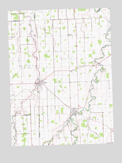
Ottoville, OH USGS Topographic Map
Click on map above to begin viewing in our Map Viewer.

This topographic map contains these locations and features:
Feature Name Type Latitude Longitude GNIS ID View Map
Antioch CemeteryCemeteryN40.9759°W84.3430°1071343View Map
Antioch ChurchChurchN40.9759°W84.3422°1070663View Map
Big RunStreamN40.9073°W84.2786°1068191View Map
Brandehoff DitchCanalN40.9620°W84.3624°1038264View Map
Country Manor EstatesPopulated PlaceN40.9333°W84.3033°2648379View Map
Delphos Country ClubLocaleN40.9056°W84.3669°1080079View Map
DouglasPopulated PlaceN40.9423°W84.3008°1062735View Map
Douglas Post Office (historical)Post OfficeN40.9417°W84.3013°2044285View Map
Dry ForkStreamN40.9948°W84.3541°1039803View Map
Flat ForkStreamN40.8773°W84.3288°1040501View Map
Fort JenningsPopulated PlaceN40.9064°W84.2966°1048750View Map
Fort Jennings (historical)MilitaryN40.9028°W84.2986°1071345View Map
Fort Jennings Elementary SchoolSchoolN40.9062°W84.2991°1050105View Map
Fort Jennings High SchoolSchoolN40.9076°W84.2938°1050106View Map
Fort Jennings Police DepartmentBuildingN40.9101°W84.3050°2732675View Map
Fort Jennings Post OfficePost OfficeN40.9070°W84.2972°2056185View Map
Fort Jennings Volunteer Fire DepartmentBuildingN40.9051°W84.2957°2550394View Map
Gerker AirfieldAirportN40.9542°W84.2704°1082686View Map
Gerker School (historical)SchoolN40.9467°W84.2686°1050117View Map
Hammons CemeteryCemeteryN40.9225°W84.3699°1070768View Map
Immaculate Conception Catholic ChurchChurchN40.9337°W84.3411°1062506View Map
Jennings CreekStreamN40.8989°W84.3011°1042081View Map
Montana (historical)Populated PlaceN40.9756°W84.3358°1050115View Map
Mount Calvary CemeteryCemeteryN40.8987°W84.3036°1043545View Map
MuntannaPopulated PlaceN40.9759°W84.3011°1065086View Map
Muntanna Post Office (historical)Post OfficeN40.9764°W84.3013°2056196View Map
Ostendorf School (historical)SchoolN40.9178°W84.2805°1050118View Map
OttovillePopulated PlaceN40.9323°W84.3388°1070885View Map
Ottoville High SchoolSchoolN40.9325°W84.3416°1050104View Map
Ottoville Police DepartmentBuildingN40.9331°W84.3420°2732618View Map
Ottoville Post OfficePost OfficeN40.9320°W84.3388°2043381View Map
Ottoville Volunteer Fire DepartmentBuildingN40.9325°W84.3391°2550390View Map
Peters School (historical)SchoolN40.9106°W84.3408°1071044View Map
Raabe CemeteryCemeteryN40.8995°W84.2792°1044835View Map
Saint Johns Evangelical Lutheran ChurchChurchN40.9064°W84.2972°1071357View Map
Saint Josephs Catholic ChurchChurchN40.9045°W84.2988°1071358View Map
Saint Josephs CemeteryCemeteryN40.9056°W84.2927°1071359View Map
Saint Marys CemeteryCemeteryN40.9262°W84.3399°1045649View Map
Township of JacksonCivilN40.9703°W84.2759°1086859View Map
Township of JenningsCivilN40.8945°W84.2796°1086860View Map
Township of MontereyCivilN40.9472°W84.3597°1086863View Map
Village of Fort JenningsCivilN40.9064°W84.2996°2398902View Map
Village of OttovilleCivilN40.9338°W84.3388°2399598View Map
Vogt School (historical)SchoolN40.9037°W84.3294°1050116View Map

Note: Coordinates in the location and feature list above are referenced to NAD83 datum.


Copyright (C) 2008-2025 Ryan Niemi / Sunset Dynamics ... All Rights Reserved