TopoQuest Logo
Do you find TopoQuest useful?
Help keep TopoQuest running and adding new maps/features by donating!
Bitcoin:  19c7KJd3qBynnjoSw5npx9KScwjBe4ifkT
Litecoin:  LXs6TkuXGGXo1vDsWCkWVdjQX94eUKd6ui
Home View Maps Find Maps Find Places Resources & Links


Ogema, Minnesota Topographic Map

USGS Map Title: Ogema, MN
USGS Map MRC: 47095A8
DRG (GeoTIFF) Download: o47095a8.tif


Neighboring USGS Topographic Map Quads:


  Flom NE, MN  
47096B1
 

  Waubun, MN  
47095B8
 

  Ogema NE, MN  
47095B7
 

  Flom SE, MN  
47096A1
 

  Ogema, MN  
47095A8
 

  White Earth, MN  
47095A7
 

  Lake Park, MN  
46096H1
 

  Callaway, MN  
46095H8
 

  Richwood, MN  
46095H7


Map MRC Location:

N48°
W96°
N48°
W95°
H8 H7 H6 H5 H4 H3 H2 H1
G8 G7 G6 G5 G4 G3 G2 G1
F8 F7 F6 F5 F4 F3 F2 F1
E8 E7 E6 E5 E4 E3 E2 E1
D8 D7 D6 D5 D4 D3 D2 D1
C8 C7 C6 C5 C4 C3 C2 C1
B8 B7 B6 B5 B4 B3 B2 B1
A8 A7 A6 A5 A4 A3 A2 A1
N47°
W96°
N47°
W95°

Ogema, MN USGS 1:24K Topographic Map Preview:
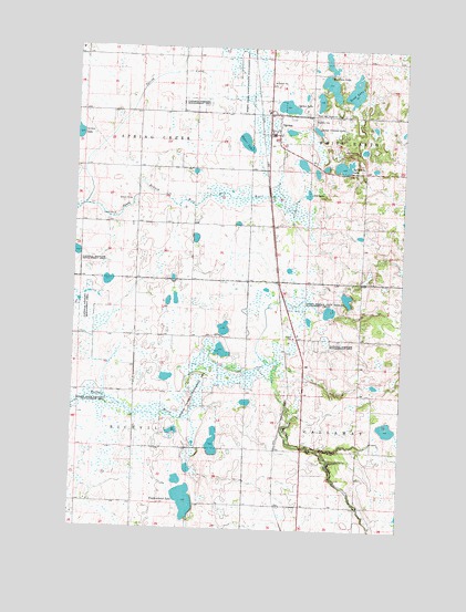
Ogema, MN USGS Topographic Map
Click on map above to begin viewing in our Map Viewer.

This topographic map contains these locations and features:
Feature Name Type Latitude Longitude GNIS ID View Map
Baker LakeLakeN47.1006°W95.9362°639582View Map
City of OgemaCivilN47.1016°W95.9225°2395308View Map
Dump Ground LakeLakeN47.1038°W95.9090°642975View Map
Groth FarmLocaleN47.1117°W95.9656°2674617View Map
Morrison LakeLakeN47.1153°W95.9041°648120View Map
Most Holy Redeemer Catholic ChurchChurchN47.1078°W95.9256°2108732View Map
Most Holy Redeemer CemeteryCemeteryN47.1083°W95.9106°648134View Map
OgemaPopulated PlaceN47.1027°W95.9250°648899View Map
Ogema CemeteryCemeteryN47.1069°W95.9103°648901View Map
Ogema Elementary SchoolSchoolN47.1083°W95.9269°2108733View Map
Ogema Fire DepartmentBuildingN47.1103°W95.9275°2108736View Map
Ogema LakeLakeN47.1100°W95.9205°648902View Map
Ogema Post Office (historical)Post OfficeN47.1028°W95.9247°2108735View Map
Ogema Springs State Wildlife Management AreaParkN47.0588°W95.9148°648903View Map
Ogema StationLocaleN47.1039°W95.9292°2108734View Map
Otto LakeLakeN47.0873°W95.9119°649062View Map
Rat Farm LakeLakeN47.0944°W95.8986°649835View Map
Riparia State Wildlife Management AreaParkN47.0336°W95.9848°650093View Map
Sand LakeLakeN47.1138°W95.8950°651159View Map
Spring CreekStreamN47.0836°W95.9967°652431View Map
Spring Creek State Wildlife Management AreaParkN47.1180°W95.9348°652449View Map
Trinity Lutheran ChurchChurchN47.1078°W95.9258°2108731View Map
Trotterchaud LakeLakeN47.0073°W95.9567°653338View Map

Note: Coordinates in the location and feature list above are referenced to NAD83 datum.


Copyright (C) 2008-2024 Ryan Niemi / Sunset Dynamics ... All Rights Reserved