TopoQuest Logo
Do you find TopoQuest useful?
Help keep TopoQuest running and adding new maps/features by donating!
Bitcoin:  19c7KJd3qBynnjoSw5npx9KScwjBe4ifkT
Litecoin:  LXs6TkuXGGXo1vDsWCkWVdjQX94eUKd6ui
Home View Maps Find Maps Find Places Resources & Links


Olivet, Michigan Topographic Map

USGS Map Title: Olivet, MI
USGS Map MRC: 42084D8
DRG (GeoTIFF) Download: o42084d8.tif


Neighboring USGS Topographic Map Quads:


  Nashville, MI  
42085E1
 

  Chester, MI  
42084E8
 

  Charlotte, MI  
42084E7
 

  Bellevue, MI  
42085D1
 

  Olivet, MI  
42084D8
 

  Duck Lake, MI  
42084D7
 

  Ceresco, MI  
42085C1
 

  Marshall, MI  
42084C8
 

  Northwest Albion, MI  
42084C7


Map MRC Location:

N43°
W85°
N43°
W84°
H8 H7 H6 H5 H4 H3 H2 H1
G8 G7 G6 G5 G4 G3 G2 G1
F8 F7 F6 F5 F4 F3 F2 F1
E8 E7 E6 E5 E4 E3 E2 E1
D8 D7 D6 D5 D4 D3 D2 D1
C8 C7 C6 C5 C4 C3 C2 C1
B8 B7 B6 B5 B4 B3 B2 B1
A8 A7 A6 A5 A4 A3 A2 A1
N42°
W85°
N42°
W84°

Olivet, MI USGS 1:24K Topographic Map Preview:
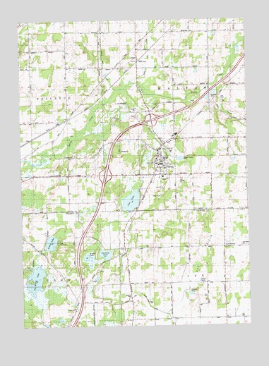
Olivet, MI USGS Topographic Map
Click on map above to begin viewing in our Map Viewer.

This topographic map contains these locations and features:
Feature Name Type Latitude Longitude GNIS ID View Map
Ackley LakeLakeN42.4092°W84.9839°619804View Map
AingerPopulated PlaceN42.4828°W84.9344°619878View Map
Ainger Bible ChurchChurchN42.4881°W84.9353°2575061View Map
Ainger Post Office (historical)Post OfficeN42.4828°W84.9344°2574840View Map
Art BuildingSchoolN42.4419°W84.9217°2574605View Map
Big CreekStreamN42.4739°W84.8925°621305View Map
Big Marsh LakeLakeN42.3944°W84.9927°621335View Map
Blair HallBuildingN42.4408°W84.9239°2574610View Map
Bosworth CemeteryCemeteryN42.4692°W84.8944°621761View Map
Burrage LibraryBuildingN42.4431°W84.9236°2574604View Map
C S Mott Academic CenterSchoolN42.4425°W84.9222°2574606View Map
Camp Tah-Ko-DahLocaleN42.4100°W84.9733°622639View Map
City of OlivetCivilN42.4440°W84.9246°1626844View Map
Dillon Relaid DrainCanalN42.4864°W84.9278°624681View Map
Dole HallBuildingN42.4431°W84.9250°2574603View Map
Fern Persons Elementary SchoolSchoolN42.4361°W84.9217°2574623View Map
First Congregational Church Historical MarkerParkN42.4421°W84.9224°2569706View Map
Frederick S Upton CenterLocaleN42.4406°W84.9228°2574612View Map
Garfield LakeLakeN42.4046°W84.9542°626656View Map
Hance HouseBuildingN42.4400°W84.9219°2574614View Map
Harbor Springs Fire DepartmentBuildingN42.4314°W84.9775°2360112View Map
Indian CreekStreamN42.4720°W84.9419°628967View Map
Interchange 48CrossingN42.4367°W84.9528°2574849View Map
Interchange 51CrossingN42.4592°W84.9278°2574848View Map
Kinyon LakeLakeN42.4032°W84.9644°629751View Map
Lee CenterPopulated PlaceN42.4070°W84.8886°630251View Map
Lee Center CemeteryCemeteryN42.4075°W84.8791°630252View Map
Lester K Kirk CenterBuildingN42.4422°W84.9253°2574608View Map
MacKay GymnasiumBuildingN42.4244°W84.9228°2574611View Map
Margaret Upton Conservatory of MusicSchoolN42.4414°W84.9250°2574609View Map
Marshall Internal and Family MedicineHospitalN42.4472°W84.9225°2574619View Map
OlivetPopulated PlaceN42.4414°W84.9242°634039View Map
Olivet CemeteryCemeteryN42.4430°W84.9264°2574859View Map
Olivet City HallBuildingN42.4469°W84.9244°2574621View Map
Olivet CollegeSchoolN42.4431°W84.9250°2574602View Map
Olivet College Historical MarkerParkN42.4427°W84.9241°2569707View Map
Olivet Congregational ChurchChurchN42.4431°W84.9231°2574616View Map
Olivet Country ClubLocaleN42.4683°W84.8889°2574624View Map
Olivet Fire DepartmentBuildingN42.4459°W84.9220°2636057View Map
Olivet First Assembly of God ChurchChurchN42.4364°W84.9294°2574615View Map
Olivet High SchoolSchoolN42.4464°W84.9172°2574620View Map
Olivet Police DepartmentBuildingN42.4466°W84.9243°2574617View Map
Olivet Post OfficePost OfficeN42.4469°W84.9256°2574618View Map
Olivet StationLocaleN42.4825°W84.9336°2575037View Map
Pine LakeLakeN42.4261°W84.9392°634957View Map
Ruth Rawlings Mott AuditoriumBuildingN42.4419°W84.9222°2574607View Map
School LakeLakeN42.3881°W84.9072°637374View Map
Sellen LakeLakeN42.3931°W84.9022°637569View Map
Shipherd HallBuildingN42.4411°W84.9222°2574613View Map
Township of LeeCivilN42.3781°W84.8878°1626599View Map
Township of WaltonCivilN42.4665°W84.8942°1627211View Map
WOCR-FM (Olivet)TowerN42.4420°W84.9250°1625746View Map

Note: Coordinates in the location and feature list above are referenced to NAD83 datum.


Copyright (C) 2008-2024 Ryan Niemi / Sunset Dynamics ... All Rights Reserved