TopoQuest Logo
Do you find TopoQuest useful?
Help keep TopoQuest running and adding new maps/features by donating!
Bitcoin:  19c7KJd3qBynnjoSw5npx9KScwjBe4ifkT
Litecoin:  LXs6TkuXGGXo1vDsWCkWVdjQX94eUKd6ui
Home View Maps Find Maps Find Places Resources & Links


Bellevue, Michigan Topographic Map

USGS Map Title: Bellevue, MI
USGS Map MRC: 42085D1
DRG (GeoTIFF) Download: o42085d1.tif


Neighboring USGS Topographic Map Quads:


  Maple Grove, MI  
42085E2
 

  Nashville, MI  
42085E1
 

  Chester, MI  
42084E8
 

  Bedford, MI  
42085D2
 

  Bellevue, MI  
42085D1
 

  Olivet, MI  
42084D8
 

  Battle Creek, MI  
42085C2
 

  Ceresco, MI  
42085C1
 

  Marshall, MI  
42084C8


Map MRC Location:

N43°
W86°
N43°
W85°
H8 H7 H6 H5 H4 H3 H2 H1
G8 G7 G6 G5 G4 G3 G2 G1
F8 F7 F6 F5 F4 F3 F2 F1
E8 E7 E6 E5 E4 E3 E2 E1
D8 D7 D6 D5 D4 D3 D2 D1
C8 C7 C6 C5 C4 C3 C2 C1
B8 B7 B6 B5 B4 B3 B2 B1
A8 A7 A6 A5 A4 A3 A2 A1
N42°
W86°
N42°
W85°

Bellevue, MI USGS 1:24K Topographic Map Preview:
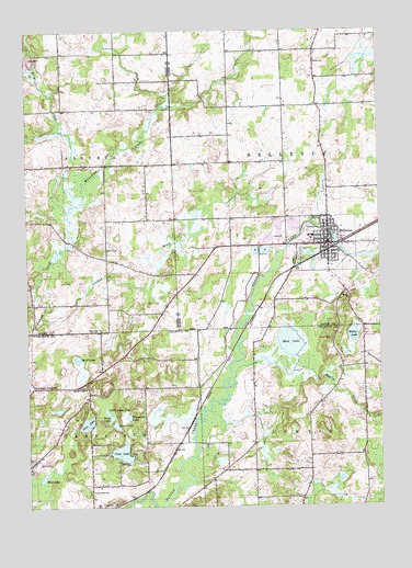
Bellevue, MI USGS Topographic Map
Click on map above to begin viewing in our Map Viewer.

This topographic map contains these locations and features:
Feature Name Type Latitude Longitude GNIS ID View Map
Ackley CreekStreamN42.4100°W85.0517°619803View Map
Base Line ChurchChurchN42.4214°W85.0989°620670View Map
Bell CemeteryCemeteryN42.4428°W85.0964°621029View Map
BellevuePopulated PlaceN42.4434°W85.0180°621063View Map
Bellevue CemeteryCemeteryN42.4480°W85.0244°2574883View Map
Bellevue Christian CenterChurchN42.4439°W85.0264°2575056View Map
Bellevue Church of ChristChurchN42.4075°W85.0447°2572312View Map
Bellevue Community Fire DepartmentBuildingN42.4446°W85.0174°2575052View Map
Bellevue Elementary SchoolSchoolN42.4450°W85.0236°2575055View Map
Bellevue First Baptist ChurchChurchN42.4431°W85.0175°2575057View Map
Bellevue High SchoolSchoolN42.4519°W85.0264°2575053View Map
Bellevue Middle SchoolSchoolN42.4444°W85.0283°2575054View Map
Bellevue Mobile Home ParkPopulated PlaceN42.4194°W85.0061°2572311View Map
Bellevue Police DepartmentBuildingN42.4450°W85.0184°2575049View Map
Bellevue Post OfficePost OfficeN42.4450°W85.0178°2575050View Map
Bellevue StationLocaleN42.4422°W85.0175°2575043View Map
Bellevue Township LibraryBuildingN42.4456°W85.0178°2575051View Map
Bellevue United Methodist ChurchChurchN42.4439°W85.0192°2575059View Map
Boughton SchoolSchoolN42.4062°W85.1042°621773View Map
Burleigh CornersLocaleN42.4064°W85.1233°622284View Map
Ceylon Post Office (historical)Post OfficeN42.4872°W85.0917°2572387View Map
Charter Township of PennfieldCivilN42.3785°W85.1210°1626891View Map
Clear LakeLakeN42.3892°W85.0918°623409View Map
Convis Post Office (historical)Post OfficeN42.3842°W85.0444°2630172View Map
Crooked BrookStreamN42.4239°W85.1172°624083View Map
Deep LakeLakeN42.3964°W85.0939°624448View Map
Ellis CreekStreamN42.4542°W85.1083°625485View Map
Follett CemeteryCemeteryN42.4917°W85.0225°626209View Map
Goose LakeLakeN42.3984°W85.0955°626969View Map
Little Goose LakeLakeN42.4003°W85.0972°630629View Map
Mud LakeLakeN42.3824°W85.1202°632916View Map
Mud LakeLakeN42.4181°W85.0321°632920View Map
Pennfield SchoolSchoolN42.3792°W85.1022°634591View Map
Pine LakeLakeN42.3969°W85.1043°634956View Map
Saint Ann Catholic ChurchChurchN42.4414°W85.0175°2575058View Map
Township of BellevueCivilN42.4657°W85.0135°1625910View Map
Township of ConvisCivilN42.3779°W85.0049°1626129View Map
Village of BellevueCivilN42.4443°W85.0187°2398080View Map
Wiegands LakeLakeN42.3986°W85.0895°1616419View Map
Willis LakeLakeN42.4202°W85.0095°1616523View Map
Wolf LakeLakeN42.4139°W85.1075°1616693View Map

Note: Coordinates in the location and feature list above are referenced to NAD83 datum.


Copyright (C) 2008-2025 Ryan Niemi / Sunset Dynamics ... All Rights Reserved