TopoQuest Logo
Do you find TopoQuest useful?
Help keep TopoQuest running and adding new maps/features by donating!
Bitcoin:  19c7KJd3qBynnjoSw5npx9KScwjBe4ifkT
Litecoin:  LXs6TkuXGGXo1vDsWCkWVdjQX94eUKd6ui
Home View Maps Find Maps Find Places Resources & Links


Olivia, Minnesota Topographic Map

USGS Map Title: Olivia, MN
USGS Map MRC: 44094G8
DRG (GeoTIFF) Download: o44094g8.tif


Neighboring USGS Topographic Map Quads:


  Blomkest, MN  
44095H1
 

  Lake Lillian, MN  
44094H8
 

  Thorpe, MN  
44094H7
 

  Danube, MN  
44095G1
 

  Olivia, MN  
44094G8
 

  Olivia SE, MN  
44094G7
 

  Bechyn, MN  
44095F1
 

  Morton NW, MN  
44094F8
 

  Morton NE, MN  
44094F7


Map MRC Location:

N45°
W95°
N45°
W94°
H8 H7 H6 H5 H4 H3 H2 H1
G8 G7 G6 G5 G4 G3 G2 G1
F8 F7 F6 F5 F4 F3 F2 F1
E8 E7 E6 E5 E4 E3 E2 E1
D8 D7 D6 D5 D4 D3 D2 D1
C8 C7 C6 C5 C4 C3 C2 C1
B8 B7 B6 B5 B4 B3 B2 B1
A8 A7 A6 A5 A4 A3 A2 A1
N44°
W95°
N44°
W94°

Olivia, MN USGS 1:24K Topographic Map Preview:
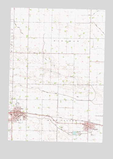
Olivia, MN USGS Topographic Map
Click on map above to begin viewing in our Map Viewer.

This topographic map contains these locations and features:
Feature Name Type Latitude Longitude GNIS ID View Map
Bird IslandPopulated PlaceN44.7675°W94.8956°640191View Map
Bird IslandLocaleN44.7689°W94.8950°2065504View Map
Bird Island CemeteryCemeteryN44.7594°W94.9094°1815501View Map
Bird Island Fire DepartmentBuildingN44.7656°W94.8945°2666382View Map
Bird Island Police DepartmentBuildingN44.7652°W94.8944°2065506View Map
Bird Island Post OfficePost OfficeN44.7661°W94.8947°2065507View Map
Bird Island Village LibraryBuildingN44.7658°W94.8947°2065508View Map
Bold - Bird Island Elementary SchoolSchoolN44.7669°W94.8983°2065511View Map
Bold Senior High SchoolSchoolN44.7694°W94.9878°2065530View Map
City of Bird IslandCivilN44.7648°W94.8949°2394173View Map
City of OliviaCivilN44.7771°W94.9976°2396057View Map
County Ditch Number Ninetynine BCanalN44.8564°W94.9869°1815505View Map
County Ditch Number SixtysixCanalN44.7633°W94.9350°1815502View Map
Cross of Calvary Lutheran ChurchChurchN44.7686°W94.9936°2065517View Map
Henton ParkParkN44.7811°W94.9881°1815499View Map
KOLV-FM (Olivia)TowerN44.7641°W94.9294°663098View Map
Kubesh ParkParkN44.7741°W94.9947°1815497View Map
Mahanaim Assembly of God ChurchChurchN44.7692°W94.9908°2065516View Map
Meadowcrest Estates Mobile Home ParkPopulated PlaceN44.7833°W94.9864°2065503View Map
Nester ParkParkN44.7727°W94.9889°1815496View Map
OliviaPopulated PlaceN44.7764°W94.9897°648947View Map
OliviaLocaleN44.7775°W94.9886°2065521View Map
Olivia Ambulance ServiceBuildingN44.7763°W94.9915°2721348View Map
Olivia City HallBuildingN44.7761°W94.9917°2065529View Map
Olivia ClinicHospitalN44.7764°W94.9853°2065523View Map
Olivia Fire DepartmentBuildingN44.7762°W94.9921°2065528View Map
Olivia German CemeteryCemeteryN44.7767°W94.9761°2065415View Map
Olivia Golf CourseLocaleN44.7697°W94.9833°2065525View Map
Olivia Health Care CenterHospitalN44.7814°W94.9906°2065502View Map
Olivia Police DepartmentBuildingN44.7761°W94.9823°2065527View Map
Olivia Post OfficePost OfficeN44.7756°W94.9878°2065518View Map
Olivia Public LibraryBuildingN44.7731°W94.9903°2065512View Map
Our Savior's Lutheran ChurchChurchN44.7636°W94.8928°2065509View Map
Prairie Family Practice CenterHospitalN44.7736°W94.9844°2065524View Map
Renville County CourthouseBuildingN44.7758°W94.9831°2065519View Map
Renville County FairgroundsLocaleN44.7611°W94.8917°2065505View Map
Renville County HospitalHospitalN44.7738°W94.9852°2065522View Map
Renville County JailBuildingN44.7762°W94.9822°2758827View Map
Renville County Sheriff's OfficeBuildingN44.7760°W94.9822°2065520View Map
Saint Aloysius Catholic ChurchChurchN44.7742°W94.9914°2065515View Map
Saint Aloysius SchoolSchoolN44.7741°W94.9922°1815498View Map
Saint Mary High SchoolSchoolN44.7666°W94.9000°1815500View Map
Saint Mary's CemeteryCemeteryN44.7680°W94.9050°2065418View Map
Saint Mary's ChurchChurchN44.7658°W94.8994°2065510View Map
Sunrise ParkParkN44.7727°W94.9772°1815495View Map
Township of Bird IslandCivilN44.7594°W94.9346°663601View Map
Township of KingmanCivilN44.8480°W94.9350°664637View Map
United Methodist ChurchChurchN44.7750°W94.9894°2065514View Map
Zion Evangelical Lutheran ChurchChurchN44.7692°W94.9917°2065513View Map

Note: Coordinates in the location and feature list above are referenced to NAD83 datum.


Copyright (C) 2008-2025 Ryan Niemi / Sunset Dynamics ... All Rights Reserved