TopoQuest Logo
Do you find TopoQuest useful?
Help keep TopoQuest running and adding new maps/features by donating!
Bitcoin:  19c7KJd3qBynnjoSw5npx9KScwjBe4ifkT
Litecoin:  LXs6TkuXGGXo1vDsWCkWVdjQX94eUKd6ui
Home View Maps Find Maps Find Places Resources & Links


Danube, Minnesota Topographic Map

USGS Map Title: Danube, MN
USGS Map MRC: 44095G1
DRG (GeoTIFF) Download: o44095g1.tif


Neighboring USGS Topographic Map Quads:


  Prinsburg, MN  
44095H2
 

  Blomkest, MN  
44095H1
 

  Lake Lillian, MN  
44094H8
 

  Renville, MN  
44095G2
 

  Danube, MN  
44095G1
 

  Olivia, MN  
44094G8
 

  Vicksburg, MN  
44095F2
 

  Bechyn, MN  
44095F1
 

  Morton NW, MN  
44094F8


Map MRC Location:

N45°
W96°
N45°
W95°
H8 H7 H6 H5 H4 H3 H2 H1
G8 G7 G6 G5 G4 G3 G2 G1
F8 F7 F6 F5 F4 F3 F2 F1
E8 E7 E6 E5 E4 E3 E2 E1
D8 D7 D6 D5 D4 D3 D2 D1
C8 C7 C6 C5 C4 C3 C2 C1
B8 B7 B6 B5 B4 B3 B2 B1
A8 A7 A6 A5 A4 A3 A2 A1
N44°
W96°
N44°
W95°

Danube, MN USGS 1:24K Topographic Map Preview:
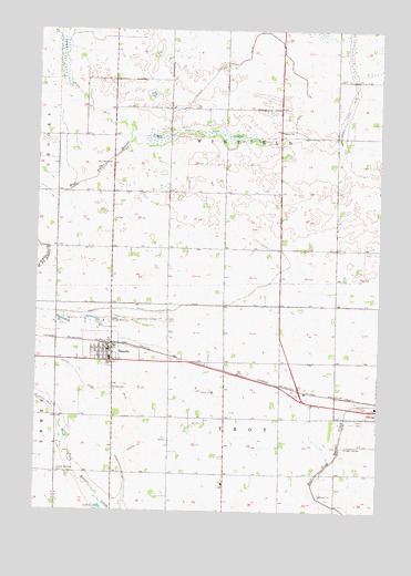
Danube, MN USGS Topographic Map
Click on map above to begin viewing in our Map Viewer.

This topographic map contains these locations and features:
Feature Name Type Latitude Longitude GNIS ID View Map
City of DanubeCivilN44.7910°W95.1034°2393713View Map
County Ditch Number FiftyfiveCanalN44.8561°W95.0108°642190View Map
County Ditch Number FiftynineCanalN44.8022°W95.0906°642211View Map
County Ditch Number One Hundred OneCanalN44.7683°W95.0742°641584View Map
County Ditch Number SixtythreeCanalN44.7633°W95.0158°642241View Map
County Ditch Number TenCanalN44.8664°W95.0572°641568View Map
County Ditch Number ThirtyoneCanalN44.8611°W95.1139°641958View Map
County Ditch Number ThirtyoneCanalN44.8477°W95.0575°641942View Map
DanubeLocaleN44.7933°W95.0978°2065556View Map
DanubePopulated PlaceN44.7919°W95.0972°642632View Map
Danube CemeteryCemeteryN44.7813°W95.0964°642633View Map
Danube Fire DepartmentBuildingN44.7922°W95.0986°2666560View Map
Danube Police DepartmentBuildingN44.7892°W95.0953°2065559View Map
Danube Post OfficePost OfficeN44.7925°W95.0987°2065557View Map
German Lutheran CemeteryCemeteryN44.8255°W95.0972°2065387View Map
Long Lake Mission CemeteryCemeteryN44.8611°W95.0680°2065388View Map
Memorial ParkParkN44.7761°W95.0006°2065526View Map
Old Salem CemeteryCemeteryN44.7597°W95.1178°2065414View Map
Olivia CemeteryCemeteryN44.7733°W95.0067°648948View Map
Olivia Regional AirportAirportN44.7781°W95.0276°660330View Map
Renville County West Middle SchoolSchoolN44.7894°W95.0978°2065560View Map
Saint Matthew's Lutheran ChurchChurchN44.7919°W95.0969°2065558View Map
Township of TroyCivilN44.7588°W95.0571°665813View Map
Township of WinfieldCivilN44.8475°W95.0568°666017View Map
United Brethren CemeteryCemeteryN44.7600°W95.1167°653521View Map
Winfield CemeteryCemeteryN44.8405°W95.0986°654253View Map

Note: Coordinates in the location and feature list above are referenced to NAD83 datum.


Copyright (C) 2008-2025 Ryan Niemi / Sunset Dynamics ... All Rights Reserved