TopoQuest Logo
Do you find TopoQuest useful?
Help keep TopoQuest running and adding new maps/features by donating!
Bitcoin:  19c7KJd3qBynnjoSw5npx9KScwjBe4ifkT
Litecoin:  LXs6TkuXGGXo1vDsWCkWVdjQX94eUKd6ui
Home View Maps Find Maps Find Places Resources & Links


Bechyn, Minnesota Topographic Map

USGS Map Title: Bechyn, MN
USGS Map MRC: 44095F1
DRG (GeoTIFF) Download: o44095f1.tif


Neighboring USGS Topographic Map Quads:


  Renville, MN  
44095G2
 

  Danube, MN  
44095G1
 

  Olivia, MN  
44094G8
 

  Vicksburg, MN  
44095F2
 

  Bechyn, MN  
44095F1
 

  Morton NW, MN  
44094F8
 

  Delhi, MN  
44095E2
 

  Redwood Falls, MN  
44095E1
 

  Morton, MN  
44094E8


Map MRC Location:

N45°
W96°
N45°
W95°
H8 H7 H6 H5 H4 H3 H2 H1
G8 G7 G6 G5 G4 G3 G2 G1
F8 F7 F6 F5 F4 F3 F2 F1
E8 E7 E6 E5 E4 E3 E2 E1
D8 D7 D6 D5 D4 D3 D2 D1
C8 C7 C6 C5 C4 C3 C2 C1
B8 B7 B6 B5 B4 B3 B2 B1
A8 A7 A6 A5 A4 A3 A2 A1
N44°
W96°
N44°
W95°

Bechyn, MN USGS 1:24K Topographic Map Preview:
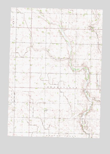
Bechyn, MN USGS Topographic Map
Click on map above to begin viewing in our Map Viewer.

This topographic map contains these locations and features:
Feature Name Type Latitude Longitude GNIS ID View Map
BechynPopulated PlaceN44.6505°W95.0761°639844View Map
Bechyn Post Office (historical)Post OfficeN44.6506°W95.0758°2065553View Map
County Ditch Number One Hundred SeventeenCanalN44.6666°W95.0503°1815487View Map
County Ditch Number One Hundred TenCanalN44.7088°W95.0836°1815488View Map
County Ditch Number One Hundred ThirtyCanalN44.6327°W95.0850°1815485View Map
County Ditch Number One Hundred Twentyfive ACanalN44.6325°W95.0711°1815486View Map
Ditch Number NinetytwoCanalN44.6588°W95.1178°642854View Map
Ditch Number SeventynineCanalN44.7161°W95.0697°642851View Map
Ditch Number SixtythreeCanalN44.7200°W95.0053°642850View Map
Ditch Number TwoCanalN44.6638°W95.0478°642845View Map
East Fork Beaver CreekStreamN44.6630°W95.0158°643071View Map
Saint Mary's Bechyn CemeteryCemeteryN44.6500°W95.0728°2065419View Map
School Number 104SchoolN44.6955°W95.0358°651332View Map
School Number 12SchoolN44.6550°W95.0353°651361View Map
School Number 27SchoolN44.6438°W95.0811°651597View Map
School Number 70SchoolN44.7388°W95.0981°651721View Map
School Number 73SchoolN44.7450°W95.0247°651723View Map
Theile - Schafer Grave SiteCemeteryN44.7000°W95.1175°2065402View Map
Township of HenryvilleCivilN44.6724°W95.0559°664457View Map
West Fork Beaver CreekStreamN44.6630°W95.0158°653957View Map

Note: Coordinates in the location and feature list above are referenced to NAD83 datum.


Copyright (C) 2008-2025 Ryan Niemi / Sunset Dynamics ... All Rights Reserved