TopoQuest Logo
Do you find TopoQuest useful?
Help keep TopoQuest running and adding new maps/features by donating!
Bitcoin:  19c7KJd3qBynnjoSw5npx9KScwjBe4ifkT
Litecoin:  LXs6TkuXGGXo1vDsWCkWVdjQX94eUKd6ui
Home View Maps Find Maps Find Places Resources & Links


Olmstead, Kentucky Topographic Map

USGS Map Title: Olmstead, KY
USGS Map MRC: 36087G1
DRG (GeoTIFF) Download: o36087g1.tif


Neighboring USGS Topographic Map Quads:


  Allegre, KY  
36087H2
 

  Sharon Grove, KY  
36087H1
 

  Lewisburg, KY  
36086H8
 

  Elkton, KY  
36087G2
 

  Olmstead, KY  
36087G1
 

  Russellville, KY  
36086G8
 

  Guthrie, KY  
36087F2
 

  Allensville, KY  
36087F1
 

  Dot, KY  
36086F8


Map MRC Location:

N37°
W88°
N37°
W87°
H8 H7 H6 H5 H4 H3 H2 H1
G8 G7 G6 G5 G4 G3 G2 G1
F8 F7 F6 F5 F4 F3 F2 F1
E8 E7 E6 E5 E4 E3 E2 E1
D8 D7 D6 D5 D4 D3 D2 D1
C8 C7 C6 C5 C4 C3 C2 C1
B8 B7 B6 B5 B4 B3 B2 B1
A8 A7 A6 A5 A4 A3 A2 A1
N36°
W88°
N36°
W87°

Olmstead, KY USGS 1:24K Topographic Map Preview:
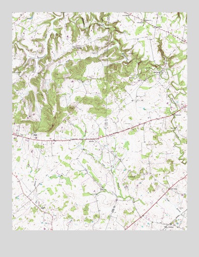
Olmstead, KY USGS Topographic Map
Click on map above to begin viewing in our Map Viewer.

This topographic map contains these locations and features:
Feature Name Type Latitude Longitude GNIS ID View Map
Bennett CemeteryCemeteryN36.8517°W87.0647°486855View Map
Browder CemeteryCemeteryN36.7628°W87.0053°487978View Map
Collins CemeteryCemeteryN36.8111°W87.0400°489860View Map
CrossroadPopulated PlaceN36.8667°W87.0219°507787View Map
Cumberland ChurchChurchN36.8706°W87.0308°490470View Map
Currence CemeteryCemeteryN36.8520°W87.0414°490497View Map
DaysvillePopulated PlaceN36.8023°W87.0669°490707View Map
Garrett BranchStreamN36.8670°W87.0586°492720View Map
GordonsvillePopulated PlaceN36.8400°W87.0189°493032View Map
Greenridge ChurchChurchN36.8696°W87.0312°493331View Map
Greenridge SchoolSchoolN36.8731°W87.0403°493332View Map
Johnson ChapelChurchN36.7639°W87.1031°495393View Map
Johnstown (historical)Populated PlaceN36.7790°W87.0456°2743079View Map
Lee CemeteryCemeteryN36.7953°W87.0547°496155View Map
Lyne CemeteryCemeteryN36.8223°W87.0042°497368View Map
Mason SpringSpringN36.8369°W87.0378°497663View Map
Mount Gilead SchoolSchoolN36.7814°W87.0372°498736View Map
North Fork Whippoorwill CreekStreamN36.8712°W87.0917°499573View Map
Old VolneyPopulated PlaceN36.7742°W87.0125°499896View Map
OlmsteadPopulated PlaceN36.7523°W87.0150°499937View Map
Olmstead Volunteer Fire DepartmentBuildingN36.7525°W87.0149°2636993View Map
Pea RidgeLocaleN36.8550°W87.0800°500304View Map
Pennick (historical)Populated PlaceN36.7670°W87.1119°2743146View Map
Providence Methodist ChurchChurchN36.8398°W87.1210°501371View Map
Russell CemeteryCemeteryN36.8045°W87.1097°502507View Map
Union SchoolSchoolN36.8089°W87.0081°505815View Map
WhippoorwillPopulated PlaceN36.8167°W87.0097°509353View Map

Note: Coordinates in the location and feature list above are referenced to NAD83 datum.


Copyright (C) 2008-2024 Ryan Niemi / Sunset Dynamics ... All Rights Reserved