TopoQuest Logo
Do you find TopoQuest useful?
Help keep TopoQuest running and adding new maps/features by donating!
Bitcoin:  19c7KJd3qBynnjoSw5npx9KScwjBe4ifkT
Litecoin:  LXs6TkuXGGXo1vDsWCkWVdjQX94eUKd6ui
Home View Maps Find Maps Find Places Resources & Links


Onyx Peak, California Topographic Map

USGS Map Title: Onyx Peak, CA
USGS Map MRC: 34116B6
DRG (GeoTIFF) Download: o34116b6.tif


Neighboring USGS Topographic Map Quads:


  Big Bear City, CA  
34116C7
 

  Rattlesnake Canyon, CA  
34116C6
 

  Bighorn Canyon, CA  
34116C5
 

  Moonridge, CA  
34116B7
 

  Onyx Peak, CA  
34116B6
 

  Rimrock, CA  
34116B5
 

  San Gorgonio Mountain, CA  
34116A7
 

  Catclaw Flat, CA  
34116A6
 

  Morongo Valley, CA  
34116A5


Map MRC Location:

N35°
W117°
N35°
W116°
H8 H7 H6 H5 H4 H3 H2 H1
G8 G7 G6 G5 G4 G3 G2 G1
F8 F7 F6 F5 F4 F3 F2 F1
E8 E7 E6 E5 E4 E3 E2 E1
D8 D7 D6 D5 D4 D3 D2 D1
C8 C7 C6 C5 C4 C3 C2 C1
B8 B7 B6 B5 B4 B3 B2 B1
A8 A7 A6 A5 A4 A3 A2 A1
N34°
W117°
N34°
W116°

Onyx Peak, CA USGS 1:24K Topographic Map Preview:
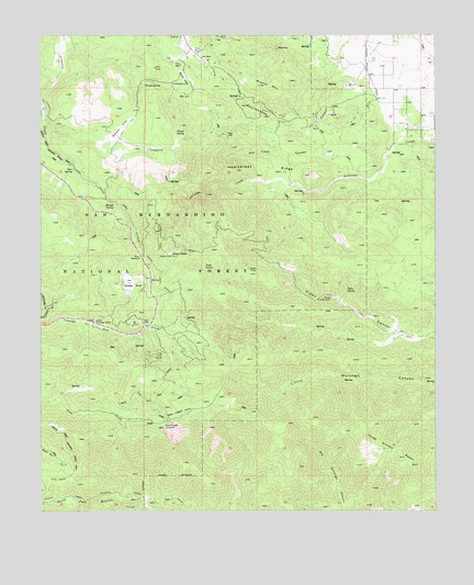
Onyx Peak, CA USGS Topographic Map
Click on map above to begin viewing in our Map Viewer.

This topographic map contains these locations and features:
Feature Name Type Latitude Longitude GNIS ID View Map
Bain RanchLocaleN34.2236°W116.6331°269628View Map
Blue CutGapN34.2464°W116.6750°269926View Map
Broom FlatFlatN34.2239°W116.7259°270025View Map
Broom SpringSpringN34.2245°W116.7077°270026View Map
Cienaga SecaPlainN34.1847°W116.7234°270464View Map
Coon Creek JumpoffAreaN34.1472°W116.7120°270592View Map
Deer SpringSpringN34.2147°W116.7402°270813View Map
Heartbreak RidgeRidgeN34.2147°W116.6797°271529View Map
Little Cienaga SecaSwampN34.1747°W116.7339°272081View Map
Mineral MountainSummitN34.2367°W116.6814°272490View Map
Missed SpringSpringN34.2051°W116.7303°272499View Map
Monte Cristo MineMineN34.2417°W116.6984°1667138View Map
Old Timer CanyonValleyN34.2278°W116.6631°272789View Map
Onyx MineMineN34.1883°W116.6845°272801View Map
Onyx PeakSummitN34.1920°W116.7090°2787836View Map
Onyx SpringSpringN34.1893°W116.6987°272804View Map
Onyx SummitGapN34.1922°W116.7189°272805View Map
Pipes CampgroundLocaleN34.1808°W116.6589°273025View Map
Pipes SpringSpringN34.1830°W116.6539°273027View Map
Rose MineMineN34.2456°W116.7006°273351View Map
Round ValleyValleyN34.2364°W116.7014°273374View Map
Tayles Hidden AcresAreaN34.1503°W116.7067°274041View Map
Three Sisters PeaksSummitN34.1389°W116.6372°274128View Map
Yocum SpringSpringN34.2368°W116.7180°274593View Map

Note: Coordinates in the location and feature list above are referenced to NAD83 datum.


Copyright (C) 2008-2024 Ryan Niemi / Sunset Dynamics ... All Rights Reserved