TopoQuest Logo
Do you find TopoQuest useful?
Help keep TopoQuest running and adding new maps/features by donating!
Bitcoin:  19c7KJd3qBynnjoSw5npx9KScwjBe4ifkT
Litecoin:  LXs6TkuXGGXo1vDsWCkWVdjQX94eUKd6ui
Home View Maps Find Maps Find Places Resources & Links


Big Bear City, California Topographic Map

USGS Map Title: Big Bear City, CA
USGS Map MRC: 34116C7
DRG (GeoTIFF) Download: o34116c7.tif


Neighboring USGS Topographic Map Quads:


  Lucerne Valley, CA  
34116D8
 

  Cougar Buttes, CA  
34116D7
 

  Old Woman Springs, CA  
34116D6
 

  Fawnskin, CA  
34116C8
 

  Big Bear City, CA  
34116C7
 

  Rattlesnake Canyon, CA  
34116C6
 

  Big Bear Lake, CA  
34116B8
 

  Moonridge, CA  
34116B7
 

  Onyx Peak, CA  
34116B6


Map MRC Location:

N35°
W117°
N35°
W116°
H8 H7 H6 H5 H4 H3 H2 H1
G8 G7 G6 G5 G4 G3 G2 G1
F8 F7 F6 F5 F4 F3 F2 F1
E8 E7 E6 E5 E4 E3 E2 E1
D8 D7 D6 D5 D4 D3 D2 D1
C8 C7 C6 C5 C4 C3 C2 C1
B8 B7 B6 B5 B4 B3 B2 B1
A8 A7 A6 A5 A4 A3 A2 A1
N34°
W117°
N34°
W116°

Big Bear City, CA USGS 1:24K Topographic Map Preview:
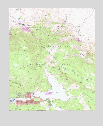
Big Bear City, CA USGS Topographic Map
Click on map above to begin viewing in our Map Viewer.

This topographic map contains these locations and features:
Feature Name Type Latitude Longitude GNIS ID View Map
Arrastre FlatFlatN34.3028°W116.8648°269577View Map
Baldwin LakePopulated PlaceN34.2795°W116.7973°1841816View Map
Baldwin LakeLakeN34.2743°W116.8102°269648View Map
Baldwin Lake Post Office (historical)Post OfficeN34.2795°W116.7973°2026838View Map
Baldwin Lake Volunteer Fire DepartmentBuildingN34.2726°W116.7909°2665335View Map
Bear ValleyBasinN34.2608°W116.8486°269759View Map
Big Bear CityPopulated PlaceN34.2611°W116.8450°1660331View Map
Big Bear City AirportAirportN34.2629°W116.8546°1653263View Map
Big Bear City Census Designated PlaceCensusN34.2536°W116.7903°2407838View Map
Big Bear City Fire Department Station 291 / Bear Valley Paramedic ServicesBuildingN34.2614°W116.8490°2664594View Map
Big Bear City Fire Department Station 292BuildingN34.2507°W116.8250°2665135View Map
Big Bear City ParkParkN34.2642°W116.8450°1841817View Map
Big Bear City Post OfficePost OfficeN34.2614°W116.8467°1841818View Map
Big Bear Convention CenterBuildingN34.2608°W116.8673°1841819View Map
Big Bear High SchoolSchoolN34.2542°W116.8250°1841820View Map
Blackhawk CanyonValleyN34.3744°W116.7953°269904View Map
Blackhawk MineMineN34.3522°W116.8023°269905View Map
Blackhawk MountainRidgeN34.3383°W116.8134°269906View Map
Blue Quartz MineMineN34.2736°W116.8667°269933View Map
Burns FlatFlatN34.3292°W116.8528°2785472View Map
Burnt FlatFlatN34.3297°W116.8531°270095View Map
Cactus FlatFlatN34.3242°W116.8159°270136View Map
Cactus SpringSpringN34.3146°W116.8086°270137View Map
Camp CohilaLocaleN34.2514°W116.8620°270181View Map
Canyon SpringSpringN34.2885°W116.7936°270289View Map
Caribou CreekStreamN34.2700°W116.8314°270297View Map
CushenburyPopulated PlaceN34.3539°W116.8584°1660528View Map
Cushenbury CanyonValleyN34.3586°W116.8581°270717View Map
Cushenbury PitMineN34.3497°W116.8484°270718View Map
Cushenbury SpringsSpringN34.3628°W116.8589°270719View Map
DoblePopulated PlaceN34.2986°W116.8217°270883View Map
Doble MineMineN34.3036°W116.8298°270884View Map
Doble Trail CampgroundLocaleN34.2992°W116.8239°274962View Map
Gold Hill MineMineN34.2553°W116.7978°271330View Map
Gold MountainSummitN34.2883°W116.8389°271333View Map
Gold Mountain Memorial ParkParkN34.2514°W116.8242°1841830View Map
Granite SpringSpringN34.2718°W116.7525°271396View Map
Grapevine CreekStreamN34.3428°W116.7734°271403View Map
Horsethief FlatFlatN34.3181°W116.7695°271659View Map
Jacoby CanyonValleyN34.3194°W116.8295°271761View Map
Jacoby SpringSpringN34.3183°W116.8321°271762View Map
Joshua TreesLocaleN34.3028°W116.7792°274963View Map
KBBV-AM (Big Bear Lake)TowerN34.2731°W116.8328°1662571View Map
Lakeview Mill (historical)LocaleN34.2736°W116.8298°1841842View Map
Lone ValleyBasinN34.2833°W116.7550°274705View Map
Marble CanyonValleyN34.3583°W116.8645°272342View Map
Marble Canyon PitMineN34.3431°W116.8742°272343View Map
Mohawk MineMineN34.3333°W116.8514°272517View Map
Monarch FlatFlatN34.3481°W116.8342°272525View Map
Nelson RidgeRidgeN34.2917°W116.8059°272636View Map
Pan Hot SpringsLocaleN34.2714°W116.8389°1667144View Map
Rebel RidgeRidgeN34.2558°W116.8695°273235View Map
Round MountainSummitN34.3461°W116.7770°1661340View Map
Santa Fe MineMineN34.3586°W116.7925°273550View Map
Saragossa SpringSpringN34.2983°W116.8539°1667147View Map
Sawmill CanyonValleyN34.2586°W116.8481°273593View Map
Silver PeakSummitN34.3378°W116.8100°273710View Map
Smart SpringSpringN34.2953°W116.7958°273754View Map
Smarts RanchLocaleN34.2906°W116.7639°1667148View Map
Squirrel SpringSpringN34.2843°W116.7733°273885View Map
Tanglewood Group CampgroundLocaleN34.2953°W116.8592°274961View Map
Terrace SpringsSpringN34.3353°W116.7720°274074View Map
Top SpringSpringN34.3117°W116.7960°274160View Map
Union FlatFlatN34.3169°W116.8536°274269View Map
Van Dusen CanyonValleyN34.2695°W116.8517°274313View Map
Whiskey SpringsSpringN34.3343°W116.8324°274460View Map

Note: Coordinates in the location and feature list above are referenced to NAD83 datum.


Copyright (C) 2008-2025 Ryan Niemi / Sunset Dynamics ... All Rights Reserved