TopoQuest Logo
Do you find TopoQuest useful?
Help keep TopoQuest running and adding new maps/features by donating!
Bitcoin:  19c7KJd3qBynnjoSw5npx9KScwjBe4ifkT
Litecoin:  LXs6TkuXGGXo1vDsWCkWVdjQX94eUKd6ui
Home View Maps Find Maps Find Places Resources & Links


Ophir, Utah Topographic Map

USGS Map Title: Ophir, UT
USGS Map MRC: 40112C3
DRG (GeoTIFF) Download: o40112c3.tif


Neighboring USGS Topographic Map Quads:


  South Mountain, UT  
40112D4
 

  Stockton, UT  
40112D3
 

  Lowe Peak, UT  
40112D2
 

  Saint John, UT  
40112C4
 

  Ophir, UT  
40112C3
 

  Mercur, UT  
40112C2
 

  Faust, UT  
40112B4
 

  Vernon NE, UT  
40112B3
 

  Fivemile Pass, UT  
40112B2


Map MRC Location:

N41°
W113°
N41°
W112°
H8 H7 H6 H5 H4 H3 H2 H1
G8 G7 G6 G5 G4 G3 G2 G1
F8 F7 F6 F5 F4 F3 F2 F1
E8 E7 E6 E5 E4 E3 E2 E1
D8 D7 D6 D5 D4 D3 D2 D1
C8 C7 C6 C5 C4 C3 C2 C1
B8 B7 B6 B5 B4 B3 B2 B1
A8 A7 A6 A5 A4 A3 A2 A1
N40°
W113°
N40°
W112°

Ophir, UT USGS 1:24K Topographic Map Preview:
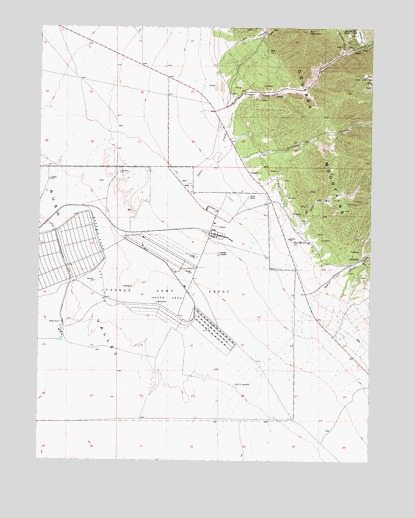
Ophir, UT USGS Topographic Map
Click on map above to begin viewing in our Map Viewer.

This topographic map contains these locations and features:
Feature Name Type Latitude Longitude GNIS ID View Map
Bates RanchLocaleN40.3524°W112.3030°1425321View Map
Bowman GulchValleyN40.3680°W112.2616°1425919View Map
Deseret Chemical DepotMilitaryN40.2978°W112.3433°2512162View Map
Dry CanyonValleyN40.3716°W112.3080°1427519View Map
Dry MountainSummitN40.3736°W112.2761°1427575View Map
Gillmore WellWellN40.2583°W112.2638°1451252View Map
Hartmann GulchValleyN40.3711°W112.2558°1428563View Map
Johnson CemeteryCemeteryN40.3219°W112.3408°2769301View Map
Mercur CanyonValleyN40.2977°W112.2719°1430228View Map
Mercur CemeteryCemeteryN40.3044°W112.2589°2128057View Map
Mercur CreekStreamN40.2980°W112.2722°1430229View Map
Montana MineMineN40.3744°W112.2622°1430426View Map
OphirPopulated PlaceN40.3694°W112.2586°1431015View Map
Ophir CanyonValleyN40.3494°W112.3049°1431016View Map
Ophir Census Designated PlaceCensusN40.3686°W112.2576°2787910View Map
Ophir CreekStreamN40.3169°W112.3322°1431017View Map
Ophir Fire DepartmentBuildingN40.3699°W112.2543°2627444View Map
Ophir New CemeteryCemeteryN40.3573°W112.2906°2128055View Map
Ophir Old CemeteryCemeteryN40.3574°W112.2892°2128056View Map
Silverado CanyonValleyN40.3374°W112.2983°1432471View Map
Town of OphirCivilN40.3693°W112.2557°2413086View Map
West Dip GulchValleyN40.3174°W112.2788°1434065View Map
West MercurPopulated PlaceN40.3147°W112.2783°1437718View Map

Note: Coordinates in the location and feature list above are referenced to NAD83 datum.


Copyright (C) 2008-2025 Ryan Niemi / Sunset Dynamics ... All Rights Reserved