TopoQuest Logo
Do you find TopoQuest useful?
Help keep TopoQuest running and adding new maps/features by donating!
Bitcoin:  19c7KJd3qBynnjoSw5npx9KScwjBe4ifkT
Litecoin:  LXs6TkuXGGXo1vDsWCkWVdjQX94eUKd6ui
Home View Maps Find Maps Find Places Resources & Links


Lowe Peak, Utah Topographic Map

USGS Map Title: Lowe Peak, UT
USGS Map MRC: 40112D2
DRG (GeoTIFF) Download: o40112d2.tif


Neighboring USGS Topographic Map Quads:


  Tooele, UT  
40112E3
 

  Bingham Canyon, UT  
40112E2
 

  Copperton, UT  
40112E1
 

  Stockton, UT  
40112D3
 

  Lowe Peak, UT  
40112D2
 

  Tickville Spring, UT  
40112D1
 

  Ophir, UT  
40112C3
 

  Mercur, UT  
40112C2
 

  Cedar Fort, UT  
40112C1


Map MRC Location:

N41°
W113°
N41°
W112°
H8 H7 H6 H5 H4 H3 H2 H1
G8 G7 G6 G5 G4 G3 G2 G1
F8 F7 F6 F5 F4 F3 F2 F1
E8 E7 E6 E5 E4 E3 E2 E1
D8 D7 D6 D5 D4 D3 D2 D1
C8 C7 C6 C5 C4 C3 C2 C1
B8 B7 B6 B5 B4 B3 B2 B1
A8 A7 A6 A5 A4 A3 A2 A1
N40°
W113°
N40°
W112°

Lowe Peak, UT USGS 1:24K Topographic Map Preview:
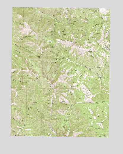
Lowe Peak, UT USGS Topographic Map
Click on map above to begin viewing in our Map Viewer.

This topographic map contains these locations and features:
Feature Name Type Latitude Longitude GNIS ID View Map
Bald KnollSummitN40.3888°W112.1361°1425253View Map
Bear GulchValleyN40.4780°W112.1572°1425348View Map
Big HoleBasinN40.3811°W112.1772°1455026View Map
Bishop ForkValleyN40.4869°W112.1669°1425627View Map
Blackjack GulchValleyN40.4877°W112.1324°1425744View Map
Bone CanyonValleyN40.4091°W112.1294°1455033View Map
Breccia KnobSummitN40.4611°W112.1274°1425948View Map
Butterfield PeaksSummitN40.4680°W112.1805°1426234View Map
Chandler ForkValleyN40.3949°W112.2316°1426528View Map
Cold SpringSpringN40.4709°W112.2367°1455046View Map
Cottonwood CanyonValleyN40.4408°W112.1530°1455024View Map
Cottonwood SpringSpringN40.4408°W112.1519°1426944View Map
Crooked CanyonValleyN40.4463°W112.1674°1455025View Map
Dead Ox PassGapN40.4074°W112.1986°1455023View Map
Farmers FlatFlatN40.4324°W112.1352°1427885View Map
Fourmile SpringSpringN40.3795°W112.1396°1455021View Map
Fox HollowValleyN40.4508°W112.1774°1428074View Map
Government SpringSpringN40.4083°W112.1866°1455020View Map
Halls BasinBasinN40.3769°W112.2013°1455019View Map
Harkers CanyonValleyN40.4947°W112.2133°1428533View Map
Iron CanyonValleyN40.4322°W112.1344°1429038View Map
Iron SpringSpringN40.4235°W112.1696°1455018View Map
Jackson HollowValleyN40.4505°W112.1805°1429104View Map
Kelsey PeakSummitN40.4519°W112.2144°1435816View Map
Left Hand Fork Butterfield CanyonValleyN40.4852°W112.1516°1429561View Map
Left Hand Fork Soldier CanyonValleyN40.4291°W112.2433°1429571View Map
Lowe BasinBasinN40.4258°W112.1880°1455017View Map
Lowe CanyonValleyN40.4091°W112.1674°1455016View Map
Lowe PeakSummitN40.4255°W112.1991°1429964View Map
Lowe SpringSpringN40.4194°W112.1769°1455015View Map
Maple CanyonValleyN40.4461°W112.1661°1430082View Map
Maple FlatFlatN40.4391°W112.1680°1437284View Map
Mill CanyonValleyN40.4488°W112.1774°1430324View Map
Mill FlatFlatN40.4497°W112.1777°1430328View Map
Monkins HollowValleyN40.4336°W112.1344°1430423View Map
Oak GroveLocaleN40.4083°W112.1372°1455014View Map
Old Mayflower MineMineN40.4511°W112.1841°1430983View Map
Picnic CanyonValleyN40.4049°W112.2219°1431219View Map
Piney PassGapN40.4561°W112.2133°1455047View Map
Pollywog SpringSpringN40.3934°W112.1473°1455013View Map
Queen MineMineN40.4980°W112.1430°1431525View Map
Rattlesnake SpringSpringN40.4588°W112.1341°1455010View Map
Right Hand Fork Soldier CanyonValleyN40.4291°W112.2436°1431833View Map
Rock SpringSpringN40.4222°W112.1728°1455012View Map
Rocky PeakSummitN40.4313°W112.2191°1455011View Map
Serviceberry CanyonValleyN40.3830°W112.2349°1455027View Map
Sheep RidgeRidgeN40.4488°W112.1355°1432384View Map
Shingle GulchValleyN40.4905°W112.1994°1432403View Map
South Fork Ophir CanyonValleyN40.3808°W112.2380°1432700View Map
Spring GulchValleyN40.4855°W112.1508°1432850View Map
Stockings ForkValleyN40.4866°W112.1341°1432988View Map
The JumpoffSummitN40.3933°W112.1791°1433350View Map
Tie ForkValleyN40.4863°W112.1711°1433520View Map
Tooele ForkValleyN40.4858°W112.1508°1433591View Map
Utah Metal Company TunnelTunnelN40.4872°W112.1908°1436563View Map
White Pine CanyonValleyN40.4877°W112.1947°1434177View Map
White Pine FlatFlatN40.4680°W112.2027°1434179View Map

Note: Coordinates in the location and feature list above are referenced to NAD83 datum.


Copyright (C) 2008-2025 Ryan Niemi / Sunset Dynamics ... All Rights Reserved