TopoQuest Logo
Do you find TopoQuest useful?
Help keep TopoQuest running and adding new maps/features by donating!
Bitcoin:  19c7KJd3qBynnjoSw5npx9KScwjBe4ifkT
Litecoin:  LXs6TkuXGGXo1vDsWCkWVdjQX94eUKd6ui
Home View Maps Find Maps Find Places Resources & Links


Ophir Mountain, Oregon Topographic Map

USGS Map Title: Ophir Mountain, OR
USGS Map MRC: 42124F2
DRG (GeoTIFF) Download: o42124f2.tif


Neighboring USGS Topographic Map Quads:


  Mount Butler, OR  
42124G3
 

  Barklow Mountain, OR  
42124G2
 

  China Flat, OR  
42124G1
 

  Father Mountain, OR  
42124F3
 

  Ophir Mountain, OR  
42124F2
 

  Illahe, OR  
42124F1
 

  Brushy Bald Mountain, OR  
42124E3
 

  Soldier Camp Mountain, OR  
42124E2
 

  Agness, OR  
42124E1


Map MRC Location:

N43°
W125°
N43°
W124°
H8 H7 H6 H5 H4 H3 H2 H1
G8 G7 G6 G5 G4 G3 G2 G1
F8 F7 F6 F5 F4 F3 F2 F1
E8 E7 E6 E5 E4 E3 E2 E1
D8 D7 D6 D5 D4 D3 D2 D1
C8 C7 C6 C5 C4 C3 C2 C1
B8 B7 B6 B5 B4 B3 B2 B1
A8 A7 A6 A5 A4 A3 A2 A1
N42°
W125°
N42°
W124°

Ophir Mountain, OR USGS 1:24K Topographic Map Preview:
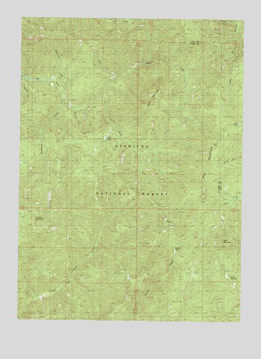
Ophir Mountain, OR USGS Topographic Map
Click on map above to begin viewing in our Map Viewer.

This topographic map contains these locations and features:
Feature Name Type Latitude Longitude GNIS ID View Map
Blackberry CreekStreamN42.7146°W124.2262°1138225View Map
Bonanza BasinBasinN42.6532°W124.1643°1138405View Map
Bungalow CreekStreamN42.7204°W124.2279°1155687View Map
Camp VictoriaLocaleN42.6646°W124.2470°1135799View Map
Copper MountainSummitN42.7187°W124.1735°1140107View Map
Copper Salmon WildernessReserveN42.7322°W124.1880°2767367View Map
Devils Half AcreSummitN42.6425°W124.1325°1140983View Map
Iron MountainSummitN42.6976°W124.1418°1144117View Map
Laird LakeLakeN42.7002°W124.2035°1154400View Map
Laird Lake Recreation SiteLocaleN42.6990°W124.2037°1926245View Map
Marys CreekStreamN42.7487°W124.1304°1155685View Map
McCurdy CampgroundLocaleN42.6659°W124.1673°1145962View Map
McCurdy CreekStreamN42.7129°W124.2220°1155688View Map
Mud LakeLakeN42.7070°W124.1280°1146572View Map
North Fork Elk RiverStreamN42.7168°W124.2048°1146951View Map
Ophir MountainSummitN42.6563°W124.1377°1147254View Map
Panther MountainSummitN42.6667°W124.2432°1147400View Map
Slide CreekStreamN42.7257°W124.2004°1155686View Map
South Fork Elk RiverStreamN42.7168°W124.2054°1149970View Map
Toast CampLocaleN42.6876°W124.2132°1151288View Map

Note: Coordinates in the location and feature list above are referenced to NAD83 datum.


Copyright (C) 2008-2024 Ryan Niemi / Sunset Dynamics ... All Rights Reserved