TopoQuest Logo
Do you find TopoQuest useful?
Help keep TopoQuest running and adding new maps/features by donating!
Bitcoin:  19c7KJd3qBynnjoSw5npx9KScwjBe4ifkT
Litecoin:  LXs6TkuXGGXo1vDsWCkWVdjQX94eUKd6ui
Home View Maps Find Maps Find Places Resources & Links


Orangedale, Florida Topographic Map

USGS Map Title: Orangedale, FL
USGS Map MRC: 30081A5
DRG (GeoTIFF) Download: o30081a5.tif


Neighboring USGS Topographic Map Quads:


  Orange Park, FL  
30081B6
 

  Bayard, FL  
30081B5
 

  Palm Valley, FL  
30081B4
 

  Fleming Island, FL  
30081A6
 

  Orangedale, FL  
30081A5
 

  Durbin, FL  
30081A4
 

  Green Cove Springs, FL  
29081H6
 

  Picolata, FL  
29081H5
 

  Bakersville, FL  
29081H4


Map MRC Location:

N31°
W82°
N31°
W81°
H8 H7 H6 H5 H4 H3 H2 H1
G8 G7 G6 G5 G4 G3 G2 G1
F8 F7 F6 F5 F4 F3 F2 F1
E8 E7 E6 E5 E4 E3 E2 E1
D8 D7 D6 D5 D4 D3 D2 D1
C8 C7 C6 C5 C4 C3 C2 C1
B8 B7 B6 B5 B4 B3 B2 B1
A8 A7 A6 A5 A4 A3 A2 A1
N30°
W82°
N30°
W81°

Orangedale, FL USGS 1:24K Topographic Map Preview:
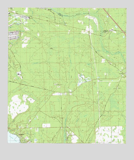
Orangedale, FL USGS Topographic Map
Click on map above to begin viewing in our Map Viewer.

This topographic map contains these locations and features:
Feature Name Type Latitude Longitude GNIS ID View Map
Big Island SwampSwampN30.0367°W81.5538°307885View Map
Big Lige BranchStreamN30.1033°W81.6106°307886View Map
Big SloughSwampN30.0742°W81.5938°46600View Map
Blacks FordPopulated PlaceN30.0472°W81.5604°307890View Map
Bowen BranchGutN30.0875°W81.5329°307897View Map
Cartwheel BaySwampN30.0693°W81.5371°307908View Map
Cedar HeadSwampN30.0640°W81.6158°307913View Map
Celebration Lutheran ChurchChurchN30.0827°W81.6194°2476104View Map
Corklan BranchStreamN30.1194°W81.5326°280843View Map
Dupont PlazaLocaleN30.1239°W81.5790°296901View Map
Fever HammockIslandN30.0872°W81.5795°307952View Map
Flat SwampSwampN30.0783°W81.5591°307959View Map
Fruit Cove Census Designated PlaceCensusN30.0972°W81.6176°2402509View Map
Fruit Cove DivisionCivilN30.0704°W81.6099°1935776View Map
Gopher IslandIslandN30.0652°W81.5568°307975View Map
Julington Creek Elementary SchoolSchoolN30.1160°W81.6030°308263View Map
Kendall CreekGutN30.0186°W81.6212°308003View Map
Little Lige BranchStreamN30.0991°W81.5976°308010View Map
Molasses BranchGutN30.0255°W81.5426°308036View Map
Northwest Saint Johns Post OfficePost OfficeN30.1238°W81.6233°2476298View Map
OrangedalePopulated PlaceN30.0086°W81.6131°308062View Map
Petty BranchGutN30.0144°W81.6154°308077View Map
Pine BluffPopulated PlaceN30.1244°W81.5859°308080View Map
Saint Johns County Fire Rescue Station 17 SampsonBuildingN30.0596°W81.5341°2644018View Map
Saint Johns County Sheriff's Office - Julington SubstationBuildingN30.1156°W81.5909°2333161View Map
SampsonPopulated PlaceN30.0647°W81.5018°308112View Map
Sampson CemeteryCemeteryN30.0516°W81.5090°308264View Map
Sampson CreekStreamN30.0827°W81.5112°308113View Map
The Club at Emerald HillsLocaleN30.0451°W81.5467°2452161View Map
The Course at WestlandLocaleN30.0496°W81.5071°2452164View Map
The Falls Country ClubLocaleN30.1113°W81.6116°2452248View Map
Trout Creek Naval Outer Landing Field (historical)MilitaryN30.0053°W81.5536°2105217View Map
WaterholeSwampN30.0742°W81.5938°308168View Map
Whites FordPopulated PlaceN30.0261°W81.5248°308173View Map

Note: Coordinates in the location and feature list above are referenced to NAD83 datum.


Copyright (C) 2008-2024 Ryan Niemi / Sunset Dynamics ... All Rights Reserved