TopoQuest Logo
Do you find TopoQuest useful?
Help keep TopoQuest running and adding new maps/features by donating!
Bitcoin:  19c7KJd3qBynnjoSw5npx9KScwjBe4ifkT
Litecoin:  LXs6TkuXGGXo1vDsWCkWVdjQX94eUKd6ui
Home View Maps Find Maps Find Places Resources & Links


Picolata, Florida Topographic Map

USGS Map Title: Picolata, FL
USGS Map MRC: 29081H5
DRG (GeoTIFF) Download: o29081h5.tif


Neighboring USGS Topographic Map Quads:


  Fleming Island, FL  
30081A6
 

  Orangedale, FL  
30081A5
 

  Durbin, FL  
30081A4
 

  Green Cove Springs, FL  
29081H6
 

  Picolata, FL  
29081H5
 

  Bakersville, FL  
29081H4
 

  Bostwick, FL  
29081G6
 

  Riverdale, FL  
29081G5
 

  Elkton, FL  
29081G4


Map MRC Location:

N30°
W82°
N30°
W81°
H8 H7 H6 H5 H4 H3 H2 H1
G8 G7 G6 G5 G4 G3 G2 G1
F8 F7 F6 F5 F4 F3 F2 F1
E8 E7 E6 E5 E4 E3 E2 E1
D8 D7 D6 D5 D4 D3 D2 D1
C8 C7 C6 C5 C4 C3 C2 C1
B8 B7 B6 B5 B4 B3 B2 B1
A8 A7 A6 A5 A4 A3 A2 A1
N29°
W82°
N29°
W81°

Picolata, FL USGS 1:24K Topographic Map Preview:
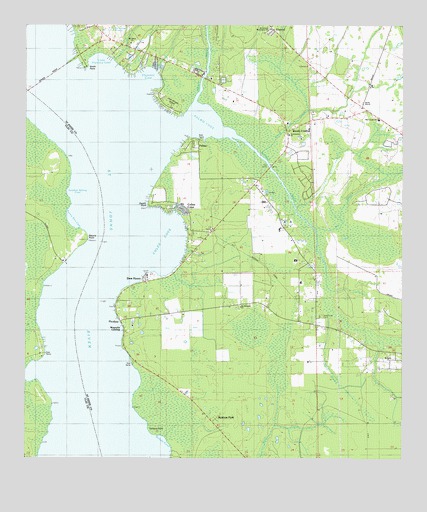
Picolata, FL USGS Topographic Map
Click on map above to begin viewing in our Map Viewer.

This topographic map contains these locations and features:
Feature Name Type Latitude Longitude GNIS ID View Map
Bakersville CemeteryCemeteryN29.9150°W81.5267°307835View Map
Bass HavenPopulated PlaceN29.9272°W81.5848°307833View Map
Bayard PointCapeN29.9386°W81.6040°278233View Map
Bethany Bible ChurchChurchN29.9058°W81.5054°307836View Map
Clarkes CreekStreamN29.9008°W81.6190°295001View Map
ColeeLocaleN29.9930°W81.5676°307847View Map
Colee CoveBayN29.9380°W81.5783°307832View Map
Dancey FlatFlatN29.9502°W81.5498°308200View Map
Deer Creek RanchLocaleN29.9947°W81.5854°307828View Map
ElwoodPopulated PlaceN29.9989°W81.5431°307947View Map
Ferreira PointCapeN29.8827°W81.5837°307951View Map
FlorencePopulated PlaceN29.9902°W81.5773°307855View Map
Florence CoveBayN29.9848°W81.5841°307839View Map
Florence PointCapeN29.9875°W81.5901°307852View Map
Fort Picolata (historical)MilitaryN29.9167°W81.5833°308385View Map
Hogarths LandingLocaleN29.9852°W81.5887°307851View Map
Honey BranchStreamN29.9161°W81.5245°307829View Map
Jack Wright IslandIslandN29.9772°W81.5768°307841View Map
Little Florence CoveBayN29.9892°W81.5994°307858View Map
Magnolia LandingLocaleN29.9114°W81.5920°308015View Map
Meldrim ParkPopulated PlaceN29.8869°W81.5612°308025View Map
Mill CreekStreamN29.9419°W81.5287°308031View Map
Mill Creek Baptist ChurchChurchN29.9730°W81.5079°307834View Map
Mount Olive ChurchChurchN29.9961°W81.5887°308046View Map
Mount Pleasant ChurchChurchN29.9189°W81.5531°308048View Map
Mud AlleyBayN29.9665°W81.5553°307849View Map
Pacetti PointCapeN29.9485°W81.5835°307843View Map
Pacettis MarinaHarborN29.9859°W81.5657°2452174View Map
PalmoPopulated PlaceN29.9664°W81.5673°308069View Map
Palmo CoveBayN29.9719°W81.5655°307840View Map
PicolataPopulated PlaceN29.9150°W81.5929°308078View Map
Picolata School (historical)SchoolN29.9194°W81.5576°308079View Map
Pocotalaco (historical)Populated PlaceN29.9169°W81.5498°308384View Map
Puerto Rico CoveBayN29.9444°W81.6092°289354View Map
Saint Johns County Fire Rescue Station 3 OrangedaleBuildingN29.9923°W81.5846°2644062View Map
Saint Johns County Fire Rescue Station 3ABuildingN29.9416°W81.5627°2644339View Map
Saint Joseph Missionary Baptist ChurchChurchN29.9933°W81.5434°307830View Map
Shands BridgeBridgeN29.9861°W81.6159°308119View Map
Sixmile CreekStreamN29.9705°W81.5620°308125View Map
Smith PointCapeN29.9879°W81.6048°307838View Map
Solano CoveBayN29.8778°W81.5789°308122View Map
Sulphur Spring CoveBayN29.9521°W81.6107°291797View Map
Trout CreekStreamN29.9780°W81.5687°308153View Map
Wards CreekStreamN29.9630°W81.5473°307848View Map
Wards Creek Community ChurchChurchN29.9686°W81.5373°307842View Map
Wateroak PointCapeN29.9608°W81.6129°301096View Map
Watson IslandIslandN29.8922°W81.5843°307844View Map
Wolfe RanchLocaleN29.9775°W81.5131°307831View Map

Note: Coordinates in the location and feature list above are referenced to NAD83 datum.


Copyright (C) 2008-2025 Ryan Niemi / Sunset Dynamics ... All Rights Reserved