TopoQuest Logo
Do you find TopoQuest useful?
Help keep TopoQuest running and adding new maps/features by donating!
Bitcoin:  19c7KJd3qBynnjoSw5npx9KScwjBe4ifkT
Litecoin:  LXs6TkuXGGXo1vDsWCkWVdjQX94eUKd6ui
Home View Maps Find Maps Find Places Resources & Links


Orofino West, Idaho Topographic Map

USGS Map Title: Orofino West, ID
USGS Map MRC: 46116D3
DRG (GeoTIFF) Download: o46116d3.tif


Neighboring USGS Topographic Map Quads:


  Southwick, ID  
46116E4
 

  Ahsahka, ID  
46116E3
 

  Dent, ID  
46116E2
 

  Peck, ID  
46116D4
 

  Orofino West, ID  
46116D3
 

  Orofino East, ID  
46116D2
 

  Fletcher, ID  
46116C4
 

  Mohler, ID  
46116C3
 

  Sixmile Creek, ID  
46116C2


Map MRC Location:

N47°
W117°
N47°
W116°
H8 H7 H6 H5 H4 H3 H2 H1
G8 G7 G6 G5 G4 G3 G2 G1
F8 F7 F6 F5 F4 F3 F2 F1
E8 E7 E6 E5 E4 E3 E2 E1
D8 D7 D6 D5 D4 D3 D2 D1
C8 C7 C6 C5 C4 C3 C2 C1
B8 B7 B6 B5 B4 B3 B2 B1
A8 A7 A6 A5 A4 A3 A2 A1
N46°
W117°
N46°
W116°

Orofino West, ID USGS 1:24K Topographic Map Preview:
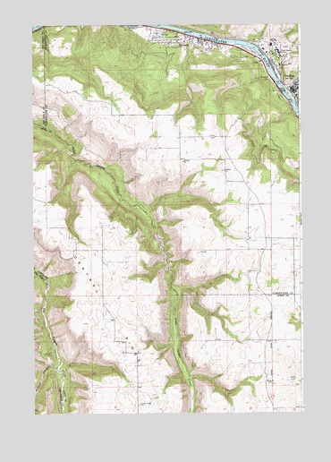
Orofino West, ID USGS Topographic Map
Click on map above to begin viewing in our Map Viewer.

This topographic map contains these locations and features:
Feature Name Type Latitude Longitude GNIS ID View Map
Canyon and Kelly Creek Ranger StationLocaleN46.4957°W116.2674°394015View Map
Central RidgeRidgeN46.4091°W116.3413°379144View Map
Central Ridge CemeteryCemeteryN46.3778°W116.3265°379145View Map
City of OrofinoCivilN46.4867°W116.2585°2411336View Map
Clearwater County AmbulanceBuildingN46.4926°W116.2671°2642815View Map
Clearwater County Sheriff's OfficeBuildingN46.4800°W116.2551°2722419View Map
Clearwater Potlatch Timber Protective AssociationBuildingN46.4939°W116.2855°2619201View Map
Clearwater Valley HospitalHospitalN46.4869°W116.2597°2721842View Map
Gilbert ChurchChurchN46.4530°W116.2857°382269View Map
Idaho Correctional Institution - OrofinoBuildingN46.4918°W116.2608°2722653View Map
Lewis-Clark Canoe Camp State ParkParkN46.4991°W116.3396°384593View Map
Nez Perce DivisionCivilN46.4789°W116.2756°1936776View Map
Nichols CanyonValleyN46.3905°W116.3651°387557View Map
North Fork Clearwater RiverStreamN46.4999°W116.3304°387675View Map
OrofinoPopulated PlaceN46.4793°W116.2551°396986View Map
Orofino CreekStreamN46.4760°W116.2549°400025View Map
Orofino Fire Department Station 1BuildingN46.4781°W116.2521°2618966View Map
Orofino Fire Department Station 2BuildingN46.4978°W116.3139°2619169View Map
Orofino High SchoolSchoolN46.4936°W116.2638°388000View Map
Orofino Junior High SchoolSchoolN46.4804°W116.2505°401039View Map
Orofino Municipal AirportAirportN46.4924°W116.2768°400718View Map
Orofino Police DepartmentBuildingN46.4781°W116.2521°2722377View Map
Orofino Post OfficePost OfficeN46.4804°W116.2525°2781759View Map
RiversidePopulated PlaceN46.4955°W116.2974°389404View Map
Riverside CemeteryCemeteryN46.4821°W116.2637°389408View Map
RussellLocaleN46.3846°W116.2671°389736View Map
State Hospital NorthHospitalN46.4904°W116.2599°391367View Map

Note: Coordinates in the location and feature list above are referenced to NAD83 datum.


Copyright (C) 2008-2025 Ryan Niemi / Sunset Dynamics ... All Rights Reserved