TopoQuest Logo
Do you find TopoQuest useful?
Help keep TopoQuest running and adding new maps/features by donating!
Bitcoin:  19c7KJd3qBynnjoSw5npx9KScwjBe4ifkT
Litecoin:  LXs6TkuXGGXo1vDsWCkWVdjQX94eUKd6ui
Home View Maps Find Maps Find Places Resources & Links


Southwick, Idaho Topographic Map

USGS Map Title: Southwick, ID
USGS Map MRC: 46116E4
DRG (GeoTIFF) Download: o46116e4.tif


Neighboring USGS Topographic Map Quads:


  Texas Ridge, ID  
46116F5
 

  Park, ID  
46116F4
 

  Aldermand Ridge, ID  
46116F3
 

  Lenore, ID  
46116E5
 

  Southwick, ID  
46116E4
 

  Ahsahka, ID  
46116E3
 

  Gifford, ID  
46116D5
 

  Peck, ID  
46116D4
 

  Orofino West, ID  
46116D3


Map MRC Location:

N47°
W117°
N47°
W116°
H8 H7 H6 H5 H4 H3 H2 H1
G8 G7 G6 G5 G4 G3 G2 G1
F8 F7 F6 F5 F4 F3 F2 F1
E8 E7 E6 E5 E4 E3 E2 E1
D8 D7 D6 D5 D4 D3 D2 D1
C8 C7 C6 C5 C4 C3 C2 C1
B8 B7 B6 B5 B4 B3 B2 B1
A8 A7 A6 A5 A4 A3 A2 A1
N46°
W117°
N46°
W116°

Southwick, ID USGS 1:24K Topographic Map Preview:
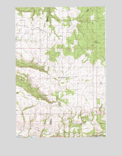
Southwick, ID USGS Topographic Map
Click on map above to begin viewing in our Map Viewer.

This topographic map contains these locations and features:
Feature Name Type Latitude Longitude GNIS ID View Map
Big GeorgePopulated PlaceN46.5027°W116.4929°397438View Map
CavendishPopulated PlaceN46.5602°W116.4340°397534View Map
Cavendish - Teakean Elementary SchoolSchoolN46.5564°W116.4256°375418View Map
Evergreen Rural Fire DistrictBuildingN46.5517°W116.3757°2619029View Map
Potlatch RidgeRidgeN46.6002°W116.4796°374521View Map
SouthwickPopulated PlaceN46.6035°W116.4721°398159View Map
Sunnyside CemeteryCemeteryN46.5091°W116.4835°375349View Map
Sunnyside Rural Fire DistrictBuildingN46.5159°W116.3982°2619054View Map
TeakeanPopulated PlaceN46.5510°W116.3807°398219View Map
Teakean ButteSummitN46.5913°W116.3904°375417View Map
United Brethren CampLocaleN46.5302°W116.4399°375662View Map

Note: Coordinates in the location and feature list above are referenced to NAD83 datum.


Copyright (C) 2008-2025 Ryan Niemi / Sunset Dynamics ... All Rights Reserved