TopoQuest Logo
Do you find TopoQuest useful?
Help keep TopoQuest running and adding new maps/features by donating!
Bitcoin:  19c7KJd3qBynnjoSw5npx9KScwjBe4ifkT
Litecoin:  LXs6TkuXGGXo1vDsWCkWVdjQX94eUKd6ui
Home View Maps Find Maps Find Places Resources & Links


Peck, Idaho Topographic Map

USGS Map Title: Peck, ID
USGS Map MRC: 46116D4
DRG (GeoTIFF) Download: o46116d4.tif


Neighboring USGS Topographic Map Quads:


  Lenore, ID  
46116E5
 

  Southwick, ID  
46116E4
 

  Ahsahka, ID  
46116E3
 

  Gifford, ID  
46116D5
 

  Peck, ID  
46116D4
 

  Orofino West, ID  
46116D3
 

  Reubens, ID  
46116C5
 

  Fletcher, ID  
46116C4
 

  Mohler, ID  
46116C3


Map MRC Location:

N47°
W117°
N47°
W116°
H8 H7 H6 H5 H4 H3 H2 H1
G8 G7 G6 G5 G4 G3 G2 G1
F8 F7 F6 F5 F4 F3 F2 F1
E8 E7 E6 E5 E4 E3 E2 E1
D8 D7 D6 D5 D4 D3 D2 D1
C8 C7 C6 C5 C4 C3 C2 C1
B8 B7 B6 B5 B4 B3 B2 B1
A8 A7 A6 A5 A4 A3 A2 A1
N46°
W117°
N46°
W116°

Peck, ID USGS 1:24K Topographic Map Preview:
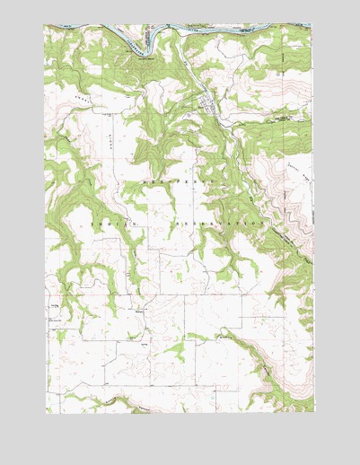
Peck, ID USGS Topographic Map
Click on map above to begin viewing in our Map Viewer.

This topographic map contains these locations and features:
Feature Name Type Latitude Longitude GNIS ID View Map
Angel RidgeRidgeN46.4782°W116.4954°371241View Map
Angel Ridge CemeteryCemeteryN46.4706°W116.4682°371242View Map
Big Canyon CreekStreamN46.4977°W116.4346°377457View Map
Big Canyon Fire DistrictBuildingN46.4757°W116.4227°2619317View Map
City of PeckCivilN46.4747°W116.4262°2411396View Map
Good Hope ChurchChurchN46.4091°W116.4954°372873View Map
Harpers BendBendN46.4896°W116.4526°372993View Map
Little Canyon CreekStreamN46.4680°W116.4201°384766View Map
MelrosePopulated PlaceN46.4082°W116.4546°376171View Map
Melrose CemeteryCemeteryN46.3986°W116.4618°373905View Map
Old Good Hope CemeteryCemeteryN46.4059°W116.4991°374256View Map
PeckPopulated PlaceN46.4988°W116.4335°397985View Map
PeckPopulated PlaceN46.4752°W116.4243°397986View Map
Peck Access AreaLocaleN46.4963°W116.4365°401096View Map
Peck CemeteryCemeteryN46.4712°W116.4333°374352View Map
Peck Elementary SchoolSchoolN46.4747°W116.4229°401081View Map
Peck Post OfficePost OfficeN46.4736°W116.4219°2766842View Map
Snells IslandIslandN46.4977°W116.3851°398150View Map
Thompson DamDamN46.4732°W116.3860°398751View Map

Note: Coordinates in the location and feature list above are referenced to NAD83 datum.


Copyright (C) 2008-2025 Ryan Niemi / Sunset Dynamics ... All Rights Reserved