TopoQuest Logo
Do you find TopoQuest useful?
Help keep TopoQuest running and adding new maps/features by donating!
Bitcoin:  19c7KJd3qBynnjoSw5npx9KScwjBe4ifkT
Litecoin:  LXs6TkuXGGXo1vDsWCkWVdjQX94eUKd6ui
Home View Maps Find Maps Find Places Resources & Links


Orvil, Texas Topographic Map

USGS Map Title: Orvil, TX
USGS Map MRC: 27099F4
DRG (GeoTIFF) Download: o27099f4.tif


Neighboring USGS Topographic Map Quads:


  Nido Ranch, TX  
27099G5
 

  Callaghan Ranch South, TX  
27099G4
 

  Callaghan Ranch SE, TX  
27099G3
 

  Cuervo Creek, TX  
27099F5
 

  Orvil, TX  
27099F4
 

  Cibolo Ranch, TX  
27099F3
 

  Laredo West, TX  
27099E5
 

  Laredo East, TX  
27099E4
 

  Tios Creek, TX  
27099E3


Map MRC Location:

N28°
W100°
N28°
W99°
H8 H7 H6 H5 H4 H3 H2 H1
G8 G7 G6 G5 G4 G3 G2 G1
F8 F7 F6 F5 F4 F3 F2 F1
E8 E7 E6 E5 E4 E3 E2 E1
D8 D7 D6 D5 D4 D3 D2 D1
C8 C7 C6 C5 C4 C3 C2 C1
B8 B7 B6 B5 B4 B3 B2 B1
A8 A7 A6 A5 A4 A3 A2 A1
N27°
W100°
N27°
W99°

Orvil, TX USGS 1:24K Topographic Map Preview:
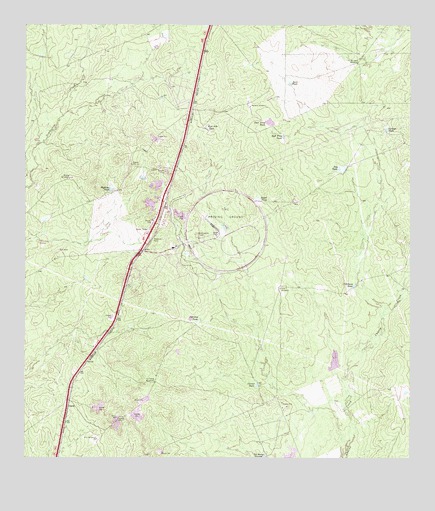
Orvil, TX USGS Topographic Map
Click on map above to begin viewing in our Map Viewer.

This topographic map contains these locations and features:
Feature Name Type Latitude Longitude GNIS ID View Map
Bull Trap TankReservoirN27.7183°W99.4156°1331615View Map
Calabaza TankReservoirN27.6754°W99.3933°1331854View Map
Cerritos TankReservoirN27.6653°W99.4456°1332597View Map
Corner TankReservoirN27.6469°W99.4260°1333374View Map
Deer Trap TankReservoirN27.7220°W99.4209°1334224View Map
Dry TankReservoirN27.7087°W99.3970°1334707View Map
East Side TankReservoirN27.7204°W99.4413°1334995View Map
El Jano WindmillLocaleN27.7392°W99.3923°1335196View Map
Highline TankReservoirN27.7031°W99.4724°1337754View Map
Juan TankReservoirN27.7335°W99.4145°1338902View Map
La Coma WindmillLocaleN27.6472°W99.4578°1339302View Map
La Presa GrandeReservoirN27.6257°W99.4233°1339386View Map
Macana WindmillLocaleN27.7267°W99.4261°1340790View Map
Mocho WindmillLocaleN27.7061°W99.4856°1341783View Map
OrvilPopulated PlaceN27.6395°W99.4862°1378810View Map
Orvil WindmillLocaleN27.6308°W99.4764°1343320View Map
Royal TankReservoirN27.7003°W99.4248°1345730View Map
Tasal WindmillLocaleN27.6742°W99.4170°1348264View Map
Tortuga TankReservoirN27.7202°W99.3831°1348660View Map

Note: Coordinates in the location and feature list above are referenced to NAD83 datum.


Copyright (C) 2008-2025 Ryan Niemi / Sunset Dynamics ... All Rights Reserved