TopoQuest Logo
Do you find TopoQuest useful?
Help keep TopoQuest running and adding new maps/features by donating!
Bitcoin:  19c7KJd3qBynnjoSw5npx9KScwjBe4ifkT
Litecoin:  LXs6TkuXGGXo1vDsWCkWVdjQX94eUKd6ui
Home View Maps Find Maps Find Places Resources & Links


Cherry Valley, Ohio Topographic Map

USGS Map Title: Cherry Valley, OH
USGS Map MRC: 41080E6
DRG (GeoTIFF) Download: o41080e6.tif


Neighboring USGS Topographic Map Quads:


  Jefferson, OH  
41080F7
 

  Dorset, OH  
41080F6
 

  Leon, OH  
41080F5
 

  Orwell, OH  
41080E7
 

  Cherry Valley, OH  
41080E6
 

  Andover, OH  
41080E5
 

  Bristolville, OH  
41080D7
 

  Gustavus, OH  
41080D6
 

  Kinsman, OH  
41080D5


Map MRC Location:

N42°
W81°
N42°
W80°
H8 H7 H6 H5 H4 H3 H2 H1
G8 G7 G6 G5 G4 G3 G2 G1
F8 F7 F6 F5 F4 F3 F2 F1
E8 E7 E6 E5 E4 E3 E2 E1
D8 D7 D6 D5 D4 D3 D2 D1
C8 C7 C6 C5 C4 C3 C2 C1
B8 B7 B6 B5 B4 B3 B2 B1
A8 A7 A6 A5 A4 A3 A2 A1
N41°
W81°
N41°
W80°

Cherry Valley, OH USGS 1:24K Topographic Map Preview:
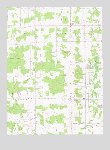
Cherry Valley, OH USGS Topographic Map
Click on map above to begin viewing in our Map Viewer.

This topographic map contains these locations and features:
Feature Name Type Latitude Longitude GNIS ID View Map
Britton FarmsLocaleN41.5897°W80.7483°2706732View Map
Campbells FarmLocaleN41.6128°W80.6772°2706721View Map
Center CemeteryCemeteryN41.5364°W80.6648°1038931View Map
Cherry ValleyPopulated PlaceN41.6067°W80.6673°1056796View Map
Cherry Valley CemeteryCemeteryN41.6084°W80.6595°1039031View Map
Cherry Valley Church of the NazareneChurchN41.6067°W80.6634°1062514View Map
Cherry Valley United Methodist ChurchChurchN41.6078°W80.6656°1062515View Map
Colebrook South CemeteryCemeteryN41.5153°W80.7292°1731114View Map
Coltman FarmsLocaleN41.5458°W80.7000°2706142View Map
Creekside FarmsLocaleN41.5389°W80.6633°2706675View Map
Fantasy LakeLakeN41.6087°W80.7179°2704671View Map
Gale FarmsLocaleN41.5944°W80.7086°2706790View Map
Galicki PondReservoirN41.5603°W80.6637°1078305View Map
Galicki Pond DamDamN41.5617°W80.6631°1078304View Map
Grand View AcresLocaleN41.5800°W80.6511°2706723View Map
Gruskiewicz FarmsLocaleN41.5192°W80.6697°2706677View Map
Hayes CemeteryCemeteryN41.5489°W80.6465°1041422View Map
Jeffco LakeReservoirN41.5664°W80.6438°1078301View Map
Jeffco Lake DamDamN41.5651°W80.6431°1078300View Map
Kriegs FarmsLocaleN41.5603°W80.7389°2706667View Map
Limpert LakeReservoirN41.5084°W80.7181°1078303View Map
Limpert Lake DamDamN41.5084°W80.7181°1078302View Map
Magyar FarmsLocaleN41.5081°W80.6897°2706668View Map
MannPopulated PlaceN41.5917°W80.6390°1065720View Map
Marrison FarmsLocaleN41.6150°W80.7358°2706781View Map
New Lyme Wildlife AreaParkN41.5748°W80.7387°1731143View Map
R and K FarmsLocaleN41.5219°W80.7031°2706671View Map
Rutledge FarmLocaleN41.6042°W80.7236°2706791View Map
Schafle Dairy FarmLocaleN41.5586°W80.7469°2706672View Map
Suchdale FarmsLocaleN41.5814°W80.6275°2706729View Map
Touch of Class FarmLocaleN41.5561°W80.7306°2706674View Map
Township of Cherry ValleyCivilN41.6073°W80.6667°1085721View Map
Township of WayneCivilN41.5353°W80.6662°1085745View Map
WaynePopulated PlaceN41.5345°W80.6665°1056563View Map
Wayne Township Volunteer Fire DepartmentBuildingN41.5347°W80.6509°2550516View Map
WickPopulated PlaceN41.5342°W80.6473°1047893View Map
Wick Post Office (historical)Post OfficeN41.5348°W80.6470°1959118View Map

Note: Coordinates in the location and feature list above are referenced to NAD83 datum.


Copyright (C) 2008-2025 Ryan Niemi / Sunset Dynamics ... All Rights Reserved