TopoQuest Logo
Do you find TopoQuest useful?
Help keep TopoQuest running and adding new maps/features by donating!
Bitcoin:  19c7KJd3qBynnjoSw5npx9KScwjBe4ifkT
Litecoin:  LXs6TkuXGGXo1vDsWCkWVdjQX94eUKd6ui
Home View Maps Find Maps Find Places Resources & Links


Orwigsburg, Pennsylvania Topographic Map

USGS Map Title: Orwigsburg, PA
USGS Map MRC: 40076F1
DRG (GeoTIFF) Download: o40076f1.tif


Neighboring USGS Topographic Map Quads:


  Shenandoah, PA  
40076G2
 

  Delano, PA  
40076G1
 

  Tamaqua, PA  
40075G8
 

  Pottsville, PA  
40076F2
 

  Orwigsburg, PA  
40076F1
 

  New Ringgold, PA  
40075F8
 

  Friedensburg, PA  
40076E2
 

  Auburn, PA  
40076E1
 

  Hamburg, PA  
40075E8


Map MRC Location:

N41°
W77°
N41°
W76°
H8 H7 H6 H5 H4 H3 H2 H1
G8 G7 G6 G5 G4 G3 G2 G1
F8 F7 F6 F5 F4 F3 F2 F1
E8 E7 E6 E5 E4 E3 E2 E1
D8 D7 D6 D5 D4 D3 D2 D1
C8 C7 C6 C5 C4 C3 C2 C1
B8 B7 B6 B5 B4 B3 B2 B1
A8 A7 A6 A5 A4 A3 A2 A1
N40°
W77°
N40°
W76°

Orwigsburg, PA USGS 1:24K Topographic Map Preview:
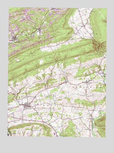
Orwigsburg, PA USGS Topographic Map
Click on map above to begin viewing in our Map Viewer.

This topographic map contains these locations and features:
Feature Name Type Latitude Longitude GNIS ID View Map
Beaver CreekStreamN40.7206°W76.0169°1169004View Map
Bethel ChurchChurchN40.6526°W76.0705°1169392View Map
Big CreekStreamN40.7495°W76.0613°1169493View Map
Black RunStreamN40.7306°W76.0899°2071341View Map
Blue Mountain East Elementary SchoolSchoolN40.6559°W76.0888°1207240View Map
Blue Mountain Middle SchoolSchoolN40.6559°W76.0863°1207239View Map
Borough of LandingvilleCivilN40.6257°W76.1235°1215552View Map
Borough of MiddleportCivilN40.7278°W76.0868°1215556View Map
Borough of New PhiladelphiaCivilN40.7178°W76.1167°1215559View Map
Borough of OrwigsburgCivilN40.6542°W76.1040°1215561View Map
Breiner SchoolSchoolN40.7473°W76.0188°1170192View Map
BrocktonPopulated PlaceN40.7484°W76.0685°1170307View Map
Brockton Post OfficePost OfficeN40.7497°W76.0692°2772618View Map
Brockton Volunteer Fire Company District 27 Station 1BuildingN40.7480°W76.0692°2653509View Map
Buteo BrookStreamN40.6344°W76.0154°2071340View Map
Citizens Fire Company MiddleportBuildingN40.7274°W76.0853°2652705View Map
Cold RunStreamN40.6804°W76.0013°1172149View Map
Deer LakePopulated PlaceN40.6251°W76.0605°1173089View Map
DrehersvillePopulated PlaceN40.6426°W76.0174°1173464View Map
Ellis CreekStreamN40.7191°W76.1157°2071337View Map
FrisbiePopulated PlaceN40.6643°W76.0660°1203636View Map
Frisbie BranchStreamN40.6582°W76.0667°2071336View Map
Good Intent Fire Company District 54 Station 1BuildingN40.7208°W76.1165°2653526View Map
HeclaPopulated PlaceN40.7023°W76.0019°1176753View Map
Heisler Egg FarmLocaleN40.7497°W76.0369°2725566View Map
KaskaPopulated PlaceN40.7401°W76.1072°1178245View Map
Kaska Volunteer Fire Company District 2 Station 1BuildingN40.7394°W76.1063°2653524View Map
Kunkles DamReservoirN40.6798°W76.0500°1178711View Map
Kunkles DamDamN40.6784°W76.0497°1194973View Map
LandingvillePopulated PlaceN40.6262°W76.1236°1178849View Map
LewistownPopulated PlaceN40.7326°W76.0280°1179246View Map
Lewistown ValleyValleyN40.7439°W76.0259°1179248View Map
Lower DamDamN40.6743°W76.1158°1200013View Map
Lower DamReservoirN40.6801°W76.1163°1194976View Map
Lower DamDamN40.6801°W76.1163°1194977View Map
Mahannon CreekStreamN40.6287°W76.1227°1180203View Map
Mahonney CreekStreamN40.6326°W76.1241°1180228View Map
McKeansburgPopulated PlaceN40.6784°W76.0235°1180734View Map
McKeansburg Census Designated PlaceCensusN40.6823°W76.0196°2389461View Map
MiddleportPopulated PlaceN40.7295°W76.0855°1181064View Map
Middleport Post OfficePost OfficeN40.7286°W76.0856°2779816View Map
Mine Hollow RunStreamN40.7242°W76.1075°2071334View Map
Morgan RunStreamN40.7271°W76.0898°2071333View Map
Neon Airport (historical)AirportN40.6898°W76.0655°1194064View Map
New PhiladelphiaPopulated PlaceN40.7195°W76.1158°1182357View Map
New Philadelphia Police DepartmentBuildingN40.7209°W76.1166°2780269View Map
New Philadelphia Post OfficePost OfficeN40.7185°W76.1167°2772874View Map
OrwigsburgPopulated PlaceN40.6548°W76.1008°1183059View Map
Orwigsburg Ambulance ServicesBuildingN40.6531°W76.0958°2722307View Map
Orwigsburg Borough Police Department’BuildingN40.6564°W76.1006°2780116View Map
Orwigsburg Fire Department District 56 Station 1BuildingN40.6557°W76.1020°2653521View Map
Orwigsburg Post OfficePost OfficeN40.6557°W76.1090°2772895View Map
Orwigsburg ReservoirReservoirN40.6747°W76.1164°1183060View Map
PinedaleLocaleN40.6259°W76.0588°1212434View Map
Pinedale SchoolSchoolN40.6287°W76.0619°1183924View Map
Red Church RunStreamN40.6407°W76.0712°2071326View Map
Rip Rap RunStreamN40.6788°W76.0017°2071325View Map
Silfis RunStreamN40.6693°W76.1102°1213035View Map
Silver CreekStreamN40.7193°W76.1155°1187672View Map
State Game Lands Number 222ParkN40.7084°W76.0413°1208073View Map
Stevens SchoolSchoolN40.6331°W76.0216°1188636View Map
Swampy CreekStreamN40.7292°W76.0863°2071323View Map
The SwampyReservoirN40.7329°W76.1002°2071614View Map
Township of WalkerCivilN40.7450°W76.0077°1217021View Map
Township of West BrunswickCivilN40.6325°W76.0625°1217024View Map
Tucker HillLocaleN40.7359°W76.1185°1212432View Map
Yost DamDamN40.7206°W76.0174°1200008View Map
Zion United Church of ChristChurchN40.6390°W76.0777°1191996View Map

Note: Coordinates in the location and feature list above are referenced to NAD83 datum.


Copyright (C) 2008-2025 Ryan Niemi / Sunset Dynamics ... All Rights Reserved