TopoQuest Logo
Do you find TopoQuest useful?
Help keep TopoQuest running and adding new maps/features by donating!
Bitcoin:  19c7KJd3qBynnjoSw5npx9KScwjBe4ifkT
Litecoin:  LXs6TkuXGGXo1vDsWCkWVdjQX94eUKd6ui
Home View Maps Find Maps Find Places Resources & Links


Oscura, New Mexico Topographic Map

USGS Map Title: Oscura, NM
USGS Map MRC: 33106D1
DRG (GeoTIFF) Download: o33106d1.tif


Neighboring USGS Topographic Map Quads:


  Cub Mountain, NM  
33105E8


  Oscura, NM  
33106D1
 

  Godfrey Peak, NM  
33105D8


  Three Rivers, NM  
33106C1
 

  Golondrina Draw, NM  
33105C8


Map MRC Location:

N34°
W107°
N34°
W106°
H8 H7 H6 H5 H4 H3 H2 H1
G8 G7 G6 G5 G4 G3 G2 G1
F8 F7 F6 F5 F4 F3 F2 F1
E8 E7 E6 E5 E4 E3 E2 E1
D8 D7 D6 D5 D4 D3 D2 D1
C8 C7 C6 C5 C4 C3 C2 C1
B8 B7 B6 B5 B4 B3 B2 B1
A8 A7 A6 A5 A4 A3 A2 A1
N33°
W107°
N33°
W106°

Oscura, NM USGS 1:24K Topographic Map Preview:
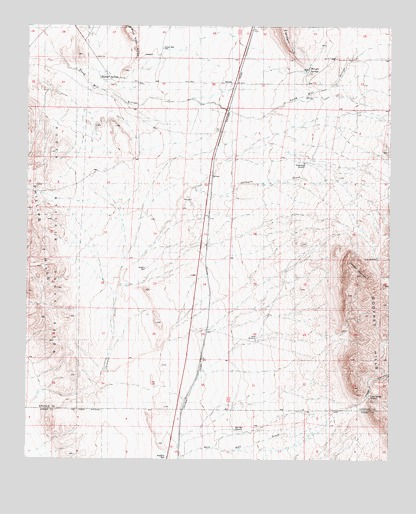
Oscura, NM USGS Topographic Map
Click on map above to begin viewing in our Map Viewer.

This topographic map contains these locations and features:
Feature Name Type Latitude Longitude GNIS ID View Map
Brownstein WindmillLocaleN33.4604°W106.0300°900367View Map
Bull Gap RidgeRidgeN33.4951°W106.0881°900365View Map
Cora CrewPopulated PlaceN33.4826°W106.0250°899588View Map
Harrold Water WellWellN33.4604°W106.0306°931730View Map
Husk WindmillLocaleN33.4329°W106.0047°900570View Map
Jackass MountainSummitN33.4284°W106.0103°900571View Map
Jackson WellWellN33.4304°W106.0844°890396View Map
Keen SpringSpringN33.4884°W106.0867°890638View Map
KimmonsPopulated PlaceN33.4909°W106.0194°899695View Map
Lopez CanyonValleyN33.3901°W106.0117°900590View Map
Lopez SpringSpringN33.3934°W106.0072°892923View Map
McKim Water WellWellN33.4920°W106.0200°931733View Map
Milagro HillSummitN33.4990°W106.0378°900366View Map
Milagro SpringsSpringN33.4880°W106.0288°898373View Map
New Water WellWellN33.4729°W106.0314°931731View Map
North SidingLocaleN33.3956°W106.0681°892658View Map
Norton WellWellN33.4940°W106.0778°892752View Map
OscuraPopulated PlaceN33.4837°W106.0544°923639View Map
Oscura Post Office (historical)Post OfficeN33.4862°W106.0522°937433View Map
Phillips SpringsSpringN33.4853°W106.1008°897440View Map
Rey MineMineN33.4492°W106.0742°916152View Map
StilesMineN33.4487°W106.0708°914766View Map
Taylor WindmillLocaleN33.4095°W106.0464°900572View Map

Note: Coordinates in the location and feature list above are referenced to NAD83 datum.


Copyright (C) 2008-2025 Ryan Niemi / Sunset Dynamics ... All Rights Reserved