TopoQuest Logo
Do you find TopoQuest useful?
Help keep TopoQuest running and adding new maps/features by donating!
Bitcoin:  19c7KJd3qBynnjoSw5npx9KScwjBe4ifkT
Litecoin:  LXs6TkuXGGXo1vDsWCkWVdjQX94eUKd6ui
Home View Maps Find Maps Find Places Resources & Links


Three Rivers, New Mexico Topographic Map

USGS Map Title: Three Rivers, NM
USGS Map MRC: 33106C1
DRG (GeoTIFF) Download: o33106c1.tif


Neighboring USGS Topographic Map Quads:


  Oscura, NM  
33106D1
 

  Godfrey Peak, NM  
33105D8


  Three Rivers, NM  
33106C1
 

  Golondrina Draw, NM  
33105C8
 

  Bitter Creek, NM  
33106B2
 

  Tularosa NE, NM  
33106B1
 

  Cat Mountain, NM  
33105B8


Map MRC Location:

N34°
W107°
N34°
W106°
H8 H7 H6 H5 H4 H3 H2 H1
G8 G7 G6 G5 G4 G3 G2 G1
F8 F7 F6 F5 F4 F3 F2 F1
E8 E7 E6 E5 E4 E3 E2 E1
D8 D7 D6 D5 D4 D3 D2 D1
C8 C7 C6 C5 C4 C3 C2 C1
B8 B7 B6 B5 B4 B3 B2 B1
A8 A7 A6 A5 A4 A3 A2 A1
N33°
W107°
N33°
W106°

Three Rivers, NM USGS 1:24K Topographic Map Preview:
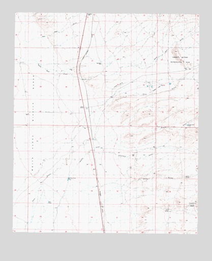
Three Rivers, NM USGS Topographic Map
Click on map above to begin viewing in our Map Viewer.

This topographic map contains these locations and features:
Feature Name Type Latitude Longitude GNIS ID View Map
Aguilar SpringSpringN33.2819°W106.0092°885599View Map
Boone DrawArroyoN33.2526°W106.1103°901004View Map
Boone Draw TankReservoirN33.3120°W106.0081°900673View Map
Bull TankReservoirN33.2673°W106.1014°900672View Map
Chosa TankReservoirN33.2810°W106.0879°887566View Map
Crawford DrawArroyoN33.2970°W106.0705°900968View Map
Crosby SpringSpringN33.2680°W106.0016°900575View Map
Crosby WellWellN33.2662°W106.0025°900576View Map
Falls RanchLocaleN33.3345°W106.0333°888961View Map
Falls Ranch SpringSpringN33.3240°W106.0589°914267View Map
Hatchet RanchLocaleN33.3129°W106.0822°889829View Map
Kitty SpringSpringN33.2648°W106.0228°890733View Map
New Well DrawArroyoN33.3592°W106.1194°900589View Map
Rocky ArroyoArroyoN33.2517°W106.1103°901037View Map
Rocky ArroyoArroyoN33.2812°W106.0378°900688View Map
Sand WellWellN33.3462°W106.0667°900573View Map
Sand Well DrawArroyoN33.3506°W106.1244°900511View Map
Three RiversPopulated PlaceN33.3215°W106.0750°920716View Map
Three Rivers Historical MarkerParkN33.3215°W106.0750°932286View Map
Three Rivers PertoglyphLocaleN33.3470°W106.0117°900574View Map
Three Rivers Petroglyph Recreational SiteParkN33.3440°W106.0255°929285View Map
Three Rivers Petroglyphs Historical MarkerParkN33.3215°W106.0750°931723View Map
Three Rivers Post Office (historical)Post OfficeN33.3215°W106.0750°937934View Map
Three Rivers Ranch Airport (historical)AirportN33.3353°W106.0229°2444043View Map

Note: Coordinates in the location and feature list above are referenced to NAD83 datum.


Copyright (C) 2008-2025 Ryan Niemi / Sunset Dynamics ... All Rights Reserved