TopoQuest Logo
Do you find TopoQuest useful?
Help keep TopoQuest running and adding new maps/features by donating!
Bitcoin:  19c7KJd3qBynnjoSw5npx9KScwjBe4ifkT
Litecoin:  LXs6TkuXGGXo1vDsWCkWVdjQX94eUKd6ui
Home View Maps Find Maps Find Places Resources & Links


Otisco Valley, New York Topographic Map

USGS Map Title: Otisco Valley, NY
USGS Map MRC: 42076G2
DRG (GeoTIFF) Download: o42076g2.tif


Neighboring USGS Topographic Map Quads:


  Marcellus, NY  
42076H3
 

  South Onondaga, NY  
42076H2
 

  Jamesville, NY  
42076H1
 

  Spafford, NY  
42076G3
 

  Otisco Valley, NY  
42076G2
 

  Tully, NY  
42076G1
 

  Sempronius, NY  
42076F3
 

  Homer, NY  
42076F2
 

  Truxton, NY  
42076F1


Map MRC Location:

N43°
W77°
N43°
W76°
H8 H7 H6 H5 H4 H3 H2 H1
G8 G7 G6 G5 G4 G3 G2 G1
F8 F7 F6 F5 F4 F3 F2 F1
E8 E7 E6 E5 E4 E3 E2 E1
D8 D7 D6 D5 D4 D3 D2 D1
C8 C7 C6 C5 C4 C3 C2 C1
B8 B7 B6 B5 B4 B3 B2 B1
A8 A7 A6 A5 A4 A3 A2 A1
N42°
W77°
N42°
W76°

Otisco Valley, NY USGS 1:24K Topographic Map Preview:
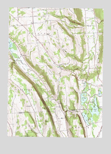
Otisco Valley, NY USGS Topographic Map
Click on map above to begin viewing in our Map Viewer.

This topographic map contains these locations and features:
Feature Name Type Latitude Longitude GNIS ID View Map
Assembly ParkPopulated PlaceN42.7798°W76.1302°942650View Map
Bare MountainSummitN42.8734°W76.1683°943002View Map
Bennett HollowValleyN42.7874°W76.1965°943674View Map
BromleyPopulated PlaceN42.7826°W76.1830°972264View Map
Bromley CemeteryCemeteryN42.7794°W76.1812°2542242View Map
Bucktail FallsFallsN42.8223°W76.2413°945086View Map
Camp HooverLocaleN42.7670°W76.1435°945602View Map
Christian Hollow CemeteryCemeteryN42.8581°W76.1373°2542243View Map
Cold Brook Valley CemeteryCemeteryN42.7803°W76.2189°2542239View Map
Crooked LakeLakeN42.7875°W76.1501°947782View Map
Dutch HillSummitN42.8445°W76.1705°948855View Map
Dutch Hill School (historical)SchoolN42.8431°W76.1842°2359170View Map
Emerson GulfValleyN42.8281°W76.1629°949628View Map
Fellows FallsFallsN42.8162°W76.1574°949964View Map
Gatehouse PondLakeN42.8030°W76.1481°950938View Map
Gifford HillSummitN42.7776°W76.2030°951080View Map
Green LakeLakeN42.7932°W76.1285°951699View Map
Hillsdale CemeteryCemeteryN42.8673°W76.2016°952833View Map
Mary Christmas Tree FarmLocaleN42.8431°W76.1806°2542069View Map
Neumans CornersLocaleN42.8490°W76.2002°958382View Map
OtiscoPopulated PlaceN42.8601°W76.2180°959544View Map
Otisco Fire DepartmentBuildingN42.8649°W76.2186°2700983View Map
Otisco ValleyPopulated PlaceN42.8287°W76.2319°959545View Map
Otisco ValleyValleyN42.8367°W76.2460°959546View Map
Preble HillSummitN42.7653°W76.1960°961108View Map
Rainbow CreekStreamN42.8631°W76.1396°977534View Map
Rattlesnake GulfValleyN42.8590°W76.1508°962217View Map
Ripley HillSummitN42.7903°W76.2402°962544View Map
Royal AcresLocaleN42.8539°W76.1494°2542033View Map
Saint Patricks CemeteryCemeteryN42.8746°W76.2196°964062View Map
School Number 10 (historical)SchoolN42.7886°W76.2244°2359175View Map
School Number 11 (historical)SchoolN42.8131°W76.2211°2359189View Map
School Number 12 (historical)SchoolN42.8431°W76.2450°2359190View Map
School Number 2 (historical)SchoolN42.8167°W76.1431°2359171View Map
School Number 3 (historical)SchoolN42.8650°W76.2375°2359172View Map
School Number 7 (historical)SchoolN42.7828°W76.1831°2359173View Map
School Number 7 (historical)SchoolN42.8644°W76.2186°2359174View Map
School Number 7 (historical)SchoolN42.7567°W76.2083°2123388View Map
Song LakeLakeN42.7688°W76.1468°965638View Map
South SpaffordPopulated PlaceN42.7795°W76.2180°973098View Map
Spafford CreekStreamN42.8370°W76.2488°965937View Map
Spafford Hollow CemeteryCemeteryN42.8152°W76.2200°959547View Map
Spafford ValleyPopulated PlaceN42.8231°W76.2402°965939View Map
The West CemeteryCemeteryN42.8576°W76.2374°967355View Map
Town of OtiscoCivilN42.8648°W76.2228°979328View Map
Town of TullyCivilN42.8113°W76.1351°979561View Map
Tracy LakeLakeN42.7966°W76.1445°967738View Map
Tully LakeLakeN42.7764°W76.1352°967936View Map
Tully Lake ParkPopulated PlaceN42.7842°W76.1360°967937View Map
Tully ValleyLocaleN42.8587°W76.1408°967938View Map
VesperPopulated PlaceN42.8176°W76.1813°968513View Map
Vesper CemeteryCemeteryN42.8176°W76.1795°2542240View Map
Vesper HillSummitN42.8109°W76.1921°968514View Map
Vesper Hills Golf ClubLocaleN42.8435°W76.2185°2615083View Map
Vesper United Methodist ChurchChurchN42.8169°W76.1797°2542241View Map

Note: Coordinates in the location and feature list above are referenced to NAD83 datum.


Copyright (C) 2008-2024 Ryan Niemi / Sunset Dynamics ... All Rights Reserved