TopoQuest Logo
Do you find TopoQuest useful?
Help keep TopoQuest running and adding new maps/features by donating!
Bitcoin:  19c7KJd3qBynnjoSw5npx9KScwjBe4ifkT
Litecoin:  LXs6TkuXGGXo1vDsWCkWVdjQX94eUKd6ui
Home View Maps Find Maps Find Places Resources & Links


Sempronius, New York Topographic Map

USGS Map Title: Sempronius, NY
USGS Map MRC: 42076F3
DRG (GeoTIFF) Download: o42076f3.tif


Neighboring USGS Topographic Map Quads:


  Owasco, NY  
42076G4
 

  Spafford, NY  
42076G3
 

  Otisco Valley, NY  
42076G2
 

  Moravia, NY  
42076F4
 

  Sempronius, NY  
42076F3
 

  Homer, NY  
42076F2
 

  West Groton, NY  
42076E4
 

  Groton, NY  
42076E3
 

  Cortland, NY  
42076E2


Map MRC Location:

N43°
W77°
N43°
W76°
H8 H7 H6 H5 H4 H3 H2 H1
G8 G7 G6 G5 G4 G3 G2 G1
F8 F7 F6 F5 F4 F3 F2 F1
E8 E7 E6 E5 E4 E3 E2 E1
D8 D7 D6 D5 D4 D3 D2 D1
C8 C7 C6 C5 C4 C3 C2 C1
B8 B7 B6 B5 B4 B3 B2 B1
A8 A7 A6 A5 A4 A3 A2 A1
N42°
W77°
N42°
W76°

Sempronius, NY USGS 1:24K Topographic Map Preview:
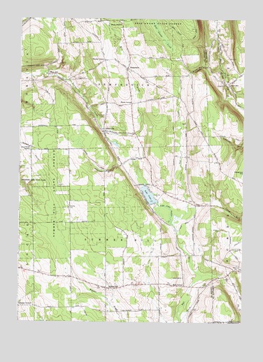
Sempronius, NY USGS Topographic Map
Click on map above to begin viewing in our Map Viewer.

This topographic map contains these locations and features:
Feature Name Type Latitude Longitude GNIS ID View Map
Atwater - Reynolds CemeteryCemeteryN42.7241°W76.3032°2519269View Map
Bear Swamp State ForestForestN42.7473°W76.2885°943321View Map
ComoPopulated PlaceN42.6734°W76.2769°972336View Map
DresservillePopulated PlaceN42.7037°W76.3277°948644View Map
Dresserville Baptist ChurchChurchN42.7036°W76.3245°2597468View Map
Eaton CemeteryCemeteryN42.6748°W76.2791°2120983View Map
Eaton Road CemeteryCemeteryN42.6928°W76.3084°2120984View Map
Four Town CornersLocaleN42.6967°W76.3685°950533View Map
Grout MillPopulated PlaceN42.7234°W76.2585°951855View Map
Halls CornerPopulated PlaceN42.6401°W76.2822°972584View Map
Hardy CornersLocaleN42.7473°W76.3180°952220View Map
Hinman CemeteryCemeteryN42.6304°W76.2768°2120985View Map
Lake ComoLakeN42.6774°W76.3026°947241View Map
Lake Como OutletStreamN42.6653°W76.2891°954905View Map
Lickville CemeteryCemeteryN42.6721°W76.3467°955283View Map
Mill BrookStreamN42.7028°W76.3274°957205View Map
Morse MillPopulated PlaceN42.7270°W76.3591°957713View Map
Murphy CornersLocaleN42.7328°W76.3280°958182View Map
Sand Hill CemeteryCemeteryN42.7097°W76.3277°964374View Map
School Number 1 (historical)SchoolN42.7175°W76.2856°2120988View Map
School Number 2 (historical)SchoolN42.6903°W76.3178°2120989View Map
School Number 3 (historical)SchoolN42.6314°W76.3744°2120990View Map
School Number 3 (historical)SchoolN42.6433°W76.3456°2120991View Map
School Number 3 (historical)SchoolN42.7036°W76.3247°2120992View Map
School Number 3 (historical)SchoolN42.7036°W76.3247°2120993View Map
School Number 4 (historical)SchoolN42.6803°W76.2808°2120994View Map
School Number 5 (historical)SchoolN42.7242°W76.3689°2120995View Map
School Number 5 (historical)SchoolN42.7297°W76.3167°2120996View Map
School Number 6 (historical)SchoolN42.6411°W76.2958°2120997View Map
School Number 6 (historical)SchoolN42.6967°W76.3675°2120998View Map
School Number 7 (historical)SchoolN42.6461°W76.2525°2123389View Map
School Number 7 (historical)SchoolN42.6531°W76.2764°2120999View Map
School Number 8 (historical)SchoolN42.6386°W76.3231°2121000View Map
Scott GulfValleyN42.7303°W76.2691°964677View Map
Searls CemeteryCemeteryN42.7070°W76.2824°2120986View Map
SemproniusPopulated PlaceN42.7295°W76.3152°964823View Map
Sempronius Baptist ChurchChurchN42.7284°W76.3130°2597480View Map
Sempronius Fire DepartmentBuildingN42.7285°W76.3148°2701312View Map
Sherman GulfValleyN42.6898°W76.3177°965078View Map
Summer HillPopulated PlaceN42.6390°W76.3258°966758View Map
Summer Hill ChurchChurchN42.6434°W76.2830°966760View Map
Summer Hill State ForestForestN42.6751°W76.3524°966761View Map
Summerhill CemeteryCemeteryN42.6398°W76.3171°2519268View Map
Town of SemproniusCivilN42.7403°W76.3213°979479View Map
Town of SummerhillCivilN42.6596°W76.3172°979536View Map
Wards CornersLocaleN42.7151°W76.3130°968792View Map
West Hill CemeteryCemeteryN42.6470°W76.2525°969264View Map
Whispering Hill FarmsLocaleN42.7231°W76.2775°2519408View Map
Wilcox CemeteryCemeteryN42.7456°W76.2782°2120987View Map

Note: Coordinates in the location and feature list above are referenced to NAD83 datum.


Copyright (C) 2008-2025 Ryan Niemi / Sunset Dynamics ... All Rights Reserved