TopoQuest Logo
Do you find TopoQuest useful?
Help keep TopoQuest running and adding new maps/features by donating!
Bitcoin:  19c7KJd3qBynnjoSw5npx9KScwjBe4ifkT
Litecoin:  LXs6TkuXGGXo1vDsWCkWVdjQX94eUKd6ui
Home View Maps Find Maps Find Places Resources & Links


Owens Bridge, Florida Topographic Map

USGS Map Title: Owens Bridge, FL
USGS Map MRC: 30084A7
DRG (GeoTIFF) Download: o30084a7.tif


Neighboring USGS Topographic Map Quads:


  Wilma, FL  
30084B8
 

  Queens Bay, FL  
30084B7
 

  Smith Creek, FL  
30084B6
 

  Sumatra, FL  
30084A8
 

  Owens Bridge, FL  
30084A7
 

  Thousand Yard Bay, FL  
30084A6


Map MRC Location:

N31°
W85°
N31°
W84°
H8 H7 H6 H5 H4 H3 H2 H1
G8 G7 G6 G5 G4 G3 G2 G1
F8 F7 F6 F5 F4 F3 F2 F1
E8 E7 E6 E5 E4 E3 E2 E1
D8 D7 D6 D5 D4 D3 D2 D1
C8 C7 C6 C5 C4 C3 C2 C1
B8 B7 B6 B5 B4 B3 B2 B1
A8 A7 A6 A5 A4 A3 A2 A1
N30°
W85°
N30°
W84°

Owens Bridge, FL USGS 1:24K Topographic Map Preview:
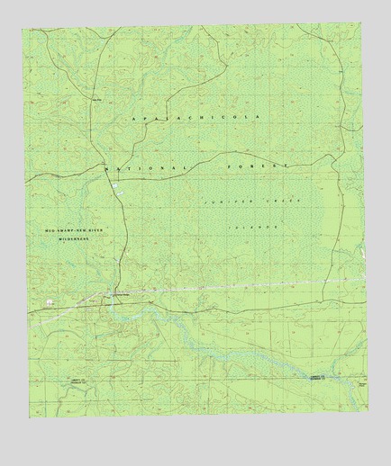
Owens Bridge, FL USGS Topographic Map
Click on map above to begin viewing in our Map Viewer.

This topographic map contains these locations and features:
Feature Name Type Latitude Longitude GNIS ID View Map
Cat BranchStreamN30.0583°W84.8610°305456View Map
Juniper CreekStreamN30.0121°W84.7616°305889View Map
Juniper Creek IslandsIslandN30.0649°W84.7891°305890View Map
Morgan PlacePopulated PlaceN30.0099°W84.7555°306060View Map
Nero Branch New RiverStreamN30.0313°W84.8391°306102View Map
Owens BridgeLocaleN30.0394°W84.8424°306179View Map
Tate Firetower (historical)TowerN30.0360°W84.7666°306481View Map
Twin PolePopulated PlaceN30.1024°W84.8496°306527View Map

Note: Coordinates in the location and feature list above are referenced to NAD83 datum.


Copyright (C) 2008-2024 Ryan Niemi / Sunset Dynamics ... All Rights Reserved