TopoQuest Logo
Do you find TopoQuest useful?
Help keep TopoQuest running and adding new maps/features by donating!
Bitcoin:  19c7KJd3qBynnjoSw5npx9KScwjBe4ifkT
Litecoin:  LXs6TkuXGGXo1vDsWCkWVdjQX94eUKd6ui
Home View Maps Find Maps Find Places Resources & Links


Thornville, Michigan Topographic Map

USGS Map Title: Thornville, MI
USGS Map MRC: 42083H2
DRG (GeoTIFF) Download: o42083h2.tif


Neighboring USGS Topographic Map Quads:


  Lapeer, MI  
43083A3
 

  Attica, MI  
43083A2
 

  Imlay City, MI  
43083A1
 

  Metamora, MI  
42083H3
 

  Thornville, MI  
42083H2
 

  Almont, MI  
42083H1
 

  Oxford, MI  
42083G3
 

  Lake Orion, MI  
42083G2
 

  Romeo, MI  
42083G1


Map MRC Location:

N43°
W84°
N43°
W83°
H8 H7 H6 H5 H4 H3 H2 H1
G8 G7 G6 G5 G4 G3 G2 G1
F8 F7 F6 F5 F4 F3 F2 F1
E8 E7 E6 E5 E4 E3 E2 E1
D8 D7 D6 D5 D4 D3 D2 D1
C8 C7 C6 C5 C4 C3 C2 C1
B8 B7 B6 B5 B4 B3 B2 B1
A8 A7 A6 A5 A4 A3 A2 A1
N42°
W84°
N42°
W83°

Thornville, MI USGS 1:24K Topographic Map Preview:
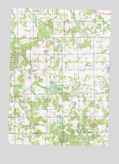
Thornville, MI USGS Topographic Map
Click on map above to begin viewing in our Map Viewer.

This topographic map contains these locations and features:
Feature Name Type Latitude Longitude GNIS ID View Map
Bethel Baptist ChurchChurchN42.9472°W83.1258°2575736View Map
Brooks LakeLakeN42.8864°W83.1859°622037View Map
Caldecott ParkParkN42.9497°W83.1303°2575768View Map
Clack LakeLakeN42.8761°W83.1848°623322View Map
Cluebine LakeLakeN42.9865°W83.1372°623504View Map
D Bar A Scout RanchLocaleN42.9584°W83.2444°1617140View Map
Dollar PondLakeN42.8870°W83.1547°624768View Map
Dryden Center CemeteryCemeteryN42.9303°W83.1641°624907View Map
Dryden High SchoolSchoolN42.9492°W83.1591°1617139View Map
Dryden Township Fire Department Station 2BuildingN42.9462°W83.1503°2620073View Map
Dryden Township LibraryBuildingN42.9461°W83.1256°2575740View Map
Dryden Township Police DepartmentBuildingN42.9459°W83.1524°2575741View Map
Dryden United Methodist ChurchChurchN42.9456°W83.1281°2575738View Map
General Squire Memorial ParkLocaleN42.9253°W83.1274°1625055View Map
General Squire Park Historical MarkerParkN42.9244°W83.1264°2571265View Map
Hagemeister LakeLakeN42.8898°W83.1586°627594View Map
Harris CemeteryCemeteryN42.9322°W83.1633°627833View Map
Holy Redeemer Lutheran ChurchChurchN42.9442°W83.1624°1617141View Map
Howard LakeLakeN42.8806°W83.1513°628696View Map
Indian CreekStreamN42.9864°W83.1283°628962View Map
Ladies Library Hall Historical MarkerParkN42.9458°W83.1258°2571257View Map
Little LakeLakeN42.8750°W83.1285°630670View Map
Lockwood LakeReservoirN42.9601°W83.2496°630864View Map
Long Lake DrainStreamN42.9867°W83.1277°1617143View Map
Loon LakeLakeN42.8796°W83.1595°631044View Map
Mud LakeLakeN42.8798°W83.1560°632949View Map
North Dryden CemeteryCemeteryN42.9661°W83.1258°633566View Map
Peters LakeLakeN42.8959°W83.1569°634706View Map
Pierce LakeLakeN42.9892°W83.1468°634830View Map
Pool Post Office (historical)Post OfficeN42.9883°W83.1972°2575325View Map
Rock Valley CemeteryCemeteryN42.8992°W83.2419°636087View Map
Russell LakeLakeN42.9949°W83.1735°636404View Map
Saint Cornelius ChurchChurchN42.9492°W83.1258°2575737View Map
Saint John's Evangelical Lutheran CemeteryCemeteryN42.9028°W83.1311°2575792View Map
Saint Johns Episcopal ChurchChurchN42.9439°W83.1258°2575739View Map
Sanborn DrainCanalN42.9361°W83.1847°637159View Map
Seven Ponds LakeLakeN42.9269°W83.1946°637592View Map
Seven Ponds Nature CenterLocaleN42.9267°W83.1861°1617142View Map
Slating LakeLakeN42.8850°W83.1539°638088View Map
South Attica CemeteryCemeteryN42.9889°W83.1813°638259View Map
South Dryden Pioneer CemeteryCemeteryN42.9236°W83.1424°638339View Map
Terry LakeLakeN42.8964°W83.1330°1614689View Map
ThornvillePopulated PlaceN42.9425°W83.2238°1614802View Map
Thornville Baptist ChurchChurchN42.9433°W83.2200°2575645View Map
Thornville CemeteryCemeteryN42.9433°W83.2183°2575793View Map
Thornville Post Office (historical)Post OfficeN42.9425°W83.2239°2575288View Map
Township of DrydenCivilN42.9308°W83.1640°1626194View Map
Whigville CemeteryCemeteryN42.9006°W83.1977°1616279View Map
Whigville CreekStreamN42.9317°W83.2172°1616280View Map
Whigville LakeLakeN42.8972°W83.1872°1616281View Map
Whigville Post Office (historical)Post OfficeN42.9028°W83.1897°2575285View Map
Wolf LakeLakeN42.8754°W83.1552°1616707View Map

Note: Coordinates in the location and feature list above are referenced to NAD83 datum.


Copyright (C) 2008-2025 Ryan Niemi / Sunset Dynamics ... All Rights Reserved