TopoQuest Logo
Do you find TopoQuest useful?
Help keep TopoQuest running and adding new maps/features by donating!
Bitcoin:  19c7KJd3qBynnjoSw5npx9KScwjBe4ifkT
Litecoin:  LXs6TkuXGGXo1vDsWCkWVdjQX94eUKd6ui
Home View Maps Find Maps Find Places Resources & Links


Padua, Minnesota Topographic Map

USGS Map Title: Padua, MN
USGS Map MRC: 45095E1
DRG (GeoTIFF) Download: o45095e1.tif


Neighboring USGS Topographic Map Quads:


  Westport, MN  
45095F2
 

  Raymond Lake, MN  
45095F1
 

  Sauk Centre, MN  
45094F8
 

  Sedan, MN  
45095E2
 

  Padua, MN  
45095E1
 

  Elrosa, MN  
45094E8
 

  Lake Johanna, MN  
45095D2
 

  Belgrade, MN  
45095D1
 

  Georgeville, MN  
45094D8


Map MRC Location:

N46°
W96°
N46°
W95°
H8 H7 H6 H5 H4 H3 H2 H1
G8 G7 G6 G5 G4 G3 G2 G1
F8 F7 F6 F5 F4 F3 F2 F1
E8 E7 E6 E5 E4 E3 E2 E1
D8 D7 D6 D5 D4 D3 D2 D1
C8 C7 C6 C5 C4 C3 C2 C1
B8 B7 B6 B5 B4 B3 B2 B1
A8 A7 A6 A5 A4 A3 A2 A1
N45°
W96°
N45°
W95°

Padua, MN USGS 1:24K Topographic Map Preview:
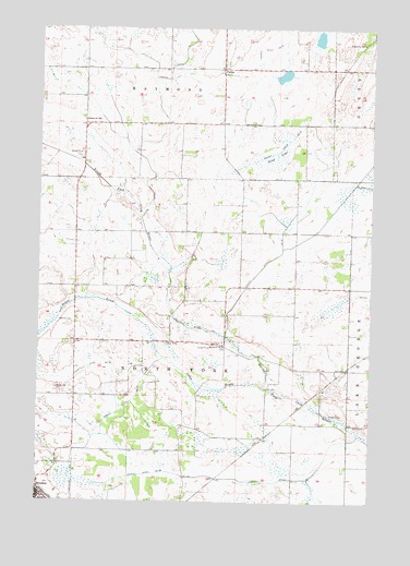
Padua, MN USGS Topographic Map
Click on map above to begin viewing in our Map Viewer.

This topographic map contains these locations and features:
Feature Name Type Latitude Longitude GNIS ID View Map
Big Grove ChurchChurchN45.5408°W95.0556°640088View Map
Big Grove Church CemeteryCemeteryN45.5403°W95.0555°2068116View Map
BrootenLocaleN45.5028°W95.1233°2068215View Map
BrootenPopulated PlaceN45.5011°W95.1245°640523View Map
Brooten Medical CenterHospitalN45.5011°W95.1222°2068217View Map
Brooten Police DepartmentBuildingN45.5011°W95.1242°2068218View Map
Brooten Post OfficePost OfficeN45.5011°W95.1242°2068216View Map
City of BrootenCivilN45.5000°W95.1158°2393435View Map
County Ditch Number FortysixCanalN45.6194°W95.0428°642117View Map
County Ditch Number ThirtyeightCanalN45.5352°W95.1059°642028View Map
County Ditch Number ThirtysixCanalN45.5152°W95.0953°642004View Map
County Ditch Number ThirtytwoCanalN45.5772°W95.0272°641962View Map
Judicial Ditch Number OneCanalN45.6208°W95.0692°645772View Map
PaduaPopulated PlaceN45.6141°W95.0570°649110View Map
Padua Mennonite SchoolSchoolN45.6147°W95.0567°2068376View Map
Padua Post Office (historical)Post OfficeN45.6142°W95.0567°2068263View Map
Saint Anthony of Padua ChurchChurchN45.6131°W95.0556°2068219View Map
Saint Anthony Padua CemeteryCemeteryN45.6128°W95.0520°2068106View Map
Sand LakeSwampN45.5924°W95.0376°651164View Map
School Number 1958SchoolN45.6214°W95.0042°651448View Map
School Number 1963SchoolN45.6005°W95.1084°651450View Map
Sedan BrookStreamN45.5311°W95.0403°651839View Map
Township of North ForkCivilN45.5430°W95.0686°665156View Map
Trinity Lutheran ChurchChurchN45.5003°W95.1228°2068214View Map

Note: Coordinates in the location and feature list above are referenced to NAD83 datum.


Copyright (C) 2008-2025 Ryan Niemi / Sunset Dynamics ... All Rights Reserved