TopoQuest Logo
Do you find TopoQuest useful?
Help keep TopoQuest running and adding new maps/features by donating!
Bitcoin:  19c7KJd3qBynnjoSw5npx9KScwjBe4ifkT
Litecoin:  LXs6TkuXGGXo1vDsWCkWVdjQX94eUKd6ui
Home View Maps Find Maps Find Places Resources & Links


Palm View Peak, California Topographic Map

USGS Map Title: Palm View Peak, CA
USGS Map MRC: 33116F5
DRG (GeoTIFF) Download: o33116f5.tif


Neighboring USGS Topographic Map Quads:


  San Jacinto Peak, CA  
33116G6
 

  Palm Springs, CA  
33116G5
 

  Cathedral City, CA  
33116G4
 

  Idyllwild, CA  
33116F6
 

  Palm View Peak, CA  
33116F5
 

  Rancho Mirage, CA  
33116F4
 

  Anza, CA  
33116E6
 

  Butterfly Peak, CA  
33116E5
 

  Toro Peak, CA  
33116E4


Map MRC Location:

N34°
W117°
N34°
W116°
H8 H7 H6 H5 H4 H3 H2 H1
G8 G7 G6 G5 G4 G3 G2 G1
F8 F7 F6 F5 F4 F3 F2 F1
E8 E7 E6 E5 E4 E3 E2 E1
D8 D7 D6 D5 D4 D3 D2 D1
C8 C7 C6 C5 C4 C3 C2 C1
B8 B7 B6 B5 B4 B3 B2 B1
A8 A7 A6 A5 A4 A3 A2 A1
N33°
W117°
N33°
W116°

Palm View Peak, CA USGS 1:24K Topographic Map Preview:
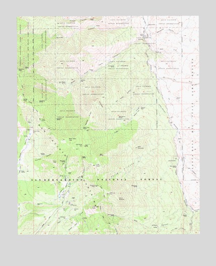
Palm View Peak, CA USGS Topographic Map
Click on map above to begin viewing in our Map Viewer.

This topographic map contains these locations and features:
Feature Name Type Latitude Longitude GNIS ID View Map
Agua Bonita SpringSpringN33.6672°W116.5171°238439View Map
Agua Fuerte SpringSpringN33.7118°W116.5925°238444View Map
Apache SpringSpringN33.7197°W116.6205°238664View Map
Bald MountainSummitN33.6747°W116.5433°238921View Map
Birthday FlatFlatN33.7139°W116.5820°1667718View Map
Bulls Eye RockPillarN33.6939°W116.5342°239831View Map
Bullseye FlatFlatN33.6947°W116.5433°1667725View Map
Camp Joe SchermanLocaleN33.6428°W116.5903°1667727View Map
Cedar CreekStreamN33.7181°W116.5339°1667731View Map
Cedar SpringSpringN33.6767°W116.5781°240390View Map
Cone PeakSummitN33.6670°W116.5986°1660505View Map
Desert Divide TrailTrailN33.6725°W116.5817°241431View Map
Devils RockpileSummitN33.6436°W116.5622°1660548View Map
Dos Palmas SpringSpringN33.7207°W116.5587°1667742View Map
Dry Camp CanyonValleyN33.7103°W116.5378°1667743View Map
Dry WashStreamN33.7147°W116.5289°1654982View Map
Duchess CanyonValleyN33.6681°W116.6236°241657View Map
Duchess SpringSpringN33.6707°W116.6066°1667744View Map
Dutch Charlie CanyonValleyN33.6381°W116.5056°270948View Map
Eagle SpringSpringN33.6697°W116.5811°241722View Map
East Fork Palm CanyonValleyN33.7317°W116.5345°241765View Map
Fobes RanchLocaleN33.6856°W116.6164°242332View Map
Fobes SaddleGapN33.6900°W116.6097°1667754View Map
Fobes SpringSpringN33.6620°W116.6232°1667755View Map
Garnet RidgeRidgeN33.6884°W116.5772°242630View Map
Goff FlatFlatN33.6403°W116.5967°242774View Map
Gooseberry SpringSpringN33.7009°W116.6109°242855View Map
Hells KitchenFlatN33.6556°W116.5531°243349View Map
Hermits BenchBenchN33.7386°W116.5378°243378View Map
Hidden FallsFallsN33.6364°W116.5099°243413View Map
Hop Patch SpringSpringN33.6670°W116.5928°243629View Map
Indian PotreroFlatN33.6961°W116.5250°243826View Map
Indian SpringSpringN33.7214°W116.5550°243834View Map
Landslide SpringSpringN33.6912°W116.5991°244569View Map
Lion PeakSummitN33.6411°W116.5720°244888View Map
Lion SpringSpringN33.6762°W116.5814°244890View Map
Little Camp SpringSpringN33.6855°W116.5808°244903View Map
Little DesertPlainN33.6645°W116.5639°244909View Map
Little ParadiseSpringN33.6697°W116.5214°1660927View Map
Live Oak CanyonValleyN33.6259°W116.5089°272136View Map
Mad Woman SpringSpringN33.6921°W116.5562°245348View Map
Maynard MineMineN33.7478°W116.5725°1667780View Map
McGregor FlatFlatN33.6367°W116.5906°245682View Map
Mesquite FlatFlatN33.6842°W116.5200°245821View Map
Morris RanchLocaleN33.6575°W116.5928°246225View Map
Needles EyeFlatN33.7184°W116.5731°246452View Map
Oak CanyonValleyN33.6342°W116.5070°246708View Map
Oak Canyon SpringSpringN33.6355°W116.5594°1667786View Map
Palm View PeakSummitN33.6795°W116.5911°1661179View Map
Pine MountainSummitN33.6486°W116.5603°247507View Map
Potrero CanyonValleyN33.6809°W116.5167°271650View Map
Pyramid PeakSummitN33.6528°W116.5725°247840View Map
Rock CanyonValleyN33.7145°W116.5272°273307View Map
Rock HouseBuildingN33.6300°W116.5300°1667798View Map
Root SpringSpringN33.6703°W116.5695°248365View Map
Sacaton FlatFlatN33.6409°W116.5889°248498View Map
Sirocco PalmsWoodsN33.7025°W116.5167°1667802View Map
Spitler PeakSummitN33.7022°W116.6228°1661491View Map
Tripp MeadowFlatN33.6509°W116.5934°250623View Map
Wentworth CanyonValleyN33.7420°W116.5372°274416View Map
West Fork Palm CanyonValleyN33.7420°W116.5372°251348View Map
Wild Grape SpringSpringN33.6526°W116.5436°1667817View Map

Note: Coordinates in the location and feature list above are referenced to NAD83 datum.


Copyright (C) 2008-2024 Ryan Niemi / Sunset Dynamics ... All Rights Reserved