TopoQuest Logo
Do you find TopoQuest useful?
Help keep TopoQuest running and adding new maps/features by donating!
Bitcoin:  19c7KJd3qBynnjoSw5npx9KScwjBe4ifkT
Litecoin:  LXs6TkuXGGXo1vDsWCkWVdjQX94eUKd6ui
Home View Maps Find Maps Find Places Resources & Links


Rancho Mirage, California Topographic Map

USGS Map Title: Rancho Mirage, CA
USGS Map MRC: 33116F4
DRG (GeoTIFF) Download: o33116f4.tif


Neighboring USGS Topographic Map Quads:


  Palm Springs, CA  
33116G5
 

  Cathedral City, CA  
33116G4
 

  Myoma, CA  
33116G3
 

  Palm View Peak, CA  
33116F5
 

  Rancho Mirage, CA  
33116F4
 

  La Quinta, CA  
33116F3
 

  Butterfly Peak, CA  
33116E5
 

  Toro Peak, CA  
33116E4
 

  Martinez Mountain, CA  
33116E3


Map MRC Location:

N34°
W117°
N34°
W116°
H8 H7 H6 H5 H4 H3 H2 H1
G8 G7 G6 G5 G4 G3 G2 G1
F8 F7 F6 F5 F4 F3 F2 F1
E8 E7 E6 E5 E4 E3 E2 E1
D8 D7 D6 D5 D4 D3 D2 D1
C8 C7 C6 C5 C4 C3 C2 C1
B8 B7 B6 B5 B4 B3 B2 B1
A8 A7 A6 A5 A4 A3 A2 A1
N33°
W117°
N33°
W116°

Rancho Mirage, CA USGS 1:24K Topographic Map Preview:
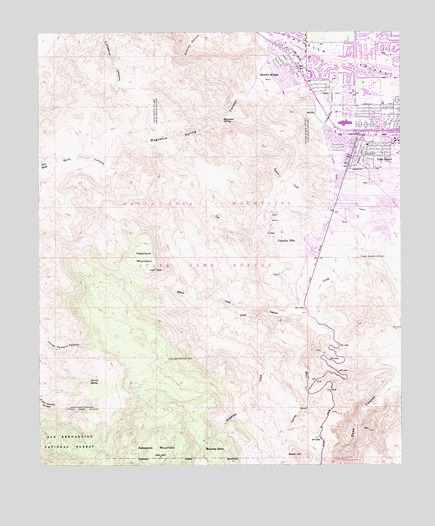
Rancho Mirage, CA USGS Topographic Map
Click on map above to begin viewing in our Map Viewer.

This topographic map contains these locations and features:
Feature Name Type Latitude Longitude GNIS ID View Map
Asbestos MountainSummitN33.6275°W116.4586°269597View Map
Bighorn Golf ClubLocaleN33.6814°W116.4086°1849352View Map
Black HillSummitN33.6270°W116.4117°269884View Map
Cahuilla HillsPopulated PlaceN33.6886°W116.4164°1660406View Map
Cahuilla ParkParkN33.7134°W116.4028°1849354View Map
Carrizo CreekStreamN33.6711°W116.4058°270319View Map
Cat CreekStreamN33.7000°W116.3983°270350View Map
Cathedral City-Palm Desert DivisionCivilN33.7403°W116.4035°1935045View Map
Chaparral Country ClubLocaleN33.7431°W116.3789°1849355View Map
Childrens MuseumBuildingN33.7397°W116.4145°1849392View Map
Christ of the Desert Newman CenterChurchN33.7286°W116.3847°1849393View Map
Civic Center ParkParkN33.7339°W116.3806°1849395View Map
College of the DesertSchoolN33.7325°W116.3876°270563View Map
Ebbens CreekStreamN33.6689°W116.4236°271012View Map
El Paseo Shopping CenterLocaleN33.7203°W116.3814°1849396View Map
Grapevine CreekStreamN33.6686°W116.4211°271402View Map
Haystack MountainSummitN33.6820°W116.4600°271525View Map
Ironwood Country ClubLocaleN33.6875°W116.3781°1849367View Map
Joslyn Cove Senior CenterBuildingN33.7270°W116.3786°1849411View Map
Kelly HeliportAirportN33.6861°W116.3967°1653798View Map
Kingdom Hall of Jehovahs WitnessesChurchN33.7289°W116.3947°1849412View Map
Magnesia Canyon Ecological ReserveParkN33.7278°W116.4425°1849371View Map
Magnesia SpringSpringN33.7249°W116.4370°272312View Map
Magnesia Spring CanyonValleyN33.7397°W116.4081°272313View Map
Marrakesh Country ClubLocaleN33.7070°W116.3775°1849372View Map
McCallum TheaterBuildingN33.7297°W116.3895°1849422View Map
Monterey Country ClubLocaleN33.7428°W116.3883°1849373View Map
Palm Desert Shopping CenterLocaleN33.7236°W116.3953°1849427View Map
Palm Valley Stormwater ChannelCanalN33.7189°W116.4011°272847View Map
Palms to Pines Shopping CenterLocaleN33.7209°W116.3789°1849423View Map
Palms to Pines West Shopping CenterLocaleN33.7203°W116.3931°1849429View Map
Potrero SpringSpringN33.6502°W116.4831°273108View Map
Ramon CreekStreamN33.6995°W116.3992°273179View Map
Rancho las Palmas Country ClubLocaleN33.7389°W116.3964°1849431View Map
Rancho las Palmas Shopping CenterLocaleN33.7378°W116.4067°1849432View Map
Rancho MiragePopulated PlaceN33.7397°W116.4128°1661281View Map
Rancho Mirage Chamber of CommerceBuildingN33.7403°W116.4122°1849433View Map
Rancho Mirage Elementary SchoolSchoolN33.7412°W116.4211°1849375View Map
Rancho Mirage Plaza Shopping CenterLocaleN33.7445°W116.4145°1849434View Map
Rancho Mirage Post OfficePost OfficeN33.7409°W116.4102°1849376View Map
Rancho Mirage Public LibraryBuildingN33.7381°W116.4078°1849435View Map
Riverside County Fire Department Station 33 Palm DesertBuildingN33.7268°W116.3979°2664558View Map
Riverside County Fire Department Station 67 Mesa ViewBuildingN33.6957°W116.3870°2664992View Map
Saint Margaret's Episcopal Church ColumbariumCemeteryN33.7032°W116.3980°2773315View Map
Shadow Mountain Golf CourseLocaleN33.7125°W116.3781°1849378View Map
Shumway RanchLocaleN33.6300°W116.4433°273690View Map
Silver Spur Mobile ManorPopulated PlaceN33.6870°W116.4064°1849379View Map
The Church of Jesus Christ of Latter Day SaintsChurchN33.7331°W116.3920°1849394View Map
Town Center Square Shopping CenterLocaleN33.7284°W116.4022°1849438View Map
Whitewater ParkParkN33.7478°W116.4161°1849387View Map

Note: Coordinates in the location and feature list above are referenced to NAD83 datum.


Copyright (C) 2008-2024 Ryan Niemi / Sunset Dynamics ... All Rights Reserved