TopoQuest Logo
Do you find TopoQuest useful?
Help keep TopoQuest running and adding new maps/features by donating!
Bitcoin:  19c7KJd3qBynnjoSw5npx9KScwjBe4ifkT
Litecoin:  LXs6TkuXGGXo1vDsWCkWVdjQX94eUKd6ui
Home View Maps Find Maps Find Places Resources & Links


Palmyra, Virginia Topographic Map

USGS Map Title: Palmyra, VA
USGS Map MRC: 37078G3
DRG (GeoTIFF) Download: o37078g3.tif


Neighboring USGS Topographic Map Quads:


  Simeon, VA  
37078H4
 

  Boyd Tavern, VA  
37078H3
 

  Zion Crossroads, VA  
37078H2
 

  Scottsville, VA  
37078G4
 

  Palmyra, VA  
37078G3
 

  Columbia, VA  
37078G2
 

  Diana Mills, VA  
37078F4
 

  Arvonia, VA  
37078F3
 

  Lakeside Village, VA  
37078F2


Map MRC Location:

N38°
W79°
N38°
W78°
H8 H7 H6 H5 H4 H3 H2 H1
G8 G7 G6 G5 G4 G3 G2 G1
F8 F7 F6 F5 F4 F3 F2 F1
E8 E7 E6 E5 E4 E3 E2 E1
D8 D7 D6 D5 D4 D3 D2 D1
C8 C7 C6 C5 C4 C3 C2 C1
B8 B7 B6 B5 B4 B3 B2 B1
A8 A7 A6 A5 A4 A3 A2 A1
N37°
W79°
N37°
W78°

Palmyra, VA USGS 1:24K Topographic Map Preview:
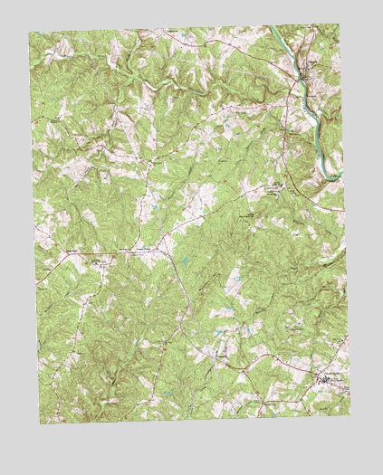
Palmyra, VA USGS Topographic Map
Click on map above to begin viewing in our Map Viewer.

This topographic map contains these locations and features:
Feature Name Type Latitude Longitude GNIS ID View Map
Abrams High SchoolSchoolN37.8238°W78.2747°1462342View Map
Ballinger CreekStreamN37.8449°W78.2600°1462745View Map
Bethel ChurchChurchN37.8213°W78.2694°1463191View Map
Bold BranchStreamN37.8718°W78.2517°1463640View Map
Burning Bush ChurchChurchN37.8210°W78.2761°1464125View Map
Central Elementary SchoolSchoolN37.8232°W78.2770°1464703View Map
Central PlainsLocaleN37.8046°W78.3264°1464698View Map
CohassetPopulated PlaceN37.7696°W78.3031°1496849View Map
CunninghamPopulated PlaceN37.8740°W78.3200°1496865View Map
Cunningham CreekStreamN37.8515°W78.2650°1465529View Map
Cunningham Elementary SchoolSchoolN37.8008°W78.3505°1465530View Map
Dunbar School (historical)SchoolN37.7624°W78.3281°1494060View Map
Fluvanna ChurchChurchN37.7938°W78.3739°1466742View Map
Fluvanna CountyCivilN37.8419°W78.2772°1494061View Map
Fluvanna County Courthouse Historic DistrictParkN37.8613°W78.2642°1494062View Map
Fluvanna County Criminal CourtBuildingN37.8593°W78.2647°2332029View Map
Fluvanna County High SchoolSchoolN37.8723°W78.2986°1494063View Map
Fluvanna County Office BuildingBuildingN37.8616°W78.2647°2631064View Map
Fluvanna County Public LibraryBuildingN37.8647°W78.2777°2648732View Map
Fluvanna County Sheriff's OfficeBuildingN37.8603°W78.2713°2331933View Map
Fluvanna County Sheriff's OfficeBuildingN37.8650°W78.2766°2331958View Map
Fluvanna Middle SchoolSchoolN37.8247°W78.2749°1466787View Map
Fork UnionPopulated PlaceN37.7632°W78.2622°1496900View Map
Fork Union Baptist ChurchChurchN37.7628°W78.2634°2710066View Map
Fork Union DistrictCivilN37.7858°W78.2868°1927320View Map
Fork Union Fire CompanyBuildingN37.7641°W78.2666°2075410View Map
Fork Union Military AcademySchoolN37.7620°W78.2589°1466786View Map
Fork Union Post OfficePost OfficeN37.7644°W78.2615°2766208View Map
Fork Union Presbyterian ChurchChurchN37.7594°W78.2656°1494064View Map
Fork Union Rescue SquadBuildingN37.7641°W78.2666°2075411View Map
Independent Holiness ChurchChurchN37.8471°W78.3639°1468456View Map
Judy CreekStreamN37.7882°W78.2517°1468893View Map
Kidds StorePopulated PlaceN37.8035°W78.3617°1496963View Map
Little Mountain HillSummitN37.8143°W78.2856°1496992View Map
Little Raccoon CreekStreamN37.8435°W78.2753°1469624View Map
Little Rock ChurchChurchN37.8324°W78.3264°1469636View Map
Martins CreekStreamN37.7882°W78.2514°1470134View Map
Middle Fork Cunningham CreekStreamN37.8515°W78.2650°1470403View Map
Mountain HillSummitN37.7921°W78.3064°1497029View Map
New Fork ChurchChurchN37.7754°W78.3239°1471415View Map
New Hope ChurchChurchN37.8049°W78.3367°1471444View Map
North Fork Cunningham CreekStreamN37.8599°W78.3311°1471603View Map
PalmyraPopulated PlaceN37.8610°W78.2633°1498526View Map
Palmyra Census Designated PlaceCensusN37.8651°W78.2627°2629033View Map
Palmyra Elementary SchoolSchoolN37.8738°W78.2617°1472031View Map
Palmyra Post OfficePost OfficeN37.8630°W78.2638°2766266View Map
Palmyra Rescue SquadBuildingN37.8720°W78.2593°2075407View Map
Palmyra Rescue StationBuildingN37.8719°W78.2594°2331916View Map
Palmyra United Methodist ChurchChurchN37.8618°W78.2644°1494077View Map
Pembroke Petit BridgeBridgeN37.8576°W78.2664°1494078View Map
Raccoon CreekStreamN37.8360°W78.2603°1472918View Map
RockawayPopulated PlaceN37.8515°W78.2639°1497122View Map
Shiloh ChurchChurchN37.8321°W78.2997°1474518View Map
South Fork Cunningham CreekStreamN37.8599°W78.3311°1474852View Map
Thessalonian ChurchChurchN37.7779°W78.2731°1475622View Map
Weber CityPopulated PlaceN37.7551°W78.2839°1476429View Map

Note: Coordinates in the location and feature list above are referenced to NAD83 datum.


Copyright (C) 2008-2024 Ryan Niemi / Sunset Dynamics ... All Rights Reserved