TopoQuest Logo
Do you find TopoQuest useful?
Help keep TopoQuest running and adding new maps/features by donating!
Bitcoin:  19c7KJd3qBynnjoSw5npx9KScwjBe4ifkT
Litecoin:  LXs6TkuXGGXo1vDsWCkWVdjQX94eUKd6ui
Home View Maps Find Maps Find Places Resources & Links


Project City, California Topographic Map

USGS Map Title: Project City, CA
USGS Map MRC: 40122F3
DRG (GeoTIFF) Download: o40122f3.tif


Neighboring USGS Topographic Map Quads:


  Bohemotash Mountain, CA  
40122G4
 

  O'Brien, CA  
40122G3
 

  Minnesota Mountain, CA  
40122G2
 

  Shasta Dam, CA  
40122F4
 

  Project City, CA  
40122F3
 

  Bella Vista, CA  
40122F2
 

  Redding, CA  
40122E4
 

  Enterprise, CA  
40122E3
 

  Palo Cedro, CA  
40122E2


Map MRC Location:

N41°
W123°
N41°
W122°
H8 H7 H6 H5 H4 H3 H2 H1
G8 G7 G6 G5 G4 G3 G2 G1
F8 F7 F6 F5 F4 F3 F2 F1
E8 E7 E6 E5 E4 E3 E2 E1
D8 D7 D6 D5 D4 D3 D2 D1
C8 C7 C6 C5 C4 C3 C2 C1
B8 B7 B6 B5 B4 B3 B2 B1
A8 A7 A6 A5 A4 A3 A2 A1
N40°
W123°
N40°
W122°

Project City, CA USGS 1:24K Topographic Map Preview:
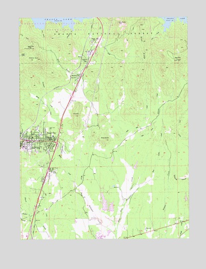
Project City, CA USGS Topographic Map
Click on map above to begin viewing in our Map Viewer.

This topographic map contains these locations and features:
Feature Name Type Latitude Longitude GNIS ID View Map
Bass MountainSummitN40.7329°W122.3672°256581View Map
Bayha (historical)Populated PlaceN40.7296°W122.3222°1682458View Map
Bear MountainSummitN40.7257°W122.2592°256686View Map
Black Diamond MineMineN40.7388°W122.3042°1682461View Map
Blue RidgeRidgeN40.7338°W122.2831°257275View Map
Bontabile CreekStreamN40.7424°W122.3361°257347View Map
Buckeye CreekStreamN40.6360°W122.3675°257601View Map
California Highway Patrol ReddingBuildingN40.6437°W122.3654°2751108View Map
Central Valley (historical)Populated PlaceN40.6804°W122.3711°1662272View Map
Central Valley High SchoolSchoolN40.6771°W122.3739°1682465View Map
Central Valley Intermediate School (historical)SchoolN40.6827°W122.3667°1682466View Map
Charles Smith Irrigation 1224 DamDamN40.6649°W122.2911°1664261View Map
Cove CreekStreamN40.7452°W122.2686°258791View Map
Deep Hole CreekStreamN40.6760°W122.3025°259191View Map
Deer Creek Elementary SchoolSchoolN40.6740°W122.3636°259227View Map
East Fork Stillwater CreekStreamN40.6265°W122.3056°259752View Map
East Valley CreekStreamN40.6499°W122.2928°259774View Map
Falkenbury Shale QuarryMineN40.7178°W122.3408°2677518View Map
Fawndale Rock QuarryMineN40.7375°W122.3061°2677521View Map
Fish MountainSummitN40.6946°W122.3342°260157View Map
Gold Hills Country ClubLocaleN40.6365°W122.3456°1682490View Map
Grand Oaks Elementary SchoolSchoolN40.6829°W122.3513°1682511View Map
Gray RocksSummitN40.7465°W122.2995°260832View Map
Gray Rocks QuarryMineN40.7458°W122.2994°2674837View Map
Houston (historical)Populated PlaceN40.6518°W122.3008°1682495View Map
Lick GulchValleyN40.7438°W122.3597°262441View Map
Lillienthal (historical)Populated PlaceN40.6840°W122.2942°1682499View Map
McCollPopulated PlaceN40.7271°W122.3297°1659085View Map
Miller ButtesSummitN40.6813°W122.3120°1659129View Map
Moody CreekStreamN40.6527°W122.3300°263783View Map
Mountain GatePopulated PlaceN40.7163°W122.3317°263897View Map
Mountain Gate Census Designated PlaceCensusN40.7184°W122.3263°2628760View Map
Mountain Gate Mobile Home ParkPopulated PlaceN40.7167°W122.3325°2508660View Map
Mountain Gate QuarryMineN40.7239°W122.3000°2674823View Map
Mountain Gate Volunteer Fire DepartmentBuildingN40.7099°W122.3356°2622078View Map
Newtown CreekStreamN40.6382°W122.3681°264078View Map
North Woods Discovery SchoolSchoolN40.7162°W122.3338°256582View Map
Pine GrovePopulated PlaceN40.6649°W122.3533°1659393View Map
Portal InnPopulated PlaceN40.7357°W122.3195°1659424View Map
Project City (historical)Populated PlaceN40.6799°W122.3520°1662274View Map
Project City Post OfficePost OfficeN40.6762°W122.3532°2783793View Map
Rancheria CreekStreamN40.6918°W122.3492°265173View Map
Redding Lakeside Mobile EstatesPopulated PlaceN40.7128°W122.3369°2508631View Map
Ross Number 1 1222 DamDamN40.6415°W122.3145°1664259View Map
Ross Number 2 1222-002 DamDamN40.6399°W122.3078°1664260View Map
Saddle BackRidgeN40.7268°W122.3647°265709View Map
Salt CreekStreamN40.6318°W122.3572°265764View Map
Sand FlatFlatN40.6510°W122.3639°1682517View Map
Shasta CollegeSchoolN40.6257°W122.3180°266051View Map
Shasta College Fire DepartmentBuildingN40.6274°W122.3154°2622275View Map
Shasta County Sheriff's Office City of Shasta LakeBuildingN40.6837°W122.3658°2738258View Map
Shasta LakePopulated PlaceN40.6804°W122.3708°1662287View Map
Shasta Lake Fire Protection District Station 1BuildingN40.6804°W122.3716°2621835View Map
Shasta Lake Fire Protection District Station 2BuildingN40.6649°W122.3526°2622084View Map
Shasta Lake Post OfficePost OfficeN40.6812°W122.3665°2783792View Map
Shasta Lake Ranger StationLocaleN40.7018°W122.3378°277111View Map
Spring BranchStreamN40.7102°W122.3297°267585View Map
Tews FieldAirportN40.6724°W122.3402°1653867View Map
Tunnel InnPopulated PlaceN40.7263°W122.3247°1660042View Map
West Fork Stillwater CreekStreamN40.6265°W122.3056°268918View Map
Wonderland Mobile Home ParkPopulated PlaceN40.7300°W122.3225°2508674View Map

Note: Coordinates in the location and feature list above are referenced to NAD83 datum.


Copyright (C) 2008-2024 Ryan Niemi / Sunset Dynamics ... All Rights Reserved