TopoQuest Logo
Do you find TopoQuest useful?
Help keep TopoQuest running and adding new maps/features by donating!
Bitcoin:  19c7KJd3qBynnjoSw5npx9KScwjBe4ifkT
Litecoin:  LXs6TkuXGGXo1vDsWCkWVdjQX94eUKd6ui
Home View Maps Find Maps Find Places Resources & Links


Panora, Iowa Topographic Map

USGS Map Title: Panora, IA
USGS Map MRC: 41094F3
DRG (GeoTIFF) Download: o41094f3.tif


Neighboring USGS Topographic Map Quads:


  Bagley, IA  
41094G4
 

  Yale, IA  
41094G3
 

  Dawson, IA  
41094G2
 

  Guthrie Center East, IA  
41094F4
 

  Panora, IA  
41094F3
 

  Adel NW, IA  
41094F2
 

  Menlo, IA  
41094E4
 

  Stuart North, IA  
41094E3
 

  Redfield, IA  
41094E2


Map MRC Location:

N42°
W95°
N42°
W94°
H8 H7 H6 H5 H4 H3 H2 H1
G8 G7 G6 G5 G4 G3 G2 G1
F8 F7 F6 F5 F4 F3 F2 F1
E8 E7 E6 E5 E4 E3 E2 E1
D8 D7 D6 D5 D4 D3 D2 D1
C8 C7 C6 C5 C4 C3 C2 C1
B8 B7 B6 B5 B4 B3 B2 B1
A8 A7 A6 A5 A4 A3 A2 A1
N41°
W95°
N41°
W94°

Panora, IA USGS 1:24K Topographic Map Preview:
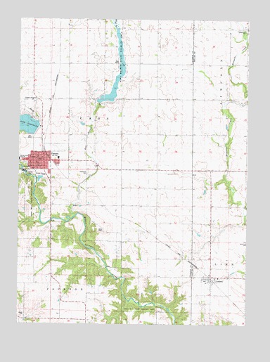
Panora, IA USGS Topographic Map
Click on map above to begin viewing in our Map Viewer.

This topographic map contains these locations and features:
Feature Name Type Latitude Longitude GNIS ID View Map
Bay BranchStreamN41.6689°W94.3452°454392View Map
Bays Branch LakeReservoirN41.7183°W94.3254°463436View Map
Bays Branch Lake DamDamN41.7153°W94.3319°463492View Map
Bays Branch State Wildlife AreaParkN41.7367°W94.3208°463317View Map
Brethren CemeteryCemeteryN41.7164°W94.3669°1996163View Map
Cass CreekStreamN41.6850°W94.2625°465390View Map
Cass Number Seven School (historical)SchoolN41.6878°W94.3669°1996060View Map
Church of the BrethrenChurchN41.7167°W94.3677°1823116View Map
City of LindenCivilN41.6427°W94.2700°2395716View Map
City of PanoraCivilN41.6910°W94.3637°2396137View Map
Eye Care Associates CenterHospitalN41.6919°W94.3564°1996067View Map
Farmers Cooperative Company ElevatorLocaleN41.6444°W94.2691°1996343View Map
First Christian ChurchChurchN41.6903°W94.3639°1996070View Map
Freedom ChurchChurchN41.6786°W94.3000°456757View Map
Greenwood CemeteryCemeteryN41.6874°W94.3377°456137View Map
Guthrie County Historical VillageLocaleN41.6878°W94.3669°1996061View Map
Guthrie County ParkParkN41.6867°W94.3705°463772View Map
Guthrie County Waterfowl Production AreaParkN41.7353°W94.3340°2765326View Map
Heartland Co-op ElevatorLocaleN41.6950°W94.3614°1996062View Map
Iowa Health Physicians CenterHospitalN41.6919°W94.3572°1996065View Map
Lennon Mills State Wildlife AreaParkN41.6792°W94.3680°463775View Map
Lenon Mill ParkParkN41.6875°W94.3691°1996162View Map
Lenon Mill State Wildlife AreaParkN41.6772°W94.3686°463315View Map
Lighthouse Assembly of God ChurchChurchN41.6864°W94.3616°1996073View Map
LindenPopulated PlaceN41.6444°W94.2691°458403View Map
Linden (historical)LocaleN41.6436°W94.2691°1996345View Map
Linden City OfficeBuildingN41.6444°W94.2691°1996342View Map
Linden Post OfficePost OfficeN41.6426°W94.2695°1996341View Map
Linn Post Office (historical)Post OfficeN41.6444°W94.2758°1996198View Map
Little League Ball ParkParkN41.6861°W94.3600°1996057View Map
Middle Raccoon River AccessLocaleN41.6486°W94.3280°1996139View Map
Milo Ray State Wildlife AreaParkN41.6317°W94.3094°463316View Map
PanoraPopulated PlaceN41.6917°W94.3630°460010View Map
Panora (historical)LocaleN41.6944°W94.3600°1996076View Map
Panora City HallBuildingN41.6919°W94.3661°1996059View Map
Panora Community ChurchChurchN41.6917°W94.3630°1996075View Map
Panora Family Dentistry CenterHospitalN41.6919°W94.3564°1996066View Map
Panora Family Medicine CenterHospitalN41.6914°W94.3625°1996064View Map
Panora Medical ClinicHospitalN41.6930°W94.3533°1996068View Map
Panora Nursing and Rehabilitation CenterHospitalN41.6930°W94.3533°1996069View Map
Panora Post OfficePost OfficeN41.6909°W94.3631°1996063View Map
Panora Public LibraryBuildingN41.6919°W94.3661°1996058View Map
Panora Rescue Squad Ambulance ServiceBuildingN41.6927°W94.3656°2599805View Map
Panora Volunteer Fire DepartmentBuildingN41.6920°W94.3662°2577322View Map
Pleasant Hill CemeteryCemeteryN41.7458°W94.2516°1823115View Map
Prairie Center ChurchChurchN41.7461°W94.2505°460385View Map
Saint Cecilia Catholic ChurchChurchN41.6936°W94.3647°1996072View Map
Saint Thomas Lutheran ChurchChurchN41.7022°W94.3619°1996071View Map
Shiloh Bible ChurchChurchN41.6444°W94.2691°1996344View Map
Township of CassCivilN41.7116°W94.3352°467541View Map
United Methodist ChurchChurchN41.6919°W94.3630°1996074View Map

Note: Coordinates in the location and feature list above are referenced to NAD83 datum.


Copyright (C) 2008-2025 Ryan Niemi / Sunset Dynamics ... All Rights Reserved