TopoQuest Logo
Do you find TopoQuest useful?
Help keep TopoQuest running and adding new maps/features by donating!
Bitcoin:  19c7KJd3qBynnjoSw5npx9KScwjBe4ifkT
Litecoin:  LXs6TkuXGGXo1vDsWCkWVdjQX94eUKd6ui
Home View Maps Find Maps Find Places Resources & Links


Stuart North, Iowa Topographic Map

USGS Map Title: Stuart North, IA
USGS Map MRC: 41094E3
DRG (GeoTIFF) Download: o41094e3.tif


Neighboring USGS Topographic Map Quads:


  Guthrie Center East, IA  
41094F4
 

  Panora, IA  
41094F3
 

  Adel NW, IA  
41094F2
 

  Menlo, IA  
41094E4
 

  Stuart North, IA  
41094E3
 

  Redfield, IA  
41094E2
 

  Rosserdale, IA  
41094D4
 

  Stuart South, IA  
41094D3
 

  Earlham West, IA  
41094D2


Map MRC Location:

N42°
W95°
N42°
W94°
H8 H7 H6 H5 H4 H3 H2 H1
G8 G7 G6 G5 G4 G3 G2 G1
F8 F7 F6 F5 F4 F3 F2 F1
E8 E7 E6 E5 E4 E3 E2 E1
D8 D7 D6 D5 D4 D3 D2 D1
C8 C7 C6 C5 C4 C3 C2 C1
B8 B7 B6 B5 B4 B3 B2 B1
A8 A7 A6 A5 A4 A3 A2 A1
N41°
W95°
N41°
W94°

Stuart North, IA USGS 1:24K Topographic Map Preview:
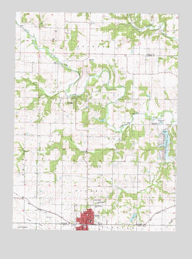
Stuart North, IA USGS Topographic Map
Click on map above to begin viewing in our Map Viewer.

This topographic map contains these locations and features:
Feature Name Type Latitude Longitude GNIS ID View Map
All Saints Catholic ChurchChurchN41.5069°W94.3172°1996047View Map
Beaver CreekStreamN41.5800°W94.3358°454446View Map
City of StuartCivilN41.5003°W94.3187°2395991View Map
Congregational ChurchChurchN41.5028°W94.3180°1996173View Map
DalePopulated PlaceN41.5958°W94.3419°455772View Map
Dale Post Office (historical)Post OfficeN41.5958°W94.3419°1996019View Map
Deer CreekStreamN41.5564°W94.2925°455853View Map
Diamondhead LakePopulated PlaceN41.5521°W94.2622°2631654View Map
Diamondhead LakeReservoirN41.5519°W94.2585°1823112View Map
Diamondhead Lake Census Designated PlaceCensusN41.5489°W94.2593°2629963View Map
Diamondhead Lake DamDamN41.5583°W94.2600°463444View Map
Diamondhead Landing Strip (historical)AirportN41.5617°W94.2636°1823113View Map
Fairview SchoolSchoolN41.5939°W94.2897°456523View Map
Heartland Baptist ChurchChurchN41.5047°W94.3172°1996048View Map
Jukam's LandingAirportN41.5200°W94.3627°2677132View Map
Lawbaugh City ParkParkN41.5025°W94.3194°1996172View Map
Long BranchStreamN41.5630°W94.2547°458585View Map
Maranatha Gospel ChurchChurchN41.5039°W94.3186°1996046View Map
Morrisburg CemeteryCemeteryN41.5983°W94.3197°459245View Map
Morrisburg ChurchChurchN41.6192°W94.3177°1823171View Map
Morrisburgh (historical)Populated PlaceN41.6000°W94.3180°465439View Map
Nations Bridge County ParkParkN41.5767°W94.3311°463895View Map
North Oak Grove CemeteryCemeteryN41.5152°W94.3123°459692View Map
Pioneer SchoolSchoolN41.5600°W94.2650°460190View Map
South Oak Grove CemeteryCemeteryN41.5136°W94.3127°1823114View Map
StuartLocaleN41.5033°W94.3169°1996053View Map
StuartPopulated PlaceN41.5033°W94.3186°462041View Map
Stuart - Mount Vernon United Methodist ChurchChurchN41.5055°W94.3205°1996050View Map
Stuart City HallBuildingN41.5042°W94.3175°1996044View Map
Stuart Elementary SchoolSchoolN41.5058°W94.3147°2720069View Map
Stuart Fire DepartmentBuildingN41.5040°W94.3163°1996042View Map
Stuart Friends ChurchChurchN41.5119°W94.3169°1996049View Map
Stuart LibraryBuildingN41.5042°W94.3175°1996043View Map
Stuart Middle SchoolSchoolN41.5064°W94.3175°1996052View Map
Stuart Post OfficePost OfficeN41.5047°W94.3165°1996041View Map
Stuart SpeedwayLocaleN41.5139°W94.3266°1996045View Map
Township of JacksonCivilN41.6111°W94.3353°468100View Map
Township of PennCivilN41.5487°W94.2894°468501View Map
Township of StuartCivilN41.5217°W94.3183°468755View Map
Union ChapelChurchN41.5911°W94.2694°462442View Map
West Central Valley High SchoolSchoolN41.5047°W94.3014°1996051View Map
West Milton Post Office (historical)Post OfficeN41.5611°W94.2836°1996020View Map

Note: Coordinates in the location and feature list above are referenced to NAD83 datum.


Copyright (C) 2008-2025 Ryan Niemi / Sunset Dynamics ... All Rights Reserved