TopoQuest Logo
Do you find TopoQuest useful?
Help keep TopoQuest running and adding new maps/features by donating!
Bitcoin:  19c7KJd3qBynnjoSw5npx9KScwjBe4ifkT
Litecoin:  LXs6TkuXGGXo1vDsWCkWVdjQX94eUKd6ui
Home View Maps Find Maps Find Places Resources & Links


Paonia, Colorado Topographic Map

USGS Map Title: Paonia, CO
USGS Map MRC: 38107G5
DRG (GeoTIFF) Download: o38107g5.tif


Neighboring USGS Topographic Map Quads:


  Gray Reservoir, CO  
38107H6
 

  Bowie, CO  
38107H5
 

  Somerset, CO  
38107H4
 

  Hotchkiss, CO  
38107G6
 

  Paonia, CO  
38107G5
 

  Minnesota Pass, CO  
38107G4
 

  Grand View Mesa, CO  
38107F6
 

  Crawford, CO  
38107F5
 

  Mount Guero, CO  
38107F4


Map MRC Location:

N39°
W108°
N39°
W107°
H8 H7 H6 H5 H4 H3 H2 H1
G8 G7 G6 G5 G4 G3 G2 G1
F8 F7 F6 F5 F4 F3 F2 F1
E8 E7 E6 E5 E4 E3 E2 E1
D8 D7 D6 D5 D4 D3 D2 D1
C8 C7 C6 C5 C4 C3 C2 C1
B8 B7 B6 B5 B4 B3 B2 B1
A8 A7 A6 A5 A4 A3 A2 A1
N38°
W108°
N38°
W107°

Paonia, CO USGS 1:24K Topographic Map Preview:
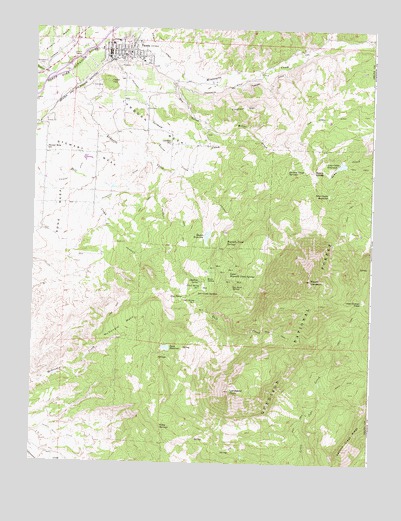
Paonia, CO USGS Topographic Map
Click on map above to begin viewing in our Map Viewer.

This topographic map contains these locations and features:
Feature Name Type Latitude Longitude GNIS ID View Map
Bell Creek SpringsSpringN38.7989°W107.5642°186570View Map
Bethlehem CemeteryCemeteryN38.8639°W107.6223°186591View Map
Bible Center ChurchChurchN38.8686°W107.5873°1795168View Map
Bone MesaSummitN38.8186°W107.6167°203234View Map
Cedar HillSummitN38.8594°W107.5976°186590View Map
Cedar Hill CemeteryCemeteryN38.8580°W107.6028°2045049View Map
Church of ChristChurchN38.8672°W107.5839°1795169View Map
Church of the NazareneChurchN38.8686°W107.5939°1795167View Map
Clark Spring Number 1SpringN38.7968°W107.5647°186568View Map
Clark Spring Number 2SpringN38.7949°W107.5619°186567View Map
Community Care Hospital of America (historical)HospitalN38.8647°W107.5817°1795298View Map
Corral Spring Number 1SpringN38.8011°W107.5632°186571View Map
Corral Spring Number 2SpringN38.8008°W107.5626°186572View Map
Dry Fork Minnesota CreekStreamN38.8694°W107.5003°186358View Map
Dry GulchValleyN38.8595°W107.5736°186566View Map
Elephant HillSummitN38.8514°W107.5442°186565View Map
First Christian ChurchChurchN38.8683°W107.5951°1795165View Map
Friends ChurchChurchN38.8683°W107.5956°1795164View Map
German CreekStreamN38.8469°W107.6237°186558View Map
German Creek SpringsSpringN38.8339°W107.5320°186560View Map
Inter-Ocean PassGapN38.7967°W107.5034°186554View Map
Inter-Ocean ReservoirReservoirN38.8276°W107.5163°186556View Map
Kauer SpringSpringN38.8029°W107.5607°186575View Map
Lamborn MesaSummitN38.8497°W107.5870°186557View Map
Lamborn SchoolSchoolN38.8422°W107.5751°186588View Map
Landsend PeakSummitN38.7708°W107.5517°186552View Map
Lone Cabin DamDamN38.8372°W107.5106°199242View Map
Lone Cabin ReservoirReservoirN38.8361°W107.5120°186562View Map
Lucas CreekStreamN38.8403°W107.5926°186586View Map
Mays SpringSpringN38.7983°W107.5698°186569View Map
McDonald MesaSummitN38.7903°W107.5903°186549View Map
Miller CreekStreamN38.8614°W107.5720°186564View Map
Minnesota DitchCanalN38.8378°W107.5834°186587View Map
Mount LambornSummitN38.8030°W107.5228°186555View Map
Needle Rock DitchCanalN38.7572°W107.6148°186548View Map
North Fork Baptist ChurchChurchN38.8711°W107.6106°1795161View Map
Northfork Miners MemorialParkN38.8705°W107.5934°1795300View Map
PaoniaPopulated PlaceN38.8683°W107.5920°186589View Map
Paonia Assembly of GodChurchN38.8736°W107.5903°1795170View Map
Paonia City Police DepartmentBuildingN38.8676°W107.5982°2757301View Map
Paonia Elementary SchoolSchoolN38.8705°W107.5949°1795172View Map
Paonia Fire DepartmentBuildingN38.8686°W107.5987°1795178View Map
Paonia Middle SchoolSchoolN38.8700°W107.5967°1795173View Map
Paonia Municipal and Community CenterBuildingN38.8675°W107.5989°1795175View Map
Paonia ParkParkN38.8708°W107.5937°1795171View Map
Paonia Post OfficePost OfficeN38.8666°W107.5976°1795177View Map
Paonia Public LibraryBuildingN38.8669°W107.5987°1795176View Map
Paonia Volunteer Fire Department - Delta County Fire Protection District 2BuildingN38.8667°W107.5911°1795162View Map
Pole Patch SpringsSpringN38.8003°W107.5522°186573View Map
Reynolds Creek SpringsSpringN38.8133°W107.5545°186584View Map
Reynolds DamDamN38.8150°W107.5639°199300View Map
Reynolds ReservoirReservoirN38.8150°W107.5639°199301View Map
Roatcap CreekStreamN38.8605°W107.6209°186300View Map
Roeber ReservoirReservoirN38.8155°W107.5611°186585View Map
Sacred Heart Catholic ChurchChurchN38.8683°W107.5945°1795166View Map
Saint Michaels Episcopal ChurchChurchN38.8714°W107.5984°1795174View Map
Sams DivideGapN38.8344°W107.5220°186561View Map
Seventh Day Adventist ChurchChurchN38.8592°W107.5926°1795179View Map
Stephens SpringSpringN38.8023°W107.5633°186574View Map
Stewart DitchCanalN38.8319°W107.6112°203212View Map
Stewart MesaSummitN38.8394°W107.6076°203233View Map
Stewart Mesa SchoolSchoolN38.8402°W107.6206°186592View Map
The Church of Jesus Christ of Latter Day Saints - Paonia WardChurchN38.8725°W107.5901°1795299View Map
Todd DamDamN38.7833°W107.5789°200900View Map
Todd DamDamN38.7839°W107.5770°201692View Map
Todd ReservoirReservoirN38.7831°W107.5753°186551View Map
Town of PaoniaCivilN38.8698°W107.5914°2413109View Map
Turner DitchCanalN38.8614°W107.5373°186563View Map
United Methodist ChurchChurchN38.8686°W107.5964°1795163View Map
Upper Reynolds Creek Spring Number 1SpringN38.8070°W107.5507°186581View Map
Upper Reynolds Creek Spring Number 2SpringN38.8058°W107.5530°186579View Map
Upper Reynolds Creek Spring Number 3SpringN38.8024°W107.5497°186577View Map
Upper Reynolds Creek Spring Number 4SpringN38.8025°W107.5520°186576View Map
Upper Reynolds Creek Spring Number 5SpringN38.8053°W107.5563°186578View Map
Upper Reynolds Creek Spring Number 6SpringN38.8068°W107.5578°186582View Map
Upper Reynolds Creek Spring Number 7SpringN38.8064°W107.5580°186583View Map
Upper Reynolds Creek SpringsSpringN38.8047°W107.5498°186580View Map
Wiley SpringsSpringN38.7594°W107.5767°186550View Map

Note: Coordinates in the location and feature list above are referenced to NAD83 datum.


Copyright (C) 2008-2024 Ryan Niemi / Sunset Dynamics ... All Rights Reserved