TopoQuest Logo
Do you find TopoQuest useful?
Help keep TopoQuest running and adding new maps/features by donating!
Bitcoin:  19c7KJd3qBynnjoSw5npx9KScwjBe4ifkT
Litecoin:  LXs6TkuXGGXo1vDsWCkWVdjQX94eUKd6ui
Home View Maps Find Maps Find Places Resources & Links


Gray Reservoir, Colorado Topographic Map

USGS Map Title: Gray Reservoir, CO
USGS Map MRC: 38107H6
DRG (GeoTIFF) Download: o38107h6.tif


Neighboring USGS Topographic Map Quads:


  Leon Peak, CO  
39107A7
 

  Chalk Mountain, CO  
39107A6
 

  Electric Mountain, CO  
39107A5
 

  Dry Creek, CO  
38107H7
 

  Gray Reservoir, CO  
38107H6
 

  Bowie, CO  
38107H5
 

  Lazear, CO  
38107G7
 

  Hotchkiss, CO  
38107G6
 

  Paonia, CO  
38107G5


Map MRC Location:

N39°
W108°
N39°
W107°
H8 H7 H6 H5 H4 H3 H2 H1
G8 G7 G6 G5 G4 G3 G2 G1
F8 F7 F6 F5 F4 F3 F2 F1
E8 E7 E6 E5 E4 E3 E2 E1
D8 D7 D6 D5 D4 D3 D2 D1
C8 C7 C6 C5 C4 C3 C2 C1
B8 B7 B6 B5 B4 B3 B2 B1
A8 A7 A6 A5 A4 A3 A2 A1
N38°
W108°
N38°
W107°

Gray Reservoir, CO USGS 1:24K Topographic Map Preview:
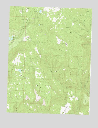
Gray Reservoir, CO USGS Topographic Map
Click on map above to begin viewing in our Map Viewer.

This topographic map contains these locations and features:
Feature Name Type Latitude Longitude GNIS ID View Map
Barrow ReservoirReservoirN38.9858°W107.7235°186308View Map
Brockman Number 1 DamDamN38.9966°W107.7253°199662View Map
Brockman Number 2 DamDamN38.9941°W107.7251°198980View Map
Brockman Reservoir Number 1ReservoirN38.9976°W107.7253°186311View Map
Brockman Reservoir Number 2ReservoirN38.9949°W107.7245°186310View Map
Burdick MineMineN38.8905°W107.7206°186298View Map
Cunningham CreekStreamN38.9644°W107.6262°175431View Map
Delta W MineMineN38.8917°W107.6614°1745528View Map
Doughty CreekStreamN38.9789°W107.7223°175410View Map
Duke BasinBasinN38.9647°W107.7220°186306View Map
East Leroux CreekStreamN38.9647°W107.7359°175411View Map
East Roatcap CreekStreamN38.8983°W107.6448°186291View Map
Ellington CreekStreamN38.9844°W107.7120°186312View Map
Fitzsimons MinesMineN38.8930°W107.6614°186293View Map
Foote DitchCanalN38.8853°W107.6409°186294View Map
Fry MesaSummitN38.9005°W107.6345°186292View Map
Gray DamDamN38.9933°W107.7056°199480View Map
Gray ReservoirReservoirN38.9951°W107.7037°186314View Map
High ParkFlatN38.9575°W107.6634°186305View Map
Hobson ReservoirReservoirN38.9948°W107.7086°186313View Map
Long DrawValleyN38.9220°W107.6820°186302View Map
Lost Hunter ReservoirReservoirN38.9938°W107.7345°186309View Map
Oak MesaSummitN38.9178°W107.7362°186276View Map
Overland DitchCanalN38.9492°W107.6798°175344View Map
Patterson Number 2 DamDamN38.9633°W107.7473°199276View Map
Patterson Reservoir Number 2ReservoirN38.9633°W107.7473°199277View Map
Patterson ReservoirsReservoirN38.9618°W107.7499°169547View Map
Schoneman Ditch CampLocaleN38.9822°W107.6537°186317View Map
Sheep Drive ReservoirReservoirN38.9790°W107.7045°186315View Map
Sink CreekStreamN38.9808°W107.6373°186318View Map
The BasinBasinN38.8950°W107.6512°186290View Map
Wakefield DitchCanalN38.9089°W107.6912°186299View Map
Wakefield MesaSummitN38.8864°W107.6606°203211View Map
West Leroux CreekStreamN38.9647°W107.7359°175353View Map
West Number 1 DamDamN38.9250°W107.7326°199346View Map
West Reservoir Number OneReservoirN38.9246°W107.7323°186303View Map
West Roatcap CreekStreamN38.8983°W107.6448°186301View Map

Note: Coordinates in the location and feature list above are referenced to NAD83 datum.


Copyright (C) 2008-2024 Ryan Niemi / Sunset Dynamics ... All Rights Reserved