TopoQuest Logo
Do you find TopoQuest useful?
Help keep TopoQuest running and adding new maps/features by donating!
Bitcoin:  19c7KJd3qBynnjoSw5npx9KScwjBe4ifkT
Litecoin:  LXs6TkuXGGXo1vDsWCkWVdjQX94eUKd6ui
Home View Maps Find Maps Find Places Resources & Links


Somerset, Colorado Topographic Map

USGS Map Title: Somerset, CO
USGS Map MRC: 38107H4
DRG (GeoTIFF) Download: o38107h4.tif


Neighboring USGS Topographic Map Quads:


  Electric Mountain, CO  
39107A5
 

  Bull Mountain, CO  
39107A4
 

  Chair Mountain, CO  
39107A3
 

  Bowie, CO  
38107H5
 

  Somerset, CO  
38107H4
 

  Paonia Reservoir, CO  
38107H3
 

  Paonia, CO  
38107G5
 

  Minnesota Pass, CO  
38107G4
 

  West Beckwith Mountain, CO  
38107G3


Map MRC Location:

N39°
W108°
N39°
W107°
H8 H7 H6 H5 H4 H3 H2 H1
G8 G7 G6 G5 G4 G3 G2 G1
F8 F7 F6 F5 F4 F3 F2 F1
E8 E7 E6 E5 E4 E3 E2 E1
D8 D7 D6 D5 D4 D3 D2 D1
C8 C7 C6 C5 C4 C3 C2 C1
B8 B7 B6 B5 B4 B3 B2 B1
A8 A7 A6 A5 A4 A3 A2 A1
N38°
W108°
N38°
W107°

Somerset, CO USGS 1:24K Topographic Map Preview:
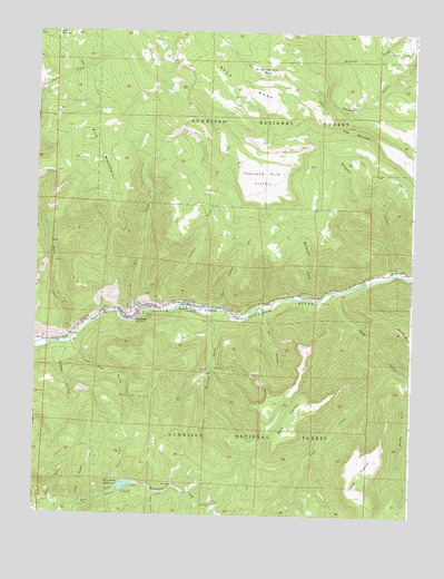
Somerset, CO USGS Topographic Map
Click on map above to begin viewing in our Map Viewer.

This topographic map contains these locations and features:
Feature Name Type Latitude Longitude GNIS ID View Map
Axelson MineMineN38.9294°W107.4281°1745532View Map
Bear CreekStreamN38.9208°W107.4873°186346View Map
Bear MineMineN38.9283°W107.4495°186366View Map
Box CanyonValleyN38.9284°W107.4246°186355View Map
Buck MesaSummitN38.9986°W107.4545°202305View Map
Clark MineMineN38.9264°W107.4631°186368View Map
Coal GulchValleyN38.9287°W107.4384°186367View Map
Deep CreekStreamN38.9136°W107.3812°186360View Map
Deer CreekStreamN38.8780°W107.4606°186359View Map
Dry Fork Cow CampLocaleN38.8780°W107.4412°186353View Map
East FlatironSummitN38.8858°W107.3917°186357View Map
Elk CreekStreamN38.9258°W107.4670°186370View Map
Fire MountainSummitN38.9717°W107.4817°186374View Map
Gribble GulchValleyN38.9185°W107.4899°186347View Map
Hall ReservoirReservoirN38.9991°W107.4938°186375View Map
Hawksnest CreekStreamN38.9314°W107.4056°186376View Map
Hawksnest MineMineN38.9322°W107.4123°186362View Map
Horse GulchValleyN38.8836°W107.4701°186351View Map
Hubbard MineMineN38.9317°W107.4926°1745533View Map
Kaiser MineMineN38.9294°W107.4678°197507View Map
Lone Pine GulchValleyN38.9193°W107.4884°186348View Map
Minnesota ReservoirReservoirN38.8825°W107.4699°186352View Map
Monument DamDamN38.8817°W107.4723°199256View Map
Mount Gunnison Number One MineMineN38.9233°W107.4506°1745536View Map
O.C. Mine Number TwoMineN38.9305°W107.4701°1745530View Map
Oliver MineMineN38.9275°W107.4334°186365View Map
Oliver Power PlantLocaleN38.9264°W107.4337°186364View Map
Paonia Coal Drilling Project MineMineN38.8789°W107.4559°1745534View Map
Pond GulchValleyN38.8774°W107.4854°186350View Map
Raven GulchValleyN38.9326°W107.3999°186363View Map
Sanborn CreekStreamN38.9286°W107.4576°186373View Map
Slide GulchValleyN38.8755°W107.4917°186349View Map
SomersetPopulated PlaceN38.9264°W107.4703°186369View Map
Somerset B Seam and C Seam MineMineN38.9275°W107.4687°1745535View Map
Somerset CemeteryCemeteryN38.9286°W107.4703°2123883View Map
Somerset MineMineN38.9305°W107.4701°1745531View Map
Somerset Post OfficePost OfficeN38.9262°W107.4701°1795181View Map
Spring CreekStreamN38.8942°W107.4787°191119View Map
Springhouse ParkFlatN38.9900°W107.4251°186372View Map
Sylvester GulchValleyN38.9265°W107.4377°186354View Map
The NarrowsRidgeN38.9753°W107.3956°186378View Map
Thompson CreekStreamN38.9375°W107.3823°186377View Map
Thousand Acre FlatsFlatN38.9625°W107.4270°186371View Map
West FlatironSummitN38.9003°W107.4153°186356View Map

Note: Coordinates in the location and feature list above are referenced to NAD83 datum.


Copyright (C) 2008-2024 Ryan Niemi / Sunset Dynamics ... All Rights Reserved