TopoQuest Logo
Do you find TopoQuest useful?
Help keep TopoQuest running and adding new maps/features by donating!
Bitcoin:  19c7KJd3qBynnjoSw5npx9KScwjBe4ifkT
Litecoin:  LXs6TkuXGGXo1vDsWCkWVdjQX94eUKd6ui
Home View Maps Find Maps Find Places Resources & Links


Paradise, Utah Topographic Map

USGS Map Title: Paradise, UT
USGS Map MRC: 41111E7
DRG (GeoTIFF) Download: o41111e7.tif


Neighboring USGS Topographic Map Quads:


  Wellsville, UT  
41111F8
 

  Logan, UT  
41111F7
 

  Logan Peak, UT  
41111F6
 

  Mount Pisgah, UT  
41111E8
 

  Paradise, UT  
41111E7
 

  Porcupine Reservoir, UT  
41111E6
 

  Mantua, UT  
41111D8
 

  James Peak, UT  
41111D7
 

  Sharp Mountain, UT  
41111D6


Map MRC Location:

N42°
W112°
N42°
W111°
H8 H7 H6 H5 H4 H3 H2 H1
G8 G7 G6 G5 G4 G3 G2 G1
F8 F7 F6 F5 F4 F3 F2 F1
E8 E7 E6 E5 E4 E3 E2 E1
D8 D7 D6 D5 D4 D3 D2 D1
C8 C7 C6 C5 C4 C3 C2 C1
B8 B7 B6 B5 B4 B3 B2 B1
A8 A7 A6 A5 A4 A3 A2 A1
N41°
W112°
N41°
W111°

Paradise, UT USGS 1:24K Topographic Map Preview:
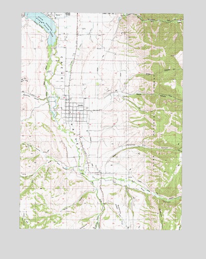
Paradise, UT USGS Topographic Map
Click on map above to begin viewing in our Map Viewer.

This topographic map contains these locations and features:
Feature Name Type Latitude Longitude GNIS ID View Map
AvonPopulated PlaceN41.5330°W111.8133°1438313View Map
Avon CemeteryCemeteryN41.5364°W111.8172°2076619View Map
Avon Census Designated PlaceCensusN41.5354°W111.8125°2407786View Map
Big Spring HollowValleyN41.5413°W111.8561°1438744View Map
Davenport CreekStreamN41.5041°W111.8155°1440275View Map
East CanyonValleyN41.5294°W111.7972°1440771View Map
East Fork Little Bear RiverStreamN41.5280°W111.8213°1440810View Map
Fourmile HillSummitN41.5002°W111.8269°1441194View Map
Green CanyonValleyN41.5805°W111.7997°1441463View Map
Highline CanalCanalN41.5977°W111.8138°1454767View Map
Hyrum CanalCanalN41.5880°W111.8383°1441969View Map
Hyrum CanyonValleyN41.5783°W111.8019°1441970View Map
Hyrum DivisionCivilN41.5684°W111.8531°1939380View Map
Hyrum Lake CampgroundLocaleN41.6044°W111.8530°1448503View Map
Hyrum ReservoirReservoirN41.6187°W111.8589°1441972View Map
Hyrum Reservoir State ParkParkN41.6202°W111.8574°1448504View Map
Indian Head and TrapperPillarN41.6235°W111.7674°1448508View Map
Indian Trail HollowValleyN41.5319°W111.8652°1442037View Map
Jackson DitchCanalN41.5324°W111.7958°1442091View Map
Little Bear RiverStreamN41.5041°W111.8149°1442665View Map
McMurdie HollowValleyN41.5752°W111.8552°1443267View Map
Miles CanyonValleyN41.5455°W111.7558°1443387View Map
Musselman AirstripAirportN41.5156°W111.8018°2787291View Map
O'Berry CanalCanalN41.6074°W111.8288°1444007View Map
ParadisePopulated PlaceN41.5688°W111.8380°1444178View Map
Paradise CanalCanalN41.5624°W111.8247°1444180View Map
Paradise CemeteryCemeteryN41.5699°W111.8238°1448801View Map
Paradise Dry CanyonValleyN41.5380°W111.8147°1444188View Map
Paradise Fire DepartmentBuildingN41.5678°W111.8361°2627299View Map
Paradise Post OfficePost OfficeN41.5708°W111.8362°2769036View Map
South CanyonValleyN41.5252°W111.8161°1445804View Map
South Fork Little Bear RiverStreamN41.5041°W111.8152°1445856View Map
Spring BranchStreamN41.5230°W111.8166°1445975View Map
The Church of Jesus Christ of Latter Day SaintsChurchN41.5758°W111.8377°1449582View Map
Town of ParadiseCivilN41.5678°W111.8330°2413112View Map
West CanyonValleyN41.5352°W111.8369°1447118View Map
West Fork Little Bear RiverStreamN41.5358°W111.8308°1447146View Map

Note: Coordinates in the location and feature list above are referenced to NAD83 datum.


Copyright (C) 2008-2025 Ryan Niemi / Sunset Dynamics ... All Rights Reserved