TopoQuest Logo
Do you find TopoQuest useful?
Help keep TopoQuest running and adding new maps/features by donating!
Bitcoin:  19c7KJd3qBynnjoSw5npx9KScwjBe4ifkT
Litecoin:  LXs6TkuXGGXo1vDsWCkWVdjQX94eUKd6ui
Home View Maps Find Maps Find Places Resources & Links


Mount Pisgah, Utah Topographic Map

USGS Map Title: Mount Pisgah, UT
USGS Map MRC: 41111E8
DRG (GeoTIFF) Download: o41111e8.tif


Neighboring USGS Topographic Map Quads:


  Honeyville, UT  
41112F1
 

  Wellsville, UT  
41111F8
 

  Logan, UT  
41111F7
 

  Brigham City, UT  
41112E1
 

  Mount Pisgah, UT  
41111E8
 

  Paradise, UT  
41111E7
 

  Willard, UT  
41112D1
 

  Mantua, UT  
41111D8
 

  James Peak, UT  
41111D7


Map MRC Location:

N42°
W112°
N42°
W111°
H8 H7 H6 H5 H4 H3 H2 H1
G8 G7 G6 G5 G4 G3 G2 G1
F8 F7 F6 F5 F4 F3 F2 F1
E8 E7 E6 E5 E4 E3 E2 E1
D8 D7 D6 D5 D4 D3 D2 D1
C8 C7 C6 C5 C4 C3 C2 C1
B8 B7 B6 B5 B4 B3 B2 B1
A8 A7 A6 A5 A4 A3 A2 A1
N41°
W112°
N41°
W111°

Mount Pisgah, UT USGS 1:24K Topographic Map Preview:
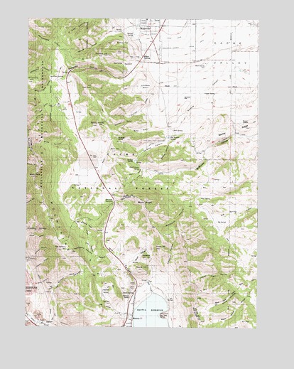
Mount Pisgah, UT USGS Topographic Map
Click on map above to begin viewing in our Map Viewer.

This topographic map contains these locations and features:
Feature Name Type Latitude Longitude GNIS ID View Map
Babbit Shanty HillSummitN41.5816°W111.9622°1438318View Map
Bankhead CanyonValleyN41.5508°W111.9149°1438388View Map
Bankhead WellWellN41.5933°W111.9155°1438389View Map
Baxter PotholeLakeN41.5833°W111.8855°1438426View Map
Baxter RidgeRidgeN41.5813°W111.8824°1438427View Map
Big HillSummitN41.5097°W111.9563°1438676View Map
Big HollowValleyN41.5047°W111.9463°1438680View Map
Big SpringSpringN41.5045°W111.9282°1438738View Map
Big SpringSpringN41.5430°W111.8981°1438739View Map
Black PeakSummitN41.5610°W111.9963°1438865View Map
Blue HillSummitN41.5713°W111.9516°1438932View Map
Bott CanyonValleyN41.5169°W111.9944°1439015View Map
Bowden CanyonValleyN41.5233°W111.9958°1439044View Map
Cart HillSummitN41.5972°W111.9683°1439488View Map
Cavok Ranch AirportAirportN41.5856°W111.9026°2787290View Map
Cedar HillSummitN41.5319°W111.9274°1439568View Map
City of WellsvilleCivilN41.6223°W111.9429°2412211View Map
Clappers HollowValleyN41.5210°W111.9249°1439763View Map
Cookys HollowValleyN41.5877°W111.9352°1439925View Map
Cooper SpringSpringN41.5963°W111.9043°1439936View Map
Dam CreekStreamN41.5138°W111.9311°1440243View Map
Dry CanyonValleyN41.5163°W111.9388°1440578View Map
Dry LakeLakeN41.5671°W111.9692°1440666View Map
Flat Bottom CanyonValleyN41.5138°W111.9899°1441116View Map
Flat Bottom HillSummitN41.5310°W111.9813°1441117View Map
Garretts HollowValleyN41.6060°W111.9419°1441284View Map
Gold Mine HillSummitN41.5283°W111.9349°1441354View Map
Hall SpringSpringN41.5801°W111.9221°1441553View Map
Hallings SpringSpringN41.5121°W111.9440°1441554View Map
Jepsen ValleyValleyN41.5113°W111.9561°1442129View Map
Jim Taylor CanyonValleyN41.5258°W111.9524°1442142View Map
Leatham SpringsSpringN41.6010°W111.9808°1442472View Map
Lindleys BasinBasinN41.5974°W111.9358°1442629View Map
Little KnollSummitN41.5049°W111.9255°1442730View Map
Mahogany CanyonValleyN41.5274°W111.9608°1443082View Map
Mantua Police DepartmentBuildingN41.5035°W111.9434°2769021View Map
Mantua ReservoirReservoirN41.5046°W111.9327°1443143View Map
Maple Grove HollowValleyN41.5185°W111.8777°1443167View Map
McBride SpringSpringN41.5762°W111.9521°1443241View Map
Mount PisgahSummitN41.5510°W111.9361°1444460View Map
Mount SterlingPopulated PlaceN41.6097°W111.9372°1443630View Map
Mount Sterling CemeteryCemeteryN41.6066°W111.9056°1443631View Map
Mud SpringSpringN41.5530°W111.9056°1443706View Map
Murray SpringSpringN41.6185°W111.9437°1443745View Map
Murrays HillSummitN41.6102°W111.9594°1443747View Map
Narrow CanyonValleyN41.6208°W111.9469°1443761View Map
Olsens SpringSpringN41.5143°W111.9424°1444089View Map
Ox Killer HollowValleyN41.5166°W111.8852°1444137View Map
Quaking Aspen HollowValleyN41.5388°W111.9586°1444688View Map
Rattlesnake CanyonValleyN41.6049°W111.9761°1444735View Map
Redford HoleBasinN41.6147°W111.9491°1444841View Map
Round HillSummitN41.5238°W111.9372°1445163View Map
Sardine CanyonValleyN41.5819°W111.9316°1445334View Map
Sardine SpringSpringN41.5674°W111.9434°1445336View Map
Sardine SummitSummitN41.5497°W111.9541°1445337View Map
Silver Mine HollowValleyN41.5999°W111.9838°1445601View Map
Skunk HollowValleyN41.5244°W111.9447°1445647View Map
Snow CanyonValleyN41.5752°W111.9772°1445734View Map
South Grove HollowValleyN41.5669°W111.9413°1445890View Map
South Grove SpringSpringN41.5635°W111.9401°1445891View Map
Stock PondLakeN41.5576°W111.9718°1446153View Map
Stoddard CanyonValleyN41.6041°W111.9852°1446156View Map
Stoddard HillSummitN41.5994°W111.9999°1446157View Map
The Church of Jesus Christ of Latter Day SaintsChurchN41.5049°W111.9433°1449379View Map
The Pothole SpringSpringN41.5768°W111.9236°1446494View Map
Town of MantuaCivilN41.5006°W111.9343°2412947View Map
Waterfall CanyonValleyN41.5266°W111.9999°1447072View Map
Watt GlenValleyN41.5819°W111.9316°1447079View Map
Wellsville CanyonValleyN41.6027°W111.9444°1447105View Map
Wellsville-Mendon Lower CanalCanalN41.6174°W111.9211°1438103View Map
Wellsville-Mendon Upper CanalCanalN41.6130°W111.9219°1438104View Map
Wide HollowValleyN41.5910°W111.9877°1447316View Map
Wildcat CanyonValleyN41.5738°W111.9236°1447351View Map

Note: Coordinates in the location and feature list above are referenced to NAD83 datum.


Copyright (C) 2008-2025 Ryan Niemi / Sunset Dynamics ... All Rights Reserved