TopoQuest Logo
Do you find TopoQuest useful?
Help keep TopoQuest running and adding new maps/features by donating!
Bitcoin:  19c7KJd3qBynnjoSw5npx9KScwjBe4ifkT
Litecoin:  LXs6TkuXGGXo1vDsWCkWVdjQX94eUKd6ui
Home View Maps Find Maps Find Places Resources & Links


Paraiso Springs, California Topographic Map

USGS Map Title: Paraiso Springs, CA
USGS Map MRC: 36121C3
DRG (GeoTIFF) Download: o36121c3.tif


Neighboring USGS Topographic Map Quads:


  Palo Escrito Peak, CA  
36121D4
 

  Soledad, CA  
36121D3
 

  North Chalone Peak, CA  
36121D2
 

  Sycamore Flat, CA  
36121C4
 

  Paraiso Springs, CA  
36121C3
 

  Greenfield, CA  
36121C2
 

  Junipero Serra Peak, CA  
36121B4
 

  Reliz Canyon, CA  
36121B3
 

  Thompson Canyon, CA  
36121B2


Map MRC Location:

N37°
W122°
N37°
W121°
H8 H7 H6 H5 H4 H3 H2 H1
G8 G7 G6 G5 G4 G3 G2 G1
F8 F7 F6 F5 F4 F3 F2 F1
E8 E7 E6 E5 E4 E3 E2 E1
D8 D7 D6 D5 D4 D3 D2 D1
C8 C7 C6 C5 C4 C3 C2 C1
B8 B7 B6 B5 B4 B3 B2 B1
A8 A7 A6 A5 A4 A3 A2 A1
N36°
W122°
N36°
W121°

Paraiso Springs, CA USGS 1:24K Topographic Map Preview:
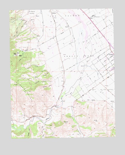
Paraiso Springs, CA USGS Topographic Map
Click on map above to begin viewing in our Map Viewer.

This topographic map contains these locations and features:
Feature Name Type Latitude Longitude GNIS ID View Map
Arroyo SecoCivilN36.3269°W121.2780°238768View Map
Arroyo Seco School (historical)SchoolN36.2936°W121.3108°1670118View Map
Beeswax CanyonValleyN36.3008°W121.3258°239162View Map
Clark Ranch AirportAirportN36.3649°W121.3105°1654016View Map
Force CanyonValleyN36.3219°W121.3335°242354View Map
Greenfield Memorial BuildingBuildingN36.3297°W121.2505°1873491View Map
Happy CanyonValleyN36.3333°W121.3585°243190View Map
Hogs CanyonValleyN36.3139°W121.3294°243525View Map
Indian ValleyBasinN36.3333°W121.3669°243844View Map
Lasher CanyonValleyN36.3650°W121.3533°244633View Map
Los Coches SubstationLocaleN36.3666°W121.2799°1654708View Map
Lowder CanyonValleyN36.3075°W121.3205°245240View Map
Milindee CanyonValleyN36.3139°W121.3294°245903View Map
Oak Avenue Elementary SchoolSchoolN36.3154°W121.2522°1873515View Map
Olson RanchLocaleN36.3369°W121.3408°1873444View Map
Paraiso SpringsSpringN36.3314°W121.3688°247240View Map
Paraiso Springs School (historical)SchoolN36.3391°W121.3419°1670147View Map
Pettits PeakSummitN36.2647°W121.3110°247421View Map
Reliz CanyonValleyN36.3052°W121.2949°273263View Map
Reliz CreekStreamN36.3147°W121.2946°273265View Map
Sweetwater CreekStreamN36.2625°W121.3558°250175View Map
Vaqueros CreekStreamN36.2647°W121.3369°274318View Map
Vineyard of Mission SoledadLocaleN36.3308°W121.3660°251071View Map

Note: Coordinates in the location and feature list above are referenced to NAD83 datum.


Copyright (C) 2008-2025 Ryan Niemi / Sunset Dynamics ... All Rights Reserved