TopoQuest Logo
Do you find TopoQuest useful?
Help keep TopoQuest running and adding new maps/features by donating!
Bitcoin:  19c7KJd3qBynnjoSw5npx9KScwjBe4ifkT
Litecoin:  LXs6TkuXGGXo1vDsWCkWVdjQX94eUKd6ui
Home View Maps Find Maps Find Places Resources & Links


Soledad, California Topographic Map

USGS Map Title: Soledad, CA
USGS Map MRC: 36121D3
DRG (GeoTIFF) Download: o36121d3.tif


Neighboring USGS Topographic Map Quads:


  Gonzales, CA  
36121E4
 

  Mount Johnson, CA  
36121E3
 

  Bickmore Canyon, CA  
36121E2
 

  Palo Escrito Peak, CA  
36121D4
 

  Soledad, CA  
36121D3
 

  North Chalone Peak, CA  
36121D2
 

  Sycamore Flat, CA  
36121C4
 

  Paraiso Springs, CA  
36121C3
 

  Greenfield, CA  
36121C2


Map MRC Location:

N37°
W122°
N37°
W121°
H8 H7 H6 H5 H4 H3 H2 H1
G8 G7 G6 G5 G4 G3 G2 G1
F8 F7 F6 F5 F4 F3 F2 F1
E8 E7 E6 E5 E4 E3 E2 E1
D8 D7 D6 D5 D4 D3 D2 D1
C8 C7 C6 C5 C4 C3 C2 C1
B8 B7 B6 B5 B4 B3 B2 B1
A8 A7 A6 A5 A4 A3 A2 A1
N36°
W122°
N36°
W121°

Soledad, CA USGS 1:24K Topographic Map Preview:
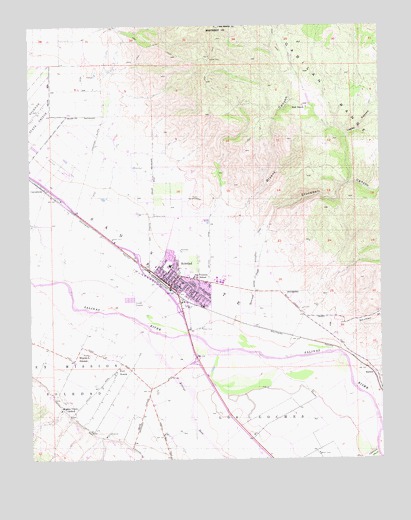
Soledad, CA USGS Topographic Map
Click on map above to begin viewing in our Map Viewer.

This topographic map contains these locations and features:
Feature Name Type Latitude Longitude GNIS ID View Map
American Medical Response SoledadBuildingN36.4278°W121.3276°2662264View Map
Arroyo SecoStreamN36.4136°W121.3424°238770View Map
Bill Ramos ParkParkN36.4275°W121.3274°1873374View Map
Bryant CanyonValleyN36.4469°W121.2994°239749View Map
CamphoraPopulated PlaceN36.4530°W121.3710°1660428View Map
City of SoledadCivilN36.4306°W121.3219°2411924View Map
Correctional Training Facility HeliportAirportN36.4669°W121.3710°1654018View Map
Fort RomiePopulated PlaceN36.4002°W121.3463°1660648View Map
Frank Ledesma Elementary SchoolSchoolN36.4380°W121.3313°2504516View Map
Gabilan Elementary SchoolSchoolN36.4283°W121.3203°1873409View Map
Hall RanchLocaleN36.4772°W121.2783°243129View Map
HarlemPopulated PlaceN36.3991°W121.2535°1660721View Map
Jack Franscioni Elementary SchoolSchoolN36.4369°W121.3155°2504526View Map
KOJY-AM (Soledad)TowerN36.4641°W121.2988°1662757View Map
KSUR-FM (Greenfield)TowerN36.4641°W121.2988°1662893View Map
Little League ParkParkN36.4289°W121.3233°1873430View Map
Lopez CanyonValleyN36.4547°W121.2619°245111View Map
Los Coche AdobeBuildingN36.4041°W121.3180°1873431View Map
Los CochesCivilN36.3805°W121.2974°245163View Map
Main Street Middle SchoolSchoolN36.4305°W121.3267°1873433View Map
Mission Elementary SchoolSchoolN36.3901°W121.3648°246030View Map
Mission SoledadChurchN36.4047°W121.3560°1661044View Map
Paul Masson VineyardsLocaleN36.4314°W121.3177°1873448View Map
Pinnacles High SchoolSchoolN36.4272°W121.3294°1873450View Map
Rose Ferrero Elementary SchoolSchoolN36.4416°W121.3245°2504518View Map
San Vicente Elementary SchoolSchoolN36.4276°W121.3166°248975View Map
Shirttail GulchValleyN36.4139°W121.2624°249409View Map
Smith and Hook WineryLocaleN36.3941°W121.3688°1873458View Map
SoledadPopulated PlaceN36.4247°W121.3263°1661463View Map
Soledad Branch Monterey County Free LibrariesBuildingN36.4277°W121.3285°1873460View Map
Soledad CemeteryCemeteryN36.4267°W121.3123°1873461View Map
Soledad Christian AcademySchoolN36.4200°W121.3169°2504492View Map
Soledad Community Education CenterSchoolN36.4339°W121.3236°2504414View Map
Soledad Fire DepartmentBuildingN36.4278°W121.3276°2623853View Map
Soledad High SchoolSchoolN36.4367°W121.3254°2504517View Map
Soledad Police DepartmentBuildingN36.4283°W121.3272°2755882View Map
Soledad Post OfficePost OfficeN36.4261°W121.3262°2780999View Map
Stonewall CanyonValleyN36.4464°W121.2899°249961View Map
Stonewall CreekStreamN36.4100°W121.3063°249962View Map
Upper Lateral Number Two and One HalfCivilN36.4341°W121.3383°238360View Map
Vosti ParkParkN36.4227°W121.3219°1873473View Map

Note: Coordinates in the location and feature list above are referenced to NAD83 datum.


Copyright (C) 2008-2025 Ryan Niemi / Sunset Dynamics ... All Rights Reserved