TopoQuest Logo
Do you find TopoQuest useful?
Help keep TopoQuest running and adding new maps/features by donating!
Bitcoin:  19c7KJd3qBynnjoSw5npx9KScwjBe4ifkT
Litecoin:  LXs6TkuXGGXo1vDsWCkWVdjQX94eUKd6ui
Home View Maps Find Maps Find Places Resources & Links


Paris East, Kentucky Topographic Map

USGS Map Title: Paris East, KY
USGS Map MRC: 38084B2
DRG (GeoTIFF) Download: o38084b2.tif


Neighboring USGS Topographic Map Quads:


  Shawhan, KY  
38084C3
 

  Millersburg, KY  
38084C2
 

  Carlisle, KY  
38084C1
 

  Paris West, KY  
38084B3
 

  Paris East, KY  
38084B2
 

  North Middletown, KY  
38084B1
 

  Clintonville, KY  
38084A3
 

  Austerlitz, KY  
38084A2
 

  Sideview, KY  
38084A1


Map MRC Location:

N39°
W85°
N39°
W84°
H8 H7 H6 H5 H4 H3 H2 H1
G8 G7 G6 G5 G4 G3 G2 G1
F8 F7 F6 F5 F4 F3 F2 F1
E8 E7 E6 E5 E4 E3 E2 E1
D8 D7 D6 D5 D4 D3 D2 D1
C8 C7 C6 C5 C4 C3 C2 C1
B8 B7 B6 B5 B4 B3 B2 B1
A8 A7 A6 A5 A4 A3 A2 A1
N38°
W85°
N38°
W84°

Paris East, KY USGS 1:24K Topographic Map Preview:
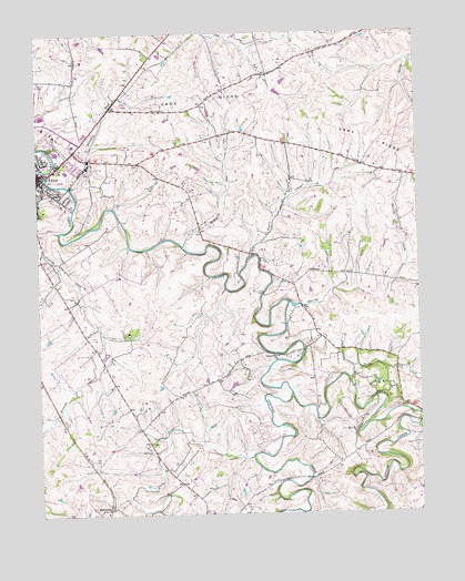
Paris East, KY USGS Topographic Map
Click on map above to begin viewing in our Map Viewer.

This topographic map contains these locations and features:
Feature Name Type Latitude Longitude GNIS ID View Map
Bourbon Community HospitalHospitalN38.2212°W84.2383°2660378View Map
Bourbon CountyCivilN38.2067°W84.2172°516855View Map
Bourbon County Fire RescueBuildingN38.2198°W84.2385°2636816View Map
Bourbon County Sheriff's OfficeBuildingN38.2131°W84.2499°2767553View Map
Clay CemeteryCemeteryN38.1387°W84.2310°489569View Map
EscondidaPopulated PlaceN38.1262°W84.2280°507948View Map
Green CreekStreamN38.1395°W84.1802°493267View Map
Harrods CreekStreamN38.1798°W84.1672°493825View Map
Houston CreekStreamN38.2148°W84.2472°494646View Map
Kennedy CreekStreamN38.1987°W84.2424°495646View Map
McDowells RunStreamN38.1948°W84.2016°497846View Map
Mitchells RunStreamN38.2106°W84.2388°498456View Map
Rogers CreekStreamN38.1920°W84.1797°502277View Map
Scott CreekStreamN38.1590°W84.1477°503099View Map
Spears Mill ChurchChurchN38.1656°W84.1708°504044View Map
Strodes CreekStreamN38.1559°W84.1672°504593View Map
WRPZ-AM (Paris)TowerN38.2251°W84.2497°517652View Map

Note: Coordinates in the location and feature list above are referenced to NAD83 datum.


Copyright (C) 2008-2024 Ryan Niemi / Sunset Dynamics ... All Rights Reserved