TopoQuest Logo
Do you find TopoQuest useful?
Help keep TopoQuest running and adding new maps/features by donating!
Bitcoin:  19c7KJd3qBynnjoSw5npx9KScwjBe4ifkT
Litecoin:  LXs6TkuXGGXo1vDsWCkWVdjQX94eUKd6ui
Home View Maps Find Maps Find Places Resources & Links


Carlisle, Kentucky Topographic Map

USGS Map Title: Carlisle, KY
USGS Map MRC: 38084C1
DRG (GeoTIFF) Download: o38084c1.tif


Neighboring USGS Topographic Map Quads:


  Shady Nook, KY  
38084D2
 

  Piqua, KY  
38084D1
 

  Cowan, KY  
38083D8
 

  Millersburg, KY  
38084C2
 

  Carlisle, KY  
38084C1
 

  Moorefield, KY  
38083C8
 

  Paris East, KY  
38084B2
 

  North Middletown, KY  
38084B1
 

  Sharpsburg, KY  
38083B8


Map MRC Location:

N39°
W85°
N39°
W84°
H8 H7 H6 H5 H4 H3 H2 H1
G8 G7 G6 G5 G4 G3 G2 G1
F8 F7 F6 F5 F4 F3 F2 F1
E8 E7 E6 E5 E4 E3 E2 E1
D8 D7 D6 D5 D4 D3 D2 D1
C8 C7 C6 C5 C4 C3 C2 C1
B8 B7 B6 B5 B4 B3 B2 B1
A8 A7 A6 A5 A4 A3 A2 A1
N38°
W85°
N38°
W84°

Carlisle, KY USGS 1:24K Topographic Map Preview:
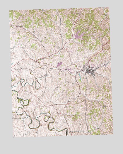
Carlisle, KY USGS Topographic Map
Click on map above to begin viewing in our Map Viewer.

This topographic map contains these locations and features:
Feature Name Type Latitude Longitude GNIS ID View Map
Banta School (historical)SchoolN38.3476°W84.0473°2555586View Map
Blacks CreekStreamN38.2712°W84.1063°487421View Map
Bowden Railroad Station (historical)LocaleN38.3173°W84.1111°2555563View Map
Brushy CreekStreamN38.3065°W84.0883°488106View Map
Brushy ForkStreamN38.3065°W84.0883°488140View Map
CarlislePopulated PlaceN38.3120°W84.0274°488935View Map
Carlisle City Fire DepartmentBuildingN38.3115°W84.0306°2636384View Map
Carlisle Police DepartmentBuildingN38.3133°W84.0277°2767408View Map
Carlisle Railroad Station (historical)LocaleN38.3113°W84.0268°2555542View Map
City of CarlisleCivilN38.3164°W84.0332°2403995View Map
Concord Church (historical)ChurchN38.2767°W84.0108°489937View Map
Concord Church CemeteryCemeteryN38.2759°W84.0119°2555483View Map
Forest Retreat (historical)LocaleN38.3357°W84.0577°2555568View Map
Forest Retreat Post Office (historical)Post OfficeN38.3379°W84.0589°2555569View Map
Gallows HillSummitN38.3353°W84.0361°2555567View Map
HeadquartersPopulated PlaceN38.3584°W84.1144°493975View Map
Headquarters Post Office (historical)Post OfficeN38.3593°W84.1140°2555867View Map
Henryville CemeteryCemeteryN38.3214°W84.0291°2555564View Map
Hickory RidgeRidgeN38.3519°W84.0208°2555625View Map
Hickory Ridge (historical)Populated PlaceN38.3520°W84.0205°2555626View Map
Irish RidgeRidgeN38.3608°W84.0034°2555364View Map
Lake CannigoReservoirN38.3482°W84.0363°2555584View Map
McBrides RunStreamN38.2729°W84.0894°497765View Map
Millers Railroad Station (historical)LocaleN38.3107°W84.0816°2555522View Map
Millers Station (historical)LocaleN38.3106°W84.0809°2555502View Map
Mount Carmel CemeteryCemeteryN38.3470°W84.0813°498697View Map
Nicholas CountyCivilN38.3356°W84.0153°516937View Map
Nicholas County HospitalHospitalN38.3115°W84.0448°2660357View Map
Nicholas County Sheriff's OfficeBuildingN38.3128°W84.0281°2767458View Map
Nicholas County Volunteer Fire DepartmentBuildingN38.3108°W84.0270°2637129View Map
North Central District 4-H CampLocaleN38.3349°W84.0343°2555566View Map
Oakland Mills ChurchChurchN38.3687°W84.0366°499747View Map
Oakland Mills Post Office (historical)Post OfficeN38.3686°W84.0369°2555869View Map
Parks SchoolSchoolN38.2779°W84.0588°500204View Map
Pleasant Springs (historical)SpringN38.2836°W84.0933°2555484View Map
Stoker CemeteryCemeteryN38.2715°W84.1149°504442View Map
Stony Creek ChurchChurchN38.3670°W84.0041°504503View Map
Taylors Creek School (historical)SchoolN38.2527°W84.0319°2555442View Map
Wilbur RunStreamN38.3276°W84.0763°506717View Map

Note: Coordinates in the location and feature list above are referenced to NAD83 datum.


Copyright (C) 2008-2025 Ryan Niemi / Sunset Dynamics ... All Rights Reserved