TopoQuest Logo
Do you find TopoQuest useful?
Help keep TopoQuest running and adding new maps/features by donating!
Bitcoin:  19c7KJd3qBynnjoSw5npx9KScwjBe4ifkT
Litecoin:  LXs6TkuXGGXo1vDsWCkWVdjQX94eUKd6ui
Home View Maps Find Maps Find Places Resources & Links


Parrish, Wisconsin Topographic Map

USGS Map Title: Parrish, WI
USGS Map MRC: 45089D4
DRG (GeoTIFF) Download: o45089d4.tif


Neighboring USGS Topographic Map Quads:


  Woodboro, WI  
45089E5
 

  Lake Julia, WI  
45089E4
 

  George Lake, WI  
45089E3
 

  Harrison, WI  
45089D5
 

  Parrish, WI  
45089D4
 

  Enterprise, WI  
45089D3
 

  Bloomville, WI  
45089C5
 

  Gleason, WI  
45089C4
 

  Bavaria, WI  
45089C3


Map MRC Location:

N46°
W90°
N46°
W89°
H8 H7 H6 H5 H4 H3 H2 H1
G8 G7 G6 G5 G4 G3 G2 G1
F8 F7 F6 F5 F4 F3 F2 F1
E8 E7 E6 E5 E4 E3 E2 E1
D8 D7 D6 D5 D4 D3 D2 D1
C8 C7 C6 C5 C4 C3 C2 C1
B8 B7 B6 B5 B4 B3 B2 B1
A8 A7 A6 A5 A4 A3 A2 A1
N45°
W90°
N45°
W89°

Parrish, WI USGS 1:24K Topographic Map Preview:
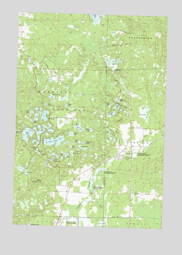
Parrish, WI USGS Topographic Map
Click on map above to begin viewing in our Map Viewer.

This topographic map contains these locations and features:
Feature Name Type Latitude Longitude GNIS ID View Map
0.5 ReservoirReservoirN45.4883°W89.4985°1793256View Map
Baldy HillSummitN45.4372°W89.4132°1561127View Map
Bass LakeLakeN45.4291°W89.4898°1561242View Map
Bear LakeLakeN45.4182°W89.4522°1561385View Map
Beaver LakeLakeN45.4726°W89.4205°1561470View Map
Bennett LakeLakeN45.4324°W89.4364°1561564View Map
Birch LakeLakeN45.4241°W89.4507°1561809View Map
BundyPopulated PlaceN45.4997°W89.4337°1577532View Map
Callsen School (historical)SchoolN45.3944°W89.4023°1840747View Map
Camp Two LakeLakeN45.4243°W89.4420°1562665View Map
Chain LakeLakeN45.4213°W89.4437°1562923View Map
Coppes LakeLakeN45.4459°W89.4580°1563394View Map
Dudley LakeLakeN45.4191°W89.4816°1564161View Map
Elm City School (historical)SchoolN45.3952°W89.4548°1840257View Map
Fish CreekStreamN45.4175°W89.4085°1564984View Map
Fish LakeLakeN45.4330°W89.4465°1564996View Map
Fox LakeLakeN45.4170°W89.4570°1565218View Map
Homestead LakeLakeN45.4508°W89.4703°1566639View Map
Jeffris JunctionLocaleN45.4702°W89.4248°1843860View Map
Lake ButeauLakeN45.4394°W89.4757°1562465View Map
Lake ClaraLakeN45.4365°W89.4866°1563110View Map
Lake DorisLakeN45.4410°W89.4870°1564059View Map
Lake MaryLakeN45.4425°W89.4808°1569105View Map
Lake OneLakeN45.4269°W89.4185°1570827View Map
Lake TwoLakeN45.4302°W89.4213°1575833View Map
Little Bass LakeLakeN45.4499°W89.4156°1568177View Map
Little Pike LakeLakeN45.4462°W89.4752°1568352View Map
Long LakeLakeN45.4289°W89.4880°1568556View Map
Lookout MountainSummitN45.4008°W89.4826°1568614View Map
McGinnis LakeLakeN45.3754°W89.4862°1569223View Map
Moraine LakeLakeN45.4141°W89.4682°1569719View Map
Otter LakeLakeN45.4470°W89.4209°1570911View Map
ParrishPopulated PlaceN45.4197°W89.4026°1571065View Map
Parrish CemeteryCemeteryN45.4155°W89.4071°1571066View Map
Paulson JunctionLocaleN45.4186°W89.4798°1840261View Map
Perch LakeLakeN45.4461°W89.4152°1571205View Map
Pinten H373 DamDamN45.4883°W89.4985°1793255View Map
Prairie River State Public Hunting and Fishing AreaParkN45.4069°W89.4268°1571889View Map
Seven Island LakeLakeN45.4247°W89.4672°1573908View Map
Snake LakeLakeN45.4215°W89.4536°1574339View Map
Stevens PondLakeN45.4423°W89.3903°1574880View Map
Stewart LakeLakeN45.4292°W89.4531°1574891View Map
Town of HarrisonCivilN45.4675°W89.4871°1583356View Map
Turtle LakeLakeN45.4048°W89.4887°1575740View Map
Two Island LakeLakeN45.4415°W89.4201°1575829View Map
WRHN-FM (Rhinelander)TowerN45.4008°W89.4818°1582623View Map

Note: Coordinates in the location and feature list above are referenced to NAD83 datum.


Copyright (C) 2008-2025 Ryan Niemi / Sunset Dynamics ... All Rights Reserved