TopoQuest Logo
Do you find TopoQuest useful?
Help keep TopoQuest running and adding new maps/features by donating!
Bitcoin:  19c7KJd3qBynnjoSw5npx9KScwjBe4ifkT
Litecoin:  LXs6TkuXGGXo1vDsWCkWVdjQX94eUKd6ui
Home View Maps Find Maps Find Places Resources & Links


Passadumkeag, Maine Topographic Map

USGS Map Title: Passadumkeag, ME
USGS Map MRC: 45068B5
DRG (GeoTIFF) Download: o45068b5.tif


Neighboring USGS Topographic Map Quads:


  Seboeis, ME  
45068C6
 

  Lincoln West, ME  
45068C5
 

  Lincoln East, ME  
45068C4
 

  Howland, ME  
45068B6
 

  Passadumkeag, ME  
45068B5
 

  Burlington, ME  
45068B4
 

  Greenbush, ME  
45068A6
 

  Olamon, ME  
45068A5
 

  Greenfield, ME  
45068A4


Map MRC Location:

N46°
W69°
N46°
W68°
H8 H7 H6 H5 H4 H3 H2 H1
G8 G7 G6 G5 G4 G3 G2 G1
F8 F7 F6 F5 F4 F3 F2 F1
E8 E7 E6 E5 E4 E3 E2 E1
D8 D7 D6 D5 D4 D3 D2 D1
C8 C7 C6 C5 C4 C3 C2 C1
B8 B7 B6 B5 B4 B3 B2 B1
A8 A7 A6 A5 A4 A3 A2 A1
N45°
W69°
N45°
W68°

Passadumkeag, ME USGS 1:24K Topographic Map Preview:
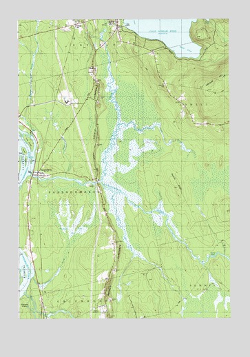
Passadumkeag, ME USGS Topographic Map
Click on map above to begin viewing in our Map Viewer.

This topographic map contains these locations and features:
Feature Name Type Latitude Longitude GNIS ID View Map
Applebee CemeteryCemeteryN45.2440°W68.5686°2736909View Map
Ayers BrookStreamN45.1773°W68.5700°561371View Map
Beaver BrookStreamN45.2014°W68.6203°561902View Map
Brady BrookStreamN45.2495°W68.5756°562869View Map
Cobb HatcheryLocaleN45.2484°W68.5786°1913416View Map
Cold StreamStreamN45.1826°W68.5784°564195View Map
Cold Stream Pond DamDamN45.2475°W68.5631°1773791View Map
Cole Memorial LibraryBuildingN45.2487°W68.5672°2738491View Map
Edgecombe School (historical)SchoolN45.2059°W68.5092°565791View Map
EnfieldPopulated PlaceN45.2489°W68.5684°565918View Map
Enfield StationLocaleN45.2481°W68.5936°565920View Map
Enfield Station Elementary SchoolSchoolN45.2463°W68.5876°1913500View Map
Enfield Village CemeteryCemeteryN45.2495°W68.5652°2736912View Map
Hammett Road CemeteryCemeteryN45.2473°W68.5962°2736919View Map
Hathaway BridgeBridgeN45.1819°W68.5782°567757View Map
Hog IslandIslandN45.1911°W68.6172°568165View Map
Lancaster BrookStreamN45.1423°W68.6195°569355View Map
Little Cold StreamStreamN45.2059°W68.5667°569739View Map
Long IslandIslandN45.1989°W68.6206°570216View Map
Olamon DamDamN45.1267°W68.6080°1774669View Map
Olamon StreamStreamN45.1281°W68.6170°572680View Map
Olamon StreamReservoirN45.1260°W68.6086°1774670View Map
Onemile BrookStreamN45.1837°W68.5992°572748View Map
PassadumkeagPopulated PlaceN45.1853°W68.6167°573039View Map
Passadumkeag Baptist ChurchChurchN45.1864°W68.6106°1913795View Map
Passadumkeag Post OfficePost OfficeN45.1850°W68.6096°1913796View Map
Passadumkeag RiverStreamN45.1853°W68.6209°573041View Map
Passadumkeag Volunteer Fire DepartmentBuildingN45.1852°W68.6127°2553107View Map
Rocky RipsRapidsN45.1509°W68.5092°574413View Map
Roundy RidgeRidgeN45.1795°W68.5314°574539View Map
Sunny Slope CemeteryCemeteryN45.1561°W68.5681°576543View Map
Tarbox IslandIslandN45.1924°W68.6230°576660View Map
Thorofare IslandsIslandN45.1938°W68.6205°577039View Map
Thousand Acre BogSwampN45.1673°W68.5925°577044View Map
Town of PassadumkeagCivilN45.1845°W68.5868°582663View Map
Webb CoveBayN45.2395°W68.5256°577922View Map
West End CemeteryCemeteryN45.2225°W68.5382°578131View Map
WPVM-FM (Howland)TowerN45.1798°W68.5761°582062View Map

Note: Coordinates in the location and feature list above are referenced to NAD83 datum.


Copyright (C) 2008-2024 Ryan Niemi / Sunset Dynamics ... All Rights Reserved