TopoQuest Logo
Do you find TopoQuest useful?
Help keep TopoQuest running and adding new maps/features by donating!
Bitcoin:  19c7KJd3qBynnjoSw5npx9KScwjBe4ifkT
Litecoin:  LXs6TkuXGGXo1vDsWCkWVdjQX94eUKd6ui
Home View Maps Find Maps Find Places Resources & Links


Patmos, Arkansas Topographic Map

USGS Map Title: Patmos, AR
USGS Map MRC: 33093E5
DRG (GeoTIFF) Download: o33093e5.tif


Neighboring USGS Topographic Map Quads:


  Sheppard, AR  
33093F6
 

  Hope, AR  
33093F5
 

  Emmet, AR  
33093F4
 

  Spring Hill, AR  
33093E6
 

  Patmos, AR  
33093E5
 

  Bodcaw, AR  
33093E4
 

  Boyd Hill, AR  
33093D6
 

  Old Town, AR  
33093D5
 

  Falcon, AR  
33093D4


Map MRC Location:

N34°
W94°
N34°
W93°
H8 H7 H6 H5 H4 H3 H2 H1
G8 G7 G6 G5 G4 G3 G2 G1
F8 F7 F6 F5 F4 F3 F2 F1
E8 E7 E6 E5 E4 E3 E2 E1
D8 D7 D6 D5 D4 D3 D2 D1
C8 C7 C6 C5 C4 C3 C2 C1
B8 B7 B6 B5 B4 B3 B2 B1
A8 A7 A6 A5 A4 A3 A2 A1
N33°
W94°
N33°
W93°

Patmos, AR USGS 1:24K Topographic Map Preview:
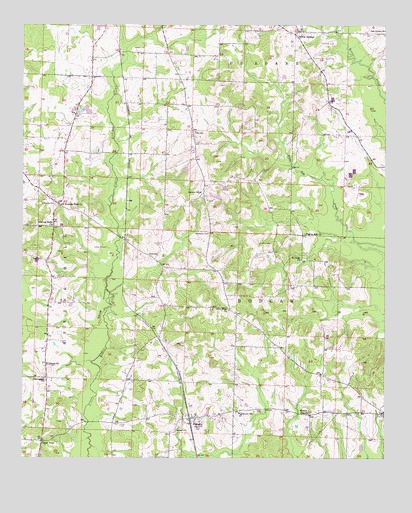
Patmos, AR USGS Topographic Map
Click on map above to begin viewing in our Map Viewer.

This topographic map contains these locations and features:
Feature Name Type Latitude Longitude GNIS ID View Map
Alton (historical)Populated PlaceN33.5626°W93.5899°61460View Map
Best CemeteryCemeteryN33.5573°W93.6182°46416View Map
Bethlehem ChurchChurchN33.5051°W93.6182°61457View Map
Center PointLocaleN33.5054°W93.6180°47638View Map
Center Point School (historical)SchoolN33.5229°W93.6174°61458View Map
Central Church of ChristChurchN33.5273°W93.6163°76574View Map
ColerPopulated PlaceN33.5748°W93.5893°57570View Map
Evening ShadePopulated PlaceN33.5735°W93.6127°61459View Map
Evening Shade ChurchChurchN33.5673°W93.6146°48937View Map
Giles CemeteryCemeteryN33.5943°W93.5657°49409View Map
Hatch CemeteryCemeteryN33.5584°W93.5788°49932View Map
Hinton ChapelChurchN33.5132°W93.5266°50150View Map
Huckabee CemeteryCemeteryN33.5734°W93.6138°50381View Map
Liberty Hill School (historical)SchoolN33.5996°W93.6074°61461View Map
Macedonia CemeteryCemeteryN33.5651°W93.5607°51541View Map
Negro Hill Church (historical)ChurchN33.5946°W93.5668°61465View Map
New HopePopulated PlaceN33.5432°W93.5538°61463View Map
New Hope Missionary Baptist ChurchChurchN33.5432°W93.5538°77818View Map
Oak Grove United Methodist ChurchChurchN33.6235°W93.5002°77875View Map
Old Evening Shade ChurchChurchN33.5737°W93.6124°77904View Map
PatmosPopulated PlaceN33.5118°W93.5663°53213View Map
Patmos Baptist ChurchChurchN33.5112°W93.5660°61462View Map
Patmos CemeteryCemeteryN33.5082°W93.5718°53214View Map
Patmos ChurchChurchN33.5768°W93.5635°53215View Map
Patmos SchoolSchoolN33.5132°W93.5499°53216View Map
Patmos Volunteer Fire DepartmentBuildingN33.5120°W93.5669°2116942View Map
Pilgrim Rest ChurchChurchN33.5648°W93.5277°53377View Map
Providence Baptist ChurchChurchN33.5229°W93.6174°78104View Map
Ruggles Private Airport (historical)AirportN33.6204°W93.5227°83727View Map
Saint Pauls ChurchChurchN33.5573°W93.5288°54454View Map
Sardis (historical)Populated PlaceN33.5507°W93.5557°61464View Map
Shover SpringsPopulated PlaceN33.6229°W93.5305°78360View Map
Shrover Springs Baptist ChurchChurchN33.6237°W93.5305°61466View Map
Town of PatmosCivilN33.5113°W93.5667°2407079View Map
Township of BodcawCivilN33.5338°W93.5463°66639View Map
Wise CemeteryCemeteryN33.5621°W93.5432°56468View Map

Note: Coordinates in the location and feature list above are referenced to NAD83 datum.


Copyright (C) 2008-2025 Ryan Niemi / Sunset Dynamics ... All Rights Reserved