TopoQuest Logo
Do you find TopoQuest useful?
Help keep TopoQuest running and adding new maps/features by donating!
Bitcoin:  19c7KJd3qBynnjoSw5npx9KScwjBe4ifkT
Litecoin:  LXs6TkuXGGXo1vDsWCkWVdjQX94eUKd6ui
Home View Maps Find Maps Find Places Resources & Links


Patroon South, Texas Topographic Map

USGS Map Title: Patroon South, TX
USGS Map MRC: 31093E8
DRG (GeoTIFF) Download: o31093e8.tif


Neighboring USGS Topographic Map Quads:


  Hurstown, TX  
31094F1
 

  Patroon North, TX  
31093F8
 

  Brushy Creek, TX  
31093F7
 

  San Augustine East, TX  
31094E1
 

  Patroon South, TX  
31093E8
 

  East Hamilton, TX  
31093E7
 

  Chinquapin, TX  
31094D1
 

  Geneva, TX  
31093D8
 

  Milam, TX  
31093D7


Map MRC Location:

N32°
W94°
N32°
W93°
H8 H7 H6 H5 H4 H3 H2 H1
G8 G7 G6 G5 G4 G3 G2 G1
F8 F7 F6 F5 F4 F3 F2 F1
E8 E7 E6 E5 E4 E3 E2 E1
D8 D7 D6 D5 D4 D3 D2 D1
C8 C7 C6 C5 C4 C3 C2 C1
B8 B7 B6 B5 B4 B3 B2 B1
A8 A7 A6 A5 A4 A3 A2 A1
N31°
W94°
N31°
W93°

Patroon South, TX USGS 1:24K Topographic Map Preview:
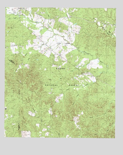
Patroon South, TX USGS Topographic Map
Click on map above to begin viewing in our Map Viewer.

This topographic map contains these locations and features:
Feature Name Type Latitude Longitude GNIS ID View Map
Alexanders StorePopulated PlaceN31.6171°W93.9266°2034927View Map
Alexanders StoreLocaleN31.6160°W93.9263°1381298View Map
Allen CreekStreamN31.6191°W93.9880°1381308View Map
Apostolic CemeteryCemeteryN31.5250°W93.9639°2575477View Map
Apostolic ChurchChurchN31.5235°W93.9646°1381329View Map
Bell CemeteryCemeteryN31.5903°W93.9662°1381390View Map
Bell ChapelChurchN31.5866°W93.9982°1381391View Map
Bickley CemeteryCemeteryN31.5018°W93.9527°1381414View Map
Black Ankle ChurchChurchN31.5282°W93.9996°1889818View Map
Browns ChapelChurchN31.5888°W93.9874°1381525View Map
Buckley CreekStreamN31.5991°W93.9435°1383047View Map
Bull Bay CreekStreamN31.5746°W93.9010°1381549View Map
Carrent ChurchChurchN31.5680°W93.9421°1381593View Map
Clear CreekStreamN31.5835°W93.9621°1381660View Map
Colorow CreekStreamN31.5638°W93.8846°1383067View Map
Cordrey CemeteryCemeteryN31.5160°W93.9266°1384857View Map
Corinth CemeteryCemeteryN31.5800°W93.9433°2575491View Map
Crockett CemeteryCemeteryN31.5732°W93.9485°1380955View Map
Dunnigan ChurchChurchN31.6160°W93.9449°1381809View Map
Forse MountainSummitN31.5202°W93.9802°1381886View Map
Horton CreekStreamN31.5491°W93.9194°1382039View Map
Indian CreekStreamN31.6021°W93.9457°1382063View Map
Ingram CemeteryCemeteryN31.5535°W93.9321°1382064View Map
Ingram ChurchChurchN31.5532°W93.9327°1380956View Map
Lick CreekStreamN31.6168°W93.9841°1382155View Map
Matlock HillsSummitN31.5585°W93.9819°1382279View Map
Munnerlyn CemeteryCemeteryN31.5750°W93.9306°2575527View Map
Mushotuba CreekStreamN31.6124°W93.9691°1382366View Map
New Jerusalem ChurchChurchN31.5168°W93.9480°1382389View Map
PatroonPopulated PlaceN31.6230°W93.9810°1382461View Map
Polley CemeteryCemeteryN31.5642°W93.9000°2575537View Map
Prairie CreekStreamN31.5877°W93.9202°1382567View Map
Reeves CemeteryCemeteryN31.5139°W93.8786°2575538View Map
Sandy CreekStreamN31.6149°W93.9985°1383181View Map
SextonPopulated PlaceN31.5630°W93.9110°1382740View Map
Sweet CemeteryCemeteryN31.5699°W93.9457°1382838View Map
Williams Family CemeteryCemeteryN31.5111°W93.9161°2575547View Map
Windham CemeteryCemeteryN31.5993°W93.9188°1382984View Map

Note: Coordinates in the location and feature list above are referenced to NAD83 datum.


Copyright (C) 2008-2024 Ryan Niemi / Sunset Dynamics ... All Rights Reserved