TopoQuest Logo
Do you find TopoQuest useful?
Help keep TopoQuest running and adding new maps/features by donating!
Bitcoin:  19c7KJd3qBynnjoSw5npx9KScwjBe4ifkT
Litecoin:  LXs6TkuXGGXo1vDsWCkWVdjQX94eUKd6ui
Home View Maps Find Maps Find Places Resources & Links


Pearl City, Illinois Topographic Map

USGS Map Title: Pearl City, IL
USGS Map MRC: 42089C7
DRG (GeoTIFF) Download: o42089c7.tif


Neighboring USGS Topographic Map Quads:


  Warren, IL  
42089D8
 

  Lena, IL  
42089D7
 

  Orangeville, IL  
42089D6
 

  Kent, IL  
42089C8
 

  Pearl City, IL  
42089C7
 

  Freeport West, IL  
42089C6
 

  Loran, IL  
42089B8
 

  Boone Branch, IL  
42089B7
 

  Shannon, IL  
42089B6


Map MRC Location:

N43°
W90°
N43°
W89°
H8 H7 H6 H5 H4 H3 H2 H1
G8 G7 G6 G5 G4 G3 G2 G1
F8 F7 F6 F5 F4 F3 F2 F1
E8 E7 E6 E5 E4 E3 E2 E1
D8 D7 D6 D5 D4 D3 D2 D1
C8 C7 C6 C5 C4 C3 C2 C1
B8 B7 B6 B5 B4 B3 B2 B1
A8 A7 A6 A5 A4 A3 A2 A1
N42°
W90°
N42°
W89°

Pearl City, IL USGS 1:24K Topographic Map Preview:
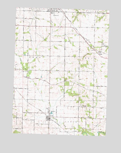
Pearl City, IL USGS Topographic Map
Click on map above to begin viewing in our Map Viewer.

This topographic map contains these locations and features:
Feature Name Type Latitude Longitude GNIS ID View Map
Albright School (historical)SchoolN42.3422°W89.8479°423772View Map
Babbs Grove CemeteryCemeteryN42.2789°W89.7771°403779View Map
Babbs Grove School (historical)SchoolN42.2786°W89.7776°423774View Map
Boop School (historical)SchoolN42.2850°W89.8746°1705971View Map
EleroyPopulated PlaceN42.3325°W89.7607°407857View Map
Eleroy CemeteryCemeteryN42.3411°W89.7587°407858View Map
Eleroy Post OfficePost OfficeN42.3335°W89.7607°1821235View Map
Goddard School (historical)SchoolN42.3636°W89.8482°423804View Map
Grace Methodist Evangelical CemeteryCemeteryN42.2678°W89.7729°409224View Map
Grisby CemeteryCemeteryN42.3717°W89.7598°409519View Map
Heitter School (historical)SchoolN42.2995°W89.7687°423810View Map
Highland CemeteryCemeteryN42.2756°W89.8271°410220View Map
Holmestead FarmsLocaleN42.3706°W89.7650°2630256View Map
Lena CemeteryCemeteryN42.3731°W89.8201°1821268View Map
Lena CemeteryCemeteryN42.3733°W89.8198°1955365View Map
Lena Post OfficePost OfficeN42.3727°W89.8290°2788890View Map
Liebhart CemeteryCemeteryN42.2778°W89.7554°412071View Map
Lower Kent School (historical)SchoolN42.3109°W89.8660°423819View Map
Mill Grove School (historical)SchoolN42.2520°W89.7729°423821View Map
New Dublin School (historical)SchoolN42.3022°W89.8126°423827View Map
Pearl CityPopulated PlaceN42.2653°W89.8260°415493View Map
Pearl City Fire DepartmentBuildingN42.2648°W89.8266°2640845View Map
Pearl City High SchoolSchoolN42.2672°W89.8296°1821263View Map
Pearl City Post OfficePost OfficeN42.2667°W89.8259°2788200View Map
Pickard School (historical)SchoolN42.3572°W89.7693°423828View Map
Rees School (historical)SchoolN42.3428°W89.8087°423835View Map
Saint Marys CemeteryCemeteryN42.3039°W89.8076°417585View Map
SalemPopulated PlaceN42.3445°W89.7790°423839View Map
Salem Evangelical CemeteryCemeteryN42.3414°W89.7796°1967747View Map
Salem United Church of ChristChurchN42.3445°W89.7790°417880View Map
Samel Evangelical CemeteryCemeteryN42.3442°W89.7793°1955369View Map
Stony Bluff School (historical)SchoolN42.3717°W89.7937°423845View Map
Township of ErinCivilN42.3284°W89.7787°428978View Map
Township of KentCivilN42.3280°W89.8652°429203View Map
Village of Pearl CityCivilN42.2661°W89.8273°2399641View Map
Yellow CreekPopulated PlaceN42.3056°W89.8565°423855View Map
Yellow Creek Brethren CemeteryCemeteryN42.3061°W89.8565°1967751View Map
Yellow Creek ChurchChurchN42.3059°W89.8573°421569View Map

Note: Coordinates in the location and feature list above are referenced to NAD83 datum.


Copyright (C) 2008-2025 Ryan Niemi / Sunset Dynamics ... All Rights Reserved