TopoQuest Logo
Do you find TopoQuest useful?
Help keep TopoQuest running and adding new maps/features by donating!
Bitcoin:  19c7KJd3qBynnjoSw5npx9KScwjBe4ifkT
Litecoin:  LXs6TkuXGGXo1vDsWCkWVdjQX94eUKd6ui
Home View Maps Find Maps Find Places Resources & Links


Warren, Illinois Topographic Map

USGS Map Title: Warren, IL
USGS Map MRC: 42089D8
DRG (GeoTIFF) Download: o42089d8.tif


Neighboring USGS Topographic Map Quads:


  Apple River, IL  
42090E1
 

  South Wayne, WI  
42089E8
 

  Browntown, WI  
42089E7
 

  Elizabeth NE, IL  
42090D1
 

  Warren, IL  
42089D8
 

  Lena, IL  
42089D7
 

  Stockton, IL  
42090C1
 

  Kent, IL  
42089C8
 

  Pearl City, IL  
42089C7


Map MRC Location:

N43°
W90°
N43°
W89°
H8 H7 H6 H5 H4 H3 H2 H1
G8 G7 G6 G5 G4 G3 G2 G1
F8 F7 F6 F5 F4 F3 F2 F1
E8 E7 E6 E5 E4 E3 E2 E1
D8 D7 D6 D5 D4 D3 D2 D1
C8 C7 C6 C5 C4 C3 C2 C1
B8 B7 B6 B5 B4 B3 B2 B1
A8 A7 A6 A5 A4 A3 A2 A1
N42°
W90°
N42°
W89°

Warren, IL USGS 1:24K Topographic Map Preview:
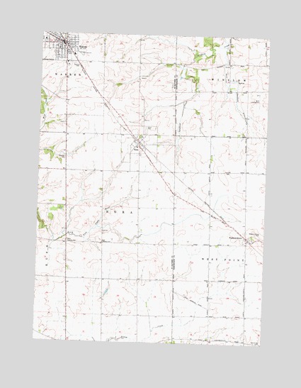
Warren, IL USGS Topographic Map
Click on map above to begin viewing in our Map Viewer.

This topographic map contains these locations and features:
Feature Name Type Latitude Longitude GNIS ID View Map
Central School (historical)SchoolN42.3758°W89.8840°423785View Map
Chelsea Church (historical)ChurchN42.4153°W89.9440°423755View Map
Chelsea School (historical)SchoolN42.4150°W89.9637°423756View Map
East Chelsea CemeteryCemeteryN42.4153°W89.9643°407622View Map
East Spafford BranchStreamN42.4956°W89.8985°407703View Map
Faith Assembly of God ChurchChurchN42.4931°W89.9862°1967780View Map
First Baptist Church of WarrenChurchN42.4933°W89.9896°1967781View Map
Garfield School (historical)SchoolN42.4008°W89.9340°423760View Map
Greenvale School (historical)SchoolN42.4006°W89.9829°423762View Map
Hays School (historical)SchoolN42.4958°W89.9465°423763View Map
Holly Grove CemeteryCemeteryN42.3751°W89.8782°410405View Map
Howardsille CemeteryCemeteryN42.3767°W89.9043°1955364View Map
Howardsville School (historical)SchoolN42.3770°W89.9237°423812View Map
Keller School (historical)SchoolN42.4825°W89.8965°423813View Map
Kerlin School (historical)SchoolN42.4156°W89.9048°423815View Map
NoraPopulated PlaceN42.4558°W89.9454°414546View Map
Nora CemeteryCemeteryN42.4625°W89.9415°414547View Map
Nora Community ChurchChurchN42.4570°W89.9473°1815792View Map
Nora Post OfficePost OfficeN42.4562°W89.9460°2788323View Map
Oakwood CemeteryCemeteryN42.4497°W89.9857°414936View Map
Puckett School (historical)SchoolN42.4442°W89.9848°423764View Map
Saint Annes Catholic CemeteryCemeteryN42.4881°W89.9812°417166View Map
Saint Pauls Lutheran ChurchChurchN42.4978°W89.9982°1967782View Map
Simmons School (historical)SchoolN42.3783°W89.9826°423765View Map
Toogood School (historical)SchoolN42.4445°W89.9098°423848View Map
Township of NoraCivilN42.4336°W89.9525°429452View Map
Village of NoraCivilN42.4565°W89.9459°2399501View Map
Village of WarrenCivilN42.4948°W89.9912°2400094View Map
Waddams GrovePopulated PlaceN42.4175°W89.8843°420355View Map
Waddams Grove CemeteryCemeteryN42.4200°W89.8798°420356View Map
WarrenPopulated PlaceN42.4964°W89.9896°420531View Map
Warren Ambulance ServiceBuildingN42.4967°W89.9902°2640367View Map
Warren Fire DepartmentBuildingN42.4962°W89.9909°2640873View Map
Warren Police DepartmentBuildingN42.4967°W89.9868°2756843View Map
Warren Post OfficePost OfficeN42.4963°W89.9893°2788439View Map
Warren Senior High SchoolSchoolN42.4939°W89.9907°1815815View Map
Warren United Methodist ChurchChurchN42.4933°W89.9890°1967783View Map
West Chelsea CemeteryCemeteryN42.4161°W89.9832°420806View Map
West Chelsea School (historical)SchoolN42.4156°W89.9837°423768View Map

Note: Coordinates in the location and feature list above are referenced to NAD83 datum.


Copyright (C) 2008-2025 Ryan Niemi / Sunset Dynamics ... All Rights Reserved