TopoQuest Logo
Do you find TopoQuest useful?
Help keep TopoQuest running and adding new maps/features by donating!
Bitcoin:  19c7KJd3qBynnjoSw5npx9KScwjBe4ifkT
Litecoin:  LXs6TkuXGGXo1vDsWCkWVdjQX94eUKd6ui
Home View Maps Find Maps Find Places Resources & Links


Loran, Illinois Topographic Map

USGS Map Title: Loran, IL
USGS Map MRC: 42089B8
DRG (GeoTIFF) Download: o42089b8.tif


Neighboring USGS Topographic Map Quads:


  Stockton, IL  
42090C1
 

  Kent, IL  
42089C8
 

  Pearl City, IL  
42089C7
 

  Pleasant Valley, IL  
42090B1
 

  Loran, IL  
42089B8
 

  Boone Branch, IL  
42089B7
 

  Wacker, IL  
42090A1
 

  Mount Carroll, IL  
42089A8
 

  Lanark, IL  
42089A7


Map MRC Location:

N43°
W90°
N43°
W89°
H8 H7 H6 H5 H4 H3 H2 H1
G8 G7 G6 G5 G4 G3 G2 G1
F8 F7 F6 F5 F4 F3 F2 F1
E8 E7 E6 E5 E4 E3 E2 E1
D8 D7 D6 D5 D4 D3 D2 D1
C8 C7 C6 C5 C4 C3 C2 C1
B8 B7 B6 B5 B4 B3 B2 B1
A8 A7 A6 A5 A4 A3 A2 A1
N42°
W90°
N42°
W89°

Loran, IL USGS 1:24K Topographic Map Preview:
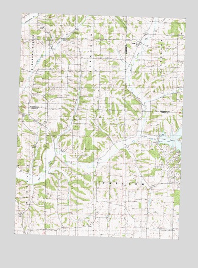
Loran, IL USGS Topographic Map
Click on map above to begin viewing in our Map Viewer.

This topographic map contains these locations and features:
Feature Name Type Latitude Longitude GNIS ID View Map
Arnold Grove School (historical)SchoolN42.1306°W89.9485°403631View Map
Arnold School (historical)SchoolN42.1684°W89.9407°403634View Map
Arnolds Grove CemeteryCemeteryN42.1283°W89.9437°1785395View Map
Arnolds Grove Dunkard CemeteryCemeteryN42.1339°W89.9437°1785396View Map
East Fork CreekStreamN42.1814°W89.9079°424149View Map
Foxfield AerodromeAirportN42.1577°W89.8856°2679057View Map
Freedom School (historical)SchoolN42.1314°W89.8904°408721View Map
Hayes School (historical)SchoolN42.2475°W89.8812°409962View Map
Heimerginder FarmsLocaleN42.2386°W89.9092°2680972View Map
Hillside School (historical)SchoolN42.2117°W89.8804°410299View Map
Lake Carroll DamDamN42.1800°W89.8901°1692024View Map
LoranPopulated PlaceN42.2350°W89.9104°412635View Map
Ray School (historical)SchoolN42.2153°W89.9207°416426View Map
Renner CemeteryCemeteryN42.1892°W89.9104°1785435View Map
Renner School (historical)SchoolN42.1892°W89.9101°416533View Map
Sage School (historical)SchoolN42.1884°W89.9851°417114View Map
Salem Evangelical ChurchChurchN42.2400°W89.9054°1967748View Map
Skunk HollowValleyN42.1746°W89.9715°418590View Map
Slick School (historical)SchoolN42.1453°W89.9101°418603View Map
Stone Church CemeteryCemeteryN42.2178°W89.8798°1955413View Map
Township of BerremanCivilN42.2402°W89.9492°428663View Map
Township of FreedomCivilN42.1529°W89.9192°429028View Map
Township of JeffersonCivilN42.2401°W89.8908°429183View Map
Union School (historical)SchoolN42.2189°W89.9548°420139View Map
Woodland Brethren CemeteryCemeteryN42.1278°W89.9879°1785453View Map
Woodland ChurchChurchN42.1272°W89.9876°421436View Map

Note: Coordinates in the location and feature list above are referenced to NAD83 datum.


Copyright (C) 2008-2025 Ryan Niemi / Sunset Dynamics ... All Rights Reserved